- Malvern, Ohio
-
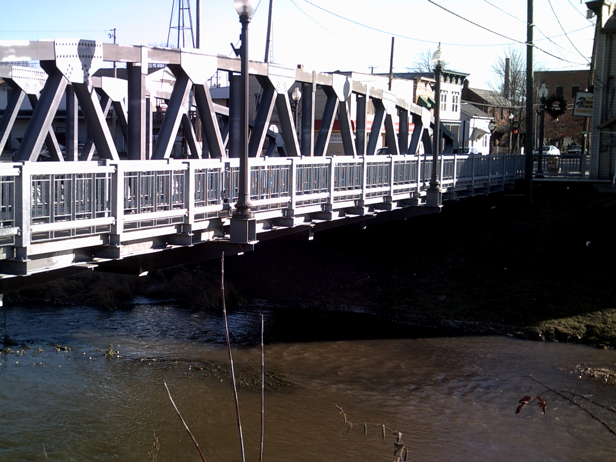
Malvern, Ohio — Village — A bridge over Sandy Creek in downtown Malvern.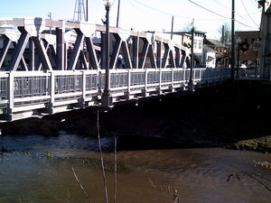 Location of Malvern, Ohio
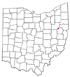
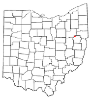
Coordinates: 40°41′25″N 81°10′47″W / 40.69028°N 81.17972°WCoordinates: 40°41′25″N 81°10′47″W / 40.69028°N 81.17972°W Country United States State Ohio County Carroll Government – Mayor Michael J. McCort Area – Total 0.7 sq mi (1.8 km2) – Land 0.7 sq mi (1.8 km2) – Water 0.0 sq mi (0.0 km2) Elevation[1] 994 ft (303 m) Population (2000) – Total 1,218 – Density 1,784.8/sq mi (689.1/km2) Time zone Eastern (EST) (UTC-5) – Summer (DST) EDT (UTC-4) ZIP code 44644 Area code(s) 330 FIPS code 39-46998[2] GNIS feature ID 1061464[1] Website http://www.villageofmalvern.net/ Malvern is a village in Carroll County, Ohio, United States. The population was 1,218 at the 2000 census. It is part of the Canton–Massillon Metropolitan Statistical Area.
Contents
History
Malvern was formed by a merger of Troy and Lodi.[3]
Geography
Malvern is located at 40°41′25″N 81°10′47″W / 40.690189°N 81.179603°W,[4] along Sandy Creek.[5]
According to the United States Census Bureau, the village has a total area of 0.7 square miles (1.8 km2), all of it land.
Malvern lies along Ohio State Route 43.
Malvern is near the second largest privately owned man made lake in Ohio, Lake Mohawk.
Education
Public education in the village of Malvern is provided by the Brown Local School District.
Demographics
As of the census[2] of 2000, there were 1,218 people, 530 households, and 332 families residing in the village. The population density was 1,784.8 people per square mile (691.6/km2). There were 576 housing units at an average density of 844.1 per square mile (327.1/km2). The racial makeup of the village was 91.30% White, 6.73% African American, 0.25% Asian, 0.57% from other races, and 1.15% from two or more races. Hispanic or Latino of any race were 0.90% of the population.
There were 530 households out of which 28.1% had children under the age of 18 living with them, 47.7% were married couples living together, 11.3% had a female householder with no husband present, and 37.2% were non-families. 33.0% of all households were made up of individuals and 18.9% had someone living alone who was 65 years of age or older. The average household size was 2.30 and the average family size was 2.87.
In the village the population was spread out with 22.7% under the age of 18, 9.6% from 18 to 24, 28.1% from 25 to 44, 21.8% from 45 to 64, and 17.8% who were 65 years of age or older. The median age was 39 years. For every 100 females there were 90.0 males. For every 100 females age 18 and over, there were 78.7 males.
The median income for a household in the village was $29,063, and the median income for a family was $35,476. Males had a median income of $27,833 versus $22,188 for females. The per capita income for the village was $15,535. About 11.6% of families and 12.8% of the population were below the poverty line, including 14.9% of those under age 18 and 14.7% of those age 65 or over.
Notable natives
Historical populations Census Pop. %± 1870 269 — 1890 638 — 1900 709 11.1% 1910 753 6.2% 1920 979 30.0% 1930 1,100 12.4% 1940 1,177 7.0% 1950 1,277 8.5% 1960 1,320 3.4% 1970 1,256 −4.8% 1990 1,112 — 2000 1,218 9.5% 2010 1,189 −2.4% [6] - Don Nigro - playwright
- Clyde Singer - artist
- Ed Poole - Retired Major League Baseball Pitcher
References
- ^ a b "US Board on Geographic Names". United States Geological Survey. 2007-10-25. http://geonames.usgs.gov. Retrieved 2008-01-31.
- ^ a b "American FactFinder". United States Census Bureau. http://factfinder.census.gov. Retrieved 2008-01-31.
- ^ Lane, Janice E. (2003). Carroll County: A Place to Call Home. Arcadia Publishing. p. 41. ISBN 0738524220.
- ^ "US Gazetteer files: 2010, 2000, and 1990". United States Census Bureau. 2011-02-12. http://www.census.gov/geo/www/gazetteer/gazette.html. Retrieved 2011-04-23.
- ^ DeLorme (1991). Ohio Atlas & Gazetteer. Yarmouth, Maine: DeLorme. ISBN 0-89933-233-1.
- ^ census data: 1870 : 1870 page 24 , 1890,1900 : Hunt, William C. (1901). Population of the United States by states and territories, counties, and minor Civil Divisions, as returned at the Twelfth Census: 1900. United States Census Printing Office. p. 306. http://books.google.com/books?id=Pnk9AAAAYAAJ&pg=PA306. , 1910, 1920, 1930 : 1930 page 40 , 1940, 1950 : 1950 page 14 , 1960 : 1960 page 16 , 1970 : 1970 page 124 , 1990: 1990 , 2000 : 2000, 2010 : [1]
Municipalities and communities of Carroll County, Ohio Villages Carrollton | Dellroy | Leesville | Magnolia‡ | Malvern | Minerva‡ | Sherrodsville

Townships Unincorporated
communitiesAugusta | Harlem Springs | Kilgore | Leavittsville | Lindentree | Mechanicstown | Morges | New Harrisburg | Pattersonville | Petersburg | Scroggsfield | Wattsville
Footnotes ‡This populated place also has portions in an adjacent county or counties
Categories:- Villages in Ohio
- Populated places in Carroll County, Ohio
- Canton–Massillon metropolitan area

Wikimedia Foundation. 2010.