- Clintondale, New York
-
Clintondale, New York — CDP — Clintondale looking east along Routes 44/55, 2007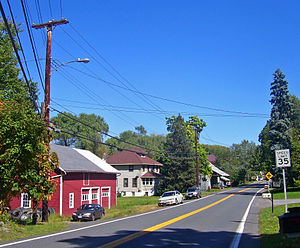 Location within the state of New York
 Clintondale, New York
Coordinates: 41°41′40″N 74°2′48″W / 41.69444°N 74.04667°W Country United States State New York County Ulster Area – Total 5.6 sq mi (14.5 km2) – Land 5.6 sq mi (14.5 km2) – Water 0.0 sq mi (0.0 km2) Elevation 545 ft (166 m) Population (2000) – Total 1,424 – Density 254.7/sq mi (98.3/km2) Time zone Eastern (EST) (UTC-5) – Summer (DST) EDT (UTC-4) ZIP code 12515 Area code(s) 845 FIPS code 36-16452 GNIS feature ID 0946900 Clintondale is a hamlet (and census-designated place) in Ulster County, New York, United States. The population was 1,424 at the 2000 census.
Clintondale is located at the north town line of the Town of Plattekill. The community is on US Route 44 and NY 55 at the junction of Route 22.
Contents
History
The community was founded in 1750.
Geography
Clintondale is located at 41°41′40″N 74°2′48″W / 41.69444°N 74.04667°W (41.694548, -74.046639)[1].
According to the United States Census Bureau, the CDP has a total area of 5.6 square miles (15 km2), of which, 5.6 square miles (15 km2) of it is land and 0.18% is water.
Demographics
As of the census[2] of 2000, there were 1,424 people, 542 households, and 346 families residing in the CDP. The population density was 254.7 per square mile (98.4/km²). There were 586 housing units at an average density of 104.8/sq mi (40.5/km²). The racial makeup of the CDP was 89.96% White, 4.35% African American, 0.49% Native American, 0.84% Asian, 0.07% Pacific Islander, 0.35% from other races, and 3.93% from two or more races. Hispanic or Latino of any race were 3.65% of the population.
There were 542 households out of which 34.1% had children under the age of 18 living with them, 50.9% were married couples living together, 8.7% had a female householder with no husband present, and 36.0% were non-families. 27.7% of all households were made up of individuals and 6.3% had someone living alone who was 65 years of age or older. The average household size was 2.59 and the average family size was 3.21.
In the CDP the population was spread out with 26.5% under the age of 18, 8.7% from 18 to 24, 30.4% from 25 to 44, 24.6% from 45 to 64, and 9.7% who were 65 years of age or older. The median age was 36 years. For every 100 females there were 94.3 males. For every 100 females age 18 and over, there were 96.6 males.
The median income for a household in the CDP was $34,737, and the median income for a family was $55,074. Males had a median income of $33,405 versus $26,023 for females. The per capita income for the CDP was $18,410. About 5.7% of families and 12.4% of the population were below the poverty line, including 15.5% of those under age 18 and 4.5% of those age 65 or over.
References
- ^ "US Gazetteer files: 2010, 2000, and 1990". United States Census Bureau. 2011-02-12. http://www.census.gov/geo/www/gazetteer/gazette.html. Retrieved 2011-04-23.
- ^ "American FactFinder". United States Census Bureau. http://factfinder.census.gov. Retrieved 2008-01-31.
External links
Coordinates: 41°41′40″N 74°02′48″W / 41.694548°N 74.046639°W
Categories:- Populated places in Ulster County, New York
- Census-designated places in New York
- Hamlets in New York
- Populated places established in 1750


Wikimedia Foundation. 2010.