- Newbottle, Northamptonshire
-
Coordinates: 52°01′41″N 1°14′20″W / 52.028°N 1.239°W
Newbottle 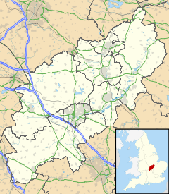
 Newbottle
Newbottle shown within NorthamptonshirePopulation 438 (2001 census)[1] OS grid reference SP523369 Parish Newbottle District South Northamptonshire Shire county Northamptonshire Region East Midlands Country England Sovereign state United Kingdom Post town Banbury Postcode district OX17 Dialling code 01295 Police Northamptonshire Fire Northamptonshire Ambulance East Midlands EU Parliament East Midlands UK Parliament Daventry Website Welcome to the Charlton-cum-Newbottle Website! List of places: UK • England • Northamptonshire Newbottle is a civil parish and largely deserted village in South Northamptonshire, about 4 miles (6.4 km) west of the market town of Brackley. It is close to the Oxfordshire county boundary and about 4.5 miles (7.2 km) south-east of the town of Banbury.
A stream that is a tributary of the River Cherwell forms the parish boundary to the north-west. The remainder of the parish boundary mostly follows field boundaries.
The parish includes the larger village of Charlton, about 0.5 miles (800 m) southeast of Newbottle. The 2001 census recorded a parish population of 438, most of whom live in Charlton.[1]
Contents
Archaeology
Rainsborough Camp is an early Iron Age hill fort in the southernmost part of the parish. Excavations in 1961-65 found that it had been inhabited and developed in phases between the 4th century BC and about 4 AD.[2]
Manor
Newbottle manor house is 16th century, built probably in the reign of Henry VIII.[2] The west wing was added in the 17th century and the library has panelling dating from about 1730.[2] The house has also an octagonal dovecote.[2]
Parish church
The Church of England parish church of Saint James has a tower built in about 1290-1210[3] and a Norman font. The present chancel is 13th century.[4] Between the nave and north aisle is a four-bay Decorated Gothic arcade.[2] The south aisle is a Perpendicular Gothic arcade addition.[4] The Gothic Revival east window in the chancel was inserted in 1865[4] and its stained glass is by C.E. Kempe.[2]
In the Middle Ages St. James' belonged to the Augustinian Dunstable Priory.[5] The Priory's annals for 1291 record it as receiving tithes from Newbottle.[5] It still possessed St. James' in 1535 when the Crown's bailiff valued the Priory's property and estates in preparation for the Dissolution of the Monasteries.[5]
St. James' now forms a single benefice with SS Peter and Paul, King's Sutton.[6]
References
- ^ a b "Area selected: South Northamptonshire (Non-Metropolitan District)". Neighbourhood Statistics: Full Dataset View. Office for National Statistics. http://neighbourhood.statistics.gov.uk/dissemination/viewFullDataset.do?instanceSelection=03070&productId=779&$ph=60_61&datasetInstanceId=3070&startColumn=1&numberOfColumns=8&containerAreaId=790474. Retrieved 14 November 2009.
- ^ a b c d e f Pevsner & Cherry, 1973, page 312
- ^ Pevsner & Cherry, 1973, page 311-312
- ^ a b c Pevsner & Cherry, 1973, page 311
- ^ a b c Victoria County History, 1904, pages 371-377
- ^ Archbishops' Council (2010). "St James, Newbottle w Charlton". A Church Near You. Church of England. http://www.achurchnearyou.com/newbottle-charlton-st-james/. Retrieved 25 March 2011.
Sources
- Pevsner, Nikolaus; Cherry, Bridget (1973) [1961]. Northamptonshire. The Buildings of England. Harmondsworth: Penguin Books. pp. 311–312. ISBN 0 14 071022 1.
- A History of the County of Bedford, Volume 1. Victoria County History. 1904. pp. 371–377.
External links
- Map sources for Newbottle, Northamptonshire
External links
 Media related to Newbottle, Northamptonshire at Wikimedia CommonsCategories:
- Villages in Northamptonshire
- Civil parishes in Northamptonshire
- Northamptonshire geography stubs

Wikimedia Foundation. 2010.