- A7 motorway (Netherlands)
-
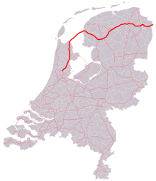 Location of the A7 motorway in the Netherlands.
The A7 motorway is a motorway in the Netherlands connecting Zaandam, via the Afsluitdijk, Sneek and Groningen to the German border near Bad Nieuweschans. The entire road is part of the European route E22, with exception of the first kilometre, between the terminus in Zaandam and the interchange Zaandam. With a length of 236 km it is the longest motorway in the Netherlands.
Contents
Motorway interruptions
The motorway A7 is interrupted twice:
- Around Sneek, the road is 'demoted' to a highway for several kilometres, and included some at-grade intersections, the at-grade intersections were replaced with grade separated intersections in 2008-2010, however, it isn't a motorway.
- Also around the city of Groningen it is demoted over a distance of several kilometres, mainly for the at-grade intersection with motorway A28, and for the road's small alignment through the city in general.
Both of the abovementioned sections are denoted as 'N7', to distinguish those parts from the motorway, for which the 'A' designation is used in the Netherlands. The A7 together with the N7 is called the Rijksweg 7.
 Westbound A7 near Groningen.
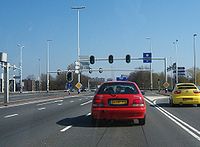 Interruption of the A7 in Groningen.
Speed limit experiment
As of March 2011, on a section of the A7 motorway motorists are allowed to drive at 130 km/h, instead of the normal country wide maximum of 120 km/h. This is a government test to investigate if driving at these higher speeds has an effect on environment and safety. If the test results positively, more motorways in the Netherlands will have a higher speed limit.
Afsluitdijk
The A7 runs along a historic part of Dutch engineering, the Afsluitdijk. This dam was originally created to protect a large coastal line from floods, by creating a large fresh water lake. The road over the Afsluitdijk was previously an N road, but is now a proper motorway.
Exit list
Province Municipality km. # Name Roads Notes North Holland Zaanstad 4 
Zaandam Terminus at roundabout in Zaandam. 5 
Interchange Zaandam A8 7  2
2Zaandijk For Zaanse Schans Wormerland 11 3Wijdewormer Purmerend 14 4Purmerend-South N235 15 5Purmerend 17 6Purmerend-North N244 Koggenland 29 7Avenhorn/Hoorn-West N243, N247 Hoorn 32 8Hoorn 34 9Hoorn-North N302 Medemblik 36 10Wognum N241 39 10aAbbekerk 43 11Medemblik N239 Wieringermeer 50 12Middenmeer N242 55 13Wieringerwerf N240, N248 Wieringen 64 14Den Oever N99  Afsluitdijk
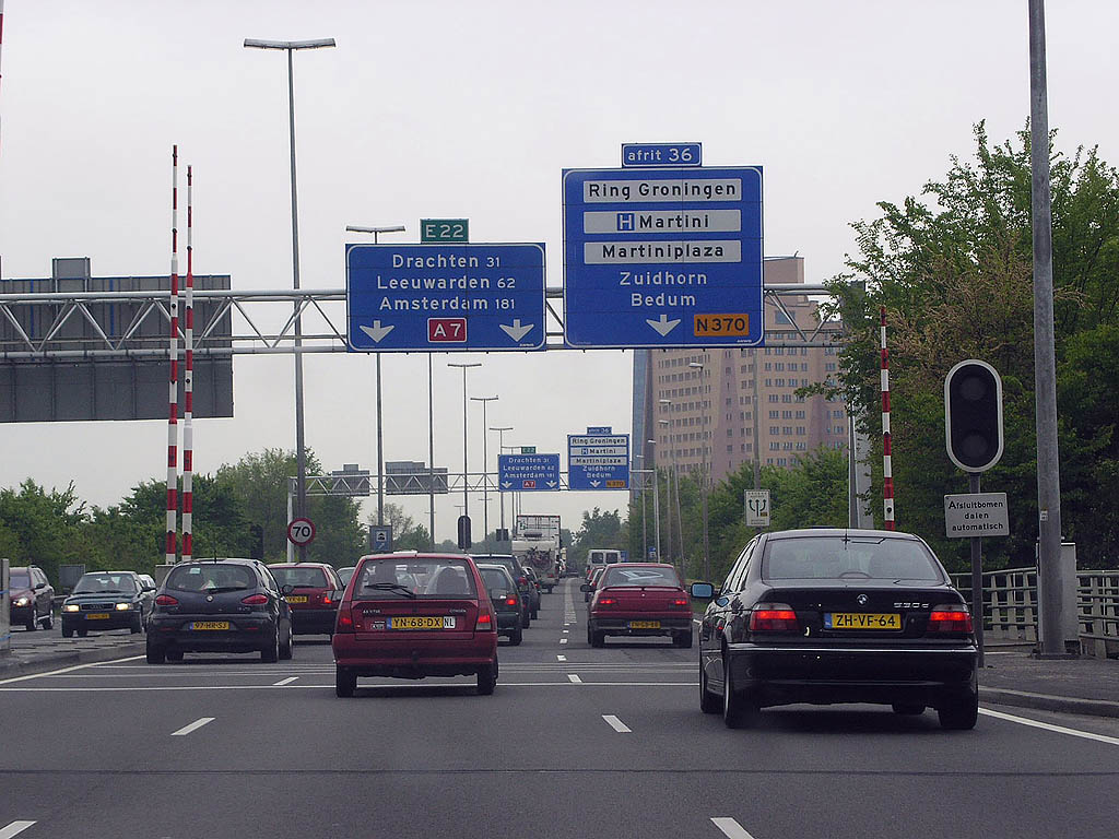
Friesland Súdwest Fryslân 97 -Kornwerderzand 101 Interchange Zurich A31 101 15Zurich 105 16Witmarsum 110 17Bolsward-North N359 112 18Bolsward-East 115 19Nijland Gap in motorway A7; the road continues as highway N7 as follows: 118 20Sneek-West 119 21Sneek-South N354 119 21aSneek-Woudvaart Westbound exit and eastbound entrance only 120 22Sneek-East The road continues as motorway A7 as follows: Skarsterlân 133 23Joure-West 136 Interchange Joure A6 140 25Oudehaske Heerenveen 142 26Heerenveen-West Westbound exit and eastbound entrance only 144 Interchange Heerenveen A32 147 26aTjalleberd Opsterland 152 27Gorredijk 158 28Beetsterzwaag Smallingerland 161 29Drachten-Centrum Centrum means (town) centre 165 30Oosterwolde N381 165 30aDrachten N31 Opsterland 170 31Frieschepalen N358 Groningen Marum 176 32Marum 180 33Boerakker N388 Leek 184 34Leek N372 Groningen 191 34aWestpoort (Groningen) 193 35Hoogkerk N372 Gap in motorway A7; the road continues as highway N7 as follows: 196 36Ring Groningen-West N370 196 36aMartini hospital Westbound exit only (Martini hospital accessible from other directions via 36)197 
Intersection Julianaplein A28 198 37Helpman 198 37aOosterpoort Eastbound exit and westbound entrance only 199 38Europaplein 204 Interchange Euvelgunne N46 205 39Westerbroek The road continues as motorway A7 as follows: Hoogezand-Sappemeer 213 40Foxhol N386 215 41Hoogezand N387 218 42Sappemeer Menterwolde 222 43Zuidbroek 224 44Noordbroek N33 Scheemda 230 45Scheemda N362 232 46Heiligerlee Winschoten 240 47Winschoten N367 Bellingwedde 246 48Oudeschans Reiderland 251 49Bad Nieuweschans  Border with Germany; this road continues as the German A280.
Motorways in the Netherlands 
 Categories:
- Motorways in the Netherlands


Wikimedia Foundation. 2010.