- Gorredijk
-
(Dutch) Gorredijk
(West Frisian) Gordyk— Town — 
Flag
Coat of arms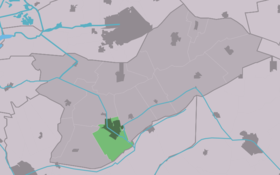
Country  Netherlands
Province  Friesland
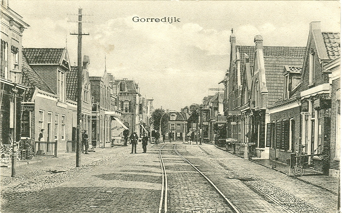
Population – Total c. 7,050 (2,007)  Gorredijk, 1914
Gorredijk (Frisian: de Gordyk) is the biggest town in the municipality of Opsterland, which lies in Friesland, which in turn is a province of the Netherlands. Gorredijk had an approximate population of 7,050 in 2007, which will have risen over 8,000 at the end of 2009 due to the development of several new housing projects.
Contents
History
Before the 1600's, the area now-a-days surrounding Gorredijk was sparsely populated by farmers who herded sheep, kept bees and produced buckwheat, oat, rye, peas, beans, flax and various herbs. However, most fields were not suitable for agriculture and consisted almost completely of bog, which could be excavated for valuable peat. This attracted several people, like Jonker Dekema and the gentlemen Compagnons, who made a good living out of excavating and selling the peat and ended up owning vast stretches of land. In 1630 a new way of transport was introduced when the Opsterlandse Compagnonsvaart, a 34 km (21 mi) long canal was finished. This is also considered the beginning of the colony "Goordyck", when the first houses and a bridge were constructed.
The year 1672 saw the construction of a Motte-and-bailey wall (de Skâns) around the settlement, due to its strategic position to protect the regained independence of Friesland in the aftermath of the Friso-Hollandic Wars. Gorredijk gained the title of Vlecke (Market town) in 1694 when the first weekly market (Gordykster Merke) and annual cattle market (which ended in the 1980s) were organized. The town also grew substantially in the early 1700's, when it merged with the nearby settlement of Kortezwaag, which would later become the name of a neighborhood. At the end of the 18th century an increase in Jewish immigrants occurred, due to the growing Dutch economy. These people constructed a synagogue, school and small Jewish cemetery in 1817 and flourished.
After the German invasion in 1940 during World War II the Netherlands fell under Nazi control. Dutch Jews were arrested, brought to Amersfoort, Vught or Westerbork and transported to the east. Very few Jews in Gorredijk would survive the war, but due to the reasonable amount of residents that were active in the Dutch resistance several people were able to remain hidden in the area for the duration of the war. During the five years of occupation three British and one American aircraft were shot down over the town, which crashed near the neighboring villages of Terwispel and Hemrik.[1][2][3]
The last fatality of the war in Gorredijk was Gerke Numan, a member of the Dutch resistance. He was part of a group of eleven people who were tasked to prevent the retreating Germans from blowing up the main drawbridge in Gorredijk, so that the advancing Canadian 3rd Infantry Division and 2nd Corps armor could make a quick advance to the north. Numan was killed by a hand grenade in the firefight that ensued with Nazis from Heerenveen and the bridge was completely destroyed. The new bridge that was constructed after the war was named after him.
Notable residents
Notable residents of Gorredijk were and are:
- Roelof Kuipers (1855 – 1922), architect (specialized in water supply)
- Tjeerd Kuipers (1857 – 1942), architect (specialized in churches)
- Hans de Jong (1921 – 2010), former weather reporter for the NCRV
- Wilco Hellinga (1970), former soccer player and current trainer of SC Heerenveen.
- Jannick de Jong (1987), speedway and grasstrack racer
- Arjen Bergsma (1989), soccer player with SC Heerenveen.
External links
- Plaatselijk Belang Gorredijk - Unofficial homepage (in Dutch)
Notes
- ^ VERLIESREGISTER 1939-1945: Alle Militaire Vliegtuigverliezen In Nederland Tijdens De Tweede Wereldoorlog / 1941 - http://www.nimh.nl/nl/images/1941%20sec_tcm5-7282.pdf
- ^ VERLIESREGISTER 1939-1945: Alle Militaire Vliegtuigverliezen In Nederland Tijdens De Tweede Wereldoorlog / 1943 - http://www.nimh.nl/nl/images/1943%20sec_tcm5-7284.pdf
- ^ De Witte Kerk Van Hemrik by Huub Mous (in Dutch) - http://www.huubmous.nl/2009/03/13/de-witte-kerk-van-hemrik/
Categories:- Articles with West Frisian language external links
- Populated places in Friesland


Wikimedia Foundation. 2010.