- Middenmeer
-
Middenmeer — Town — 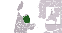 The town centre (darkgreen) and the statistical district (lightgreen) of Middenmeer in the municipality of Wieringermeer.
Coordinates: 52°48′31″N 4°59′54″E / 52.80861°N 4.99833°ECoordinates: 52°48′31″N 4°59′54″E / 52.80861°N 4.99833°E Country Netherlands Province North Holland Municipality Wieringermeer Population (2007) - Total 3,163 Demonym mixed Time zone CET (UTC+1) - Summer (DST) CEST (UTC+2) Postal code 1775 Middenmeer is a town in the Dutch province of North Holland. It is part of the municipality of Wieringermeer, and lies about 18 km north of Hoorn.
Middenmeer was established in 1932 under the name of Sluis III. Nearby the village was a military airfield Middenmeer in WO II used by the Ie Verkenningsgroep of the Dutch Royal Airforce. Now Middenmeer has an airfield for light and ultra light airplanes.
On July 1, 1941, the Wieringermeer became a municipality and its first mayor was ir. S. Smeding.
On April 17, 1945, the dikes of the Wieringermeer polder were blown up by the German occupying forces and the Wieringermeer was inundated. Middenmeer as well as neighboring villages had to be evacuated.
On December 11, 1945 the polder was dry again. In Middenmeer started the first Moedermavo (School for mothers) of the Netherlands, a school for women.
People
Sicco Mansholt was mayor in 1945 for some weeks.
In 2001, the town of Middenmeer had 2805 inhabitants. The built-up area of the town was 0.82 km², and contained 1193 residences.[1] The wider statistical area of Middenmeer has a population of around 3210.[2]
References
- ^ Statistics Netherlands (CBS), Bevolkingskernen in Nederland 2001 [1]. Statistics are for the continuous built-up area.
- ^ Statistics Netherlands (CBS), Gemeente Op Maat 2004: Wieringermeer [2].
Categories:- Populated places in North Holland
- North Holland geography stubs


Wikimedia Foundation. 2010.