- Marum
-
For other uses, see Marum (disambiguation).
Marum — Municipality — 
Flag
Coat of arms
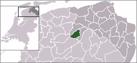
Coordinates: 53°09′N 6°16′E / 53.15°N 6.267°E Country Netherlands Province Groningen Area(2006) - Total 64.88 km2 (25.1 sq mi) - Land 64.51 km2 (24.9 sq mi) - Water 0.37 km2 (0.1 sq mi) Population (1 January, 2007) - Total 10,061 - Density 156/km2 (404/sq mi) Source: CBS, Statline. Time zone CET (UTC+1) - Summer (DST) CEST (UTC+2) Marum (
 pronunciation (help·info)) is a municipality and a town in the northeastern Netherlands.
Population centres
Boerakker, Jonkersvaart, Lucaswolde, Marum, Niebert, Noordwijk, Nuis, De Wilp.
External links
Gallery
-

Town hall of Marum
Appingedam · Bedum · Bellingwedde · Delfzijl · Eemsmond · Groningen · Grootegast · Haren · Hoogezand-Sappemeer · Leek · Loppersum · De Marne · Marum · Menterwolde · Oldambt · Pekela · Slochteren · Stadskanaal · Ten Boer · Veendam · Vlagtwedde · Winsum · Zuidhorn

See also: Netherlands · Provinces · Municipalities Coordinates: 53°09′N 6°16′E / 53.15°N 6.267°E
Categories:- Municipalities of Groningen (province)
- Populated places in Groningen (province)
- Groningen geography stubs
-


Wikimedia Foundation. 2010.