- Wieringen
Infobox Settlement
official_name = Wieringen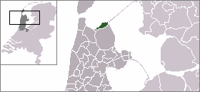
mapsize = 280px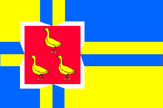
flag_size = 150x75px
image_shield = Wieringen wapen.png
subdivision_type = Country
subdivision_name =Netherlands
subdivision_type1 = Province
subdivision_name1 =North Holland
leader_name = T.J. Lont
leader_party = CDA
area_footnotes = (2006)
area_total_km2 = 212.50
area_land_km2 = 26.77
area_water_km2 = 185.73
population_as_of =1 January ,2007
population_note = Source: CBS, [http://statline.cbs.nl/ Statline] .
settlement_type = Municipality
population_total = 8705
population_density_km2 = 325
timezone = CET
utc_offset = +1
timezone_DST = CEST
utc_offset_DST = +2
latd = 52.90
latNS = N
longd = 4.97
longEW = E
website = [http://www.wieringen.nl www.wieringen.nl]. It consists of a former island, also named Wieringen, and there are plans to make Wieringen an island again by widening the Amsteldiepkanaal into a lake called the Wieringerrandmeer.
Population centres
The municipality of Wieringen consists of the following cities, towns, villages and/or districts: Dam,
De Haukes ,De Hoelm ,Den Oever ,Hippolytushoef ,Hollebalg ,Noordburen ,Oosterklief , Oosterland,Smerp , Stroe,Vatrop ,Westerklief and Westerland.History
The landscape of Wieringen is not all flat: it is characterised by dam ramparts of
boulder clay , which were formed during the SaaleIce Age . The name Wieringen has nothing to do with "wier"(seaweed in Dutch), but this connection was often made in former days. Probably the name came fromOld Frisian "wîr" = "height".Earliest references
The first known references to Wieringen is as "Wiron" or "pagus Wirense" in
Latin in a [http://www.pagowirense.nl/english/wr-his2c.htm list of property] owned by themonastery atFulda , dated late 8th century or early 9th century AD. In that list, the entries that mention Wieringen are:-:"Ego Gebi tradidi ad monasterium sancti Bonifacii in pago Wirense curtilem unam cum omnibus que ad eam pertinent, terris et mancipiis, domibus et mancipiis." = "I, Gebi, have transferred to the monastery of St.
Bonifacius in the area Wieringen one mansion with all that goes with it, land with the serfs and dwellings with the serfs.".:"Ego Gerwic de Fresia trado sancto Bonifacio ad Fuldense monasterium terram iuris mei iuxta fluvium Maresdeop et quicquid proprietatis habui sive in agris vel pratis, silvis, domibus vel mancipiis." = "I, Gerwic of
Friesland , transfer to St.Bonifacius of themonastery ofFulda the land that is under my jurisdiction near the riverMarsdiep , and all I had in possession either fields or meadows, forests, houses or serfs.".::It describes the
Marsdiep as "fluvium Maresdeop": "fluvium" isLatin for "river"; it seems that in that timeTexel andWieringen were much bigger and spread across what is now the western end of theWaddenzee and perhaps also other areas which are now sea or have been re-empoldered since. Wieringen and Texel may have met as opposite banks of the Maresdeop (which name may mean "morass deep"), which was then an ordinary river with banks of permanent land (but perhaps a large river, as it is called a "deep").:"Ego Geltrud tradidi ad monasterium sancti Bonifacii omnem proprietatem meam in agris, silvis et de pratis ad XX carradas feni, in loco nuncupato Wictulfingafurt in pago Wironi." = "I, Geltrud, have transferred to the monastery of St.
Bonifacius all my property in fields, forests and from the meadows to [= "enough land to produce"?] 20 cart-loads ofhay , in the place named Wictulfingafurt, in the area Wieringen ...". Wictulfingafurt means "the ford of the sons or people of a man called Wictulf".:"Ego in Dei nomine Isanbalt et uxor mea Sigibirn de Fresia tradimus ad sanctum Bonifacium in villa que dicitur Brochenlar, in pago Wirah, quicquid proprietatis habuimus, hoc est de terra arabili quantum XI modus conseri potest." = "In God's name I, Isanbalt and my wife Sigibirn from
Friesland , transfer to St. Bonifacius in the manor which is named Brochenlar, in the area [named] Wieringen, all we had in property, that is ofplough land as much as can be sowed with 11 measures [of seed] .".::The places Wictulfingafurt and Brochenlar cannot now be found, and their sites are likeliest now under the sea, or under some
polder which has been made since.:"Ego Hunbertus tradidi ad sanctum Bonifacium quicquid mihi in regione Frésionum in pago Wirah mei reliquere parentes in hereditatem, cunctamque meam possessionem, hoc est in terris, agris, pratis, pascuis, silvis, aquis, domibus ac familiis." = "I, Hunbertus, have transferred to St. Bonifacius whatever in the region of the
Frisians in the area Wieringen my parents left me in inheritance, and my complete possessions, that it in fields, meadows, grassland, forests, waters, dwellings, and all the families [= "inhabitants of that estate"] ".::These gifts are all dated between 800AD and 820AD and include 5 manors.
:A possessions list of the St. Martin's church in Utrecht, dated 948, lists a church domain with 12 farms at "Alvitlo" (= De Elft), and 72 [probably mostly small] farms at "Strude" (= Stroe). Both these places still exist and are in Wieringen.
:The amount of property in land in these two lists, would need an area much bigger than the modern (up to the 1930's) island of Wieringen.
Later history
Silver treasure was found in 1996 in a pasture at the hamlet ofWesterklief , showing that Wieringen in the 9th century was for a short time an operating base ofViking s. The treasure is approx. 1.7 kilograms of silver coins and jewels and small silver ingots. It now can be seen in theRijksmuseum voor Oudheden in Leiden. Some years later were found smaller silver treasures from the same period which confirmed the picture. Wieringen became an island around 1200 as a result of successive storm floods.The area was initially inhabited and controlled by
Frisians , until the Dutch countFloris V made the Wieringers subject in 1284. Afterwards the area was unquiet for a time, and since 1297 was directly under the county ofHolland , for it fell under Westfriesland. Westfriesland fell for some time under Frisian rule. In 1299 the county of Holland retook Holland and Westfriesland, and Wieringen fell under the district of Westfriesland. In 1432 all the island of Wieringen officially became one township and received city rights. But as more of Holland and Westfriesland developed and became more habitable, the importance of Wieringen decreased relatively.In 1798, when the
Batavian Republic formed, the province ofHolland and West Friesland was divided differently: it fell under thedépartement of Texel (from theVlie to theRhine ). In 1807 underNapoleon the province was differently subdivided and in two types of provinces; Amstelland and Maasland, but in 1814 came to that an end. In 1815 Holland with Westfriesland became a province of the Kingdom of the Netherlands. To reduce the dominance of the province of Holland, in 1840 under King Willem I it was split into the provinces ofNoord-Holland andZuid-Holland . Since then Wieringen has been under the province ofNoord-Holland .In 1924 Wieringen stopped being an island, because on 31 July 1924 the
Amsteldiep was closed by a short dam called the Amsteldiepdijk. In 1930 the Eastern Wieringermeerdijk was completed in the Zuiderzee, and with it the adjacent polder theWieringermeer . The closing of the Zuiderzee was completed in 1932 by theAfsluitdijk , a large dike which links Wieringen with Friesland. This dike starts atDen Oever .Soon after these changes Wieringen became an exile refuge for the German crown prince Wilhelm. He with his father Wilhelm II fled in November 1918 from Flanders to the Netherlands and got political asylum. On 22 November 1918 he arrived on the island, and he left 10 November 1923 to Germany. In the meantime at the blacksmithy in
Hippolytushoef he learned how to forgehorseshoe s.Local government
The municipal council of Wieringen consists of 13 seats, which are divided as follows:
* OW '91 - 5 seats
* VVD - 3 seats
* PvdA - 3 seats
* CDA - 2 seatsReferences
* Statistics are taken from the [http://www.sdu.nl/staatscourant/gemeentes/gem532nh.htm SDU Staatscourant]
Wikimedia Foundation. 2010.