- Wester-Koggenland
Infobox Settlement
name =PAGENAME
official_name =
other_name =
native_name =
nickname =
settlement_type =
total_type =
motto =
imagesize =
image_caption =
flag_size =
image_
seal_size =
image_shield =
shield_size =
image_blank_emblem =
blank_emblem_type =
blank_emblem_size =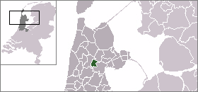
mapsize =
map_caption =
mapsize1 =
map_caption1 =
image_dot_
dot_mapsize =
dot_map_caption =
dot_x = |dot_y =
pushpin_
pushpin_label_position =
pushpin_map_caption =Location within the Netherlands
pushpin_mapsize =
subdivision_type = Country
subdivision_name = Kingdom of the Netherlands
subdivision_type1 = Constituent country
subdivision_name1 = NLD
subdivision_type2 = Province
subdivision_name2 =North Holland
subdivision_type3 =
subdivision_name3 =
seat_type =
seat =
parts_type =
parts_style =
parts =
p1 =
p2 =
government_footnotes =
government_type =
leader_title =
leader_name =
leader_title1 =
leader_name1 =
established_title =
established_date =
area_magnitude =
unit_pref =
area_footnotes =
area_total_km2 =62.59
area_land_km2 =59.99
area_water_km2 =2.60
area_total_sq_mi =
area_land_sq_mi =
area_water_sq_mi =
area_water_percent =
elevation_footnotes =
elevation_m =
elevation_ft =
elevation_max_m =
elevation_max_ft =
elevation_min_m =
elevation_min_ft =
population_as_of =2005
population_footnotes =
population_note =
population_total =13757
population_density_km2 =229
population_density_sq_mi =
timezone = CET
utc_offset = +1
timezone_DST = CEST
utc_offset_DST = +2
coor_type =
latd=52 |latm=37 |lats= |latNS=N
longd=4 |longm=57 |longs= |longEW=E
postal_code_type =
postal_code =
area_code =
website = [http://www.wester-koggenland.nl www.wester-koggenland.nl]
blank_name =
blank_info =
blank1_name =
blank1_info =
footnotes =.
Population centres
The area of the former municipality of Wester-Koggenland consists of the following cities, towns, villages and/or districts:
Avenhorn ,Berkhout ,De Goorn ,Oudendijk , Rustenburg,Scharwoude ,Spierdijk ,Ursem ,Wogmeer (partly),Zuidermeer .Local government
Before the merger, the last municipal council of Wester-Koggenland consisted of 15 seats, which were divided as follows:
* CDA - 5 seats
* Gemeentebelangen - 4 seats
* VVD - 3 seats
* PvdA - 2 seats
* Fractie Mollet - 1 seatReferences
* Statistics are taken from the [http://www.sdu.nl/staatscourant/gemeentes/gem526nh.htm SDU Staatscourant]

Wikimedia Foundation. 2010.