- Compton, West Sussex
-
Coordinates: 50°55′39″N 0°53′49″W / 50.92748°N 0.89701°W
Compton 
Compton Church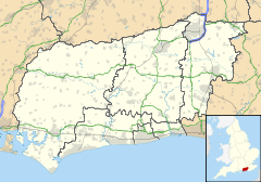
 Compton
Compton shown within West SussexArea 17.51 km2 (6.76 sq mi) [1] Population 386 [1] 2001 Census - Density 22 /km2 (57 /sq mi) OS grid reference SU776147 - London 52 miles (84 km) NE Parish Compton District Chichester Shire county West Sussex Region South East Country England Sovereign state United Kingdom Post town CHICHESTER Postcode district PO18 Dialling code 023 Police Sussex Fire West Sussex Ambulance South East Coast EU Parliament South East England UK Parliament Chichester List of places: UK • England • West Sussex Compton is a village and civil parish in the Chichester district of West Sussex. The village lies on the B2146 road, six miles (9.5 km) southeast of Petersfield, Hampshire and eight miles (13 km) northwest of Chichester. The parish also includes the villages of West Marden and Up Marden.
The village has a long history, perhaps first being mentioned in the will of King Alfred the Great. It is in the Sussex Downs Area of Outstanding Natural Beauty.
High ground nearby is known as Compton Down and on a part of the down known as Telegraph Hill there was an Admiralty semaphore station.
References
- ^ a b "2001 Census: West Sussex – Population by Parish". West Sussex County Council. http://www.westsussex.gov.uk/communityandliving/census2001/pop_parish_summary.pdf. Retrieved 26 April 2009.
External links
- Compton from the Victoria County History at British History Online
Categories:- Villages in West Sussex
- West Sussex geography stubs


Wikimedia Foundation. 2010.