- West Dean, West Sussex
-
Coordinates: 50°54′23″N 0°46′36″W / 50.90644°N 0.77656°W
West Dean 
West Dean House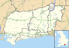
 West Dean
West Dean shown within West SussexArea 24.84 km2 (9.59 sq mi) [1] Population 425 [1] 2001 Census - Density 17 /km2 (44 /sq mi) OS grid reference SU861126 - London 50 miles (80 km) NE Parish West Dean District Chichester Shire county West Sussex Region South East Country England Sovereign state United Kingdom Post town CHICHESTER Postcode district PO18 Dialling code 01243 Police Sussex Fire West Sussex Ambulance South East Coast EU Parliament South East England UK Parliament Chichester List of places: UK • England • West Sussex West Dean is a village and civil parish in the District of Chichester in West Sussex, England located 7.5 kilometres (4.7 mi) north of Chichester on the A286 road just west of Singleton. The parish includes the hamlets of Binderton and Chilgrove.
Binderton is mentioned in the Domesday Book under Sussex in the lands belonging to Earl Roger. The book which was written in 1086 said:
The Earl himself[2] holds Binderton. Countess Gytha held it. Then assessed at 7 hides but now three. There is land for four ploughs. In demesne there are two ploughs and eight villans with nine bordars with two ploughs. There are four acres of meadow and a church. TRE[3] it was woth 100 shillings then sixty shillings, now seven pounds.[4]West Dean is set in the valley of the River Lavant in the South Downs has an Anglican parish church dedicated to Saint Andrew. The church and most of the houses are built of flint, usually with brick quoins and window dressings. There is one pub, the Selsey Arms.
Contents
West Dean House
The village is dominated by West Dean House, a large mansion built of flint which now houses West Dean College, an arts and crafts school.[5] The house, built by the Peachey family in 1804, was later bought by the James family and was the home of Edward James, who donated it to a charitable trust in 1964. The gardens around the house are open to the public and have well preserved Victorian walled gardens and glasshouses. There is also a park and arboretum.[6]
The parish has a land area of 2484 hectares (6136 acres)[citation needed]. In the 2001 census 425 people lived in 177 households, of whom 248 were economically active.[1] The village is on the route of the Monarch's Way long distance footpath.
Landmarks
Kingley Vale lies on the border of the parish which is a Site of Special Scientific Interest and a National Nature Reserve. It is noted for its Yew woodlands.[7] The site is also known for its archaeological interest including Bronze Age and Roman earthworks, cross dykes, a camp and a field system.
References
- ^ a b c "2001 Census: West Sussex – Population by Parish". West Sussex County Council. http://www.westsussex.gov.uk/communityandliving/census2001/pop_parish_summary.pdf. Retrieved 2 June 2009.
- ^ Earl Roger held several manors in Sussex including Mid Lavant, Chichester, and Cocking.
- ^ Tempore Regis Edward ie in the time of King Edward before the Norman Conquest in 1066
- ^ Domesday Book, a complete translation, Ann Williams and GH Martin (Eds), p55, ISBN 0140515356, 2002
- ^ West Dean College
- ^ West Dean Gardens
- ^ (PDF) SSSI Citation — Kingley Vale. Natural England. http://www.english-nature.org.uk/citation/citation_photo/1002819.pdf. Retrieved 4 April 2009.
- The geographic coordinates are from the Ordnance Survey.
External links
 Media related to West Dean, West Sussex at Wikimedia CommonsCategories:
- Villages in West Sussex
- Monarch's Way


Wikimedia Foundation. 2010.