- Chelsfield railway station
-
Chelsfield 

 Chelsfield
Location of Chelsfield in Greater LondonLocation Chelsfield Local authority Bromley Managed by Southeastern Station code CLD Number of platforms 2 Accessible  [1]
[1]Fare zone 6 National Rail annual entry and exit 2004-05  0.623 million[2]
2005-06 0.627 million[2]2006-07 0.877 million[2]2007-08 0.954 million[2]2008-09  0.874 million[2]
2009-10 0.85 million[2]2 March 1868 Opened List of stations Underground · National Rail External links Departures • Layout Facilities • Buses Coordinates: 51°21′23″N 0°06′27″E / 51.3565°N 0.1076°E
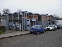
Chelsfield railway station is in the London Borough of Bromley, and serves the southern parts of the built-up area of Orpington - Chelsfield itself, and Green Street Green. It is in Travelcard Zone 6.
The line on which it is located, and the station itself, was opened on 2 March 1868 by the South Eastern Railway to shorten its route from London to Dover. The building of the route, which crosses the North Downs, was a difficult undertaking, with steep gradients. At Chelsfield the line is rising steadily on a 1 in 120 gradient through the 597yds (543m) Chelsfield Tunnel beyond the station. The modern station building is on the Up side of the line.
Service
The typical off-peak service from the station is two trains per hour southbound to Sevenoaks and two trains per hour northbound to London Charing Cross, calling at all stations to Hither Green and then running fast to London Bridge. In the peak hours this is supplemented by stopping Tunbridge Wells to London Charing Cross services, running fast from Chelsfield to London Bridge. Sevenoaks to Charing Cross services are diverted to Cannon Street.
Preceding station  National Rail
Following station Orpington Southeastern
South Eastern Main Line
via Paddock WoodKnockholt Southeastern
Tunbridge Wells stopping services
Peak HoursSevenoaks/
KnockholtReferences
- ^ "London and South East". Rail Map for People with Reduced Mobility. National Rail. September 2006. http://www.nationalrail.co.uk/system/galleries/download/mobility_maps/LondonSouthEast.pdf. Retrieved 1 January 2010.
- ^ a b c d e f "Station usage". Rail statistics. Office of Rail Regulation. 30 April 2010. http://www.rail-reg.gov.uk/server/show/nav.1529. Retrieved 17 January 2011. Please note: Some methodology may vary year on year.
External links
- Train times and station information for Chelsfield railway station from National Rail
Categories:- Stations in London fare zone 6
- Railway stations in Bromley
- Former South Eastern Railway (UK) stations
- Railway stations opened in 1868
- Railway stations served by Southeastern
- DfT Category D stations


Wikimedia Foundation. 2010.