- Mio, Michigan
-
Mio, Michigan — CDP — Location of Mio within Oscoda County, Michigan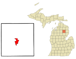 Location within the state of Michigan
 Mio, Michigan
Coordinates: 44°39′08″N 84°7′47″W / 44.65222°N 84.12972°W Country United States State Michigan County Oscoda Township Big Creek
MentorArea - Total 8.1 sq mi (21.0 km2) - Land 7.5 sq mi (19.3 km2) - Water 0.6 sq mi (1.7 km2) Elevation[1] 1,020 ft (311 m) Population (2000) - Total 2,016 - Density 270.1/sq mi (104.3/km2) Time zone Eastern (EST) (UTC-5) - Summer (DST) EDT (UTC-4) ZIP code 48647 Area code(s) 989 FIPS code 26-54660[2] GNIS feature ID 1620853[1] Mio (
 /ˈmaɪ.oʊ/) is an unincorporated community in the U.S. state of Michigan. It is the county seat of Oscoda County[3] and is situated along the boundary between Mentor Township on the east and Big Creek Township on the west.
Mio is also a census-designated place (CDP) used for statistical purposes, but has no legal status as an incorporated municipality. As of the 2000 census, the CDP population was 2,016.
The town was founded in 1881, and was originally called “Mioe”, in honor of the wife of town founder, Henry Deyarmond. Other founders are Colige Comins, Reirlo Fosdick, and John Randall.[4] A post office named Mioe opened May 3, 1882. The name changed to Mio on November 21, 1883.[5] The Mio post office, with ZIP code 48647, also serves the northern portions of Mentor Township and the northeastern part of Big Creek Township, as well as a large area of eastern and southern Elmer Township and smaller portions of western Clinton Township and Comins Township.[6]
Contents
State record
On July 13, 1936, the temperature in Mio climbed to 112°F (44°C), the highest temperature ever recorded in Michigan. The coldest recorded temperature is −51 °F (−46 °C) at Vanderbilt on February 9, 1934.[7]
Along the AuSable River stands the biggest red cedar tree in Michigan. The tree can be found down a trail along the river between Comins Flatts and M-Dot in Mio.
Geography
According to the United States Census Bureau, the CDP has a total area of 8.1 square miles (21 km2) of which, 7.5 square miles (19 km2) of it is land and 0.6 square miles (1.6 km2) of it (8.01%) is water.
Geographic features
- Mio is situated in the Au Sable River Valley.
- It is surrounded by the Huron National Forest and near the Rifle River State Recreation Area.
- The area is part of the Au Sable State Forest, specifically the
- Grayling FMU (Alcona, Crawford, Oscoda, and northern Iosco counties).
- Much of the area sits on the Grayling outwash plain.[8]
- The Oscoda County Park is minutes away.[9]
- Mio is part of Northern Michigan.
Education
Main Article: Mio Ausable Schools
Mio is home to a public K-12 school, located on M-33. The school is a conjuncture of a Elementary, Middle, and High School.
Transportation
Michigan State Trunklines
Oscoda County Intercounty Highways
 F-32
F-32
Demographics
As of the census[2] of 2000, there were 2,016 people, 826 households, and 537 families residing in the CDP. The population density was 270.1 per square mile (104.3/km²). There were 1,191 housing units at an average density of 159.6 per square mile (61.6/km²). The racial makeup of the CDP was 96.83% White, 0.15% African American, 0.55% Native American, 0.10% Asian, 0.25% from other races, and 2.13% from two or more races. Hispanic or Latino of any race were 1.44% of the population.
There were 826 households out of which 30.3% had children under the age of 18 living with them, 49.4% were married couples living together, 11.5% had a female householder with no husband present, and 34.9% were non-families. 28.5% of all households were made up of individuals and 13.4% had someone living alone who was 65 years of age or older. The average household size was 2.44 and the average family size was 2.99.
In the CDP the population was spread out with 26.0% under the age of 18, 8.2% from 18 to 24, 27.8% from 25 to 44, 21.9% from 45 to 64, and 16.1% who were 65 years of age or older. The median age was 38 years. For every 100 females there were 92.6 males. For every 100 females age 18 and over, there were 87.5 males.
The median income for a household in the CDP was $26,831, and the median income for a family was $31,379. Males had a median income of $29,542 versus $20,927 for females. The per capita income for the community was $13,064. About 13.9% of families and 21.3% of the population were below the poverty line, including 33.3% of those under age 18 and 13.4% of those age 65 or over.
Local attractions and activities
The community is centered in the Huron National Forest along the Au Sable River. Wildlife are nearby, including bear, deer, eagles, Kirtland's Warblers, and turkeys. Local attractions and activities include:
- Amish Community with Stores and Bakeries
- Birding
- Boating, Paddling (canoe and kayak)
- Coptic Orthodox St. Mina Retreat Center
- Fishing, particularly trout fishing.
- Geocaching
- Hiking
- Hunting
- Kirtland Warbler Habitat and Festival The Kirtland's Warbler has its habitat in the area.[10] There is a Kirtland's Warbler Festival, which is sponsored in part by Kirtland Community College.[11]
- Mennonite Relief Expo & Fair
- Michigan Shore to Shore Riding & Hiking Trail passes through Mio. It runs from Empire to Oscoda, and points north and south. It is a 500-mile interconnected system of trails.[12]
- Nordic skiing
- ORV, motor cycle and groomed snowmobile trails.[13]
- Steiner's Museum of pioneer artifacts is in nearby Fairview[14]
- Our Lady of the Woods Catholic Shrine[15]
Local recurring events
There are many recurring local events.[16]
- First Dam Canoe Race (MCRA - Canoe Race)[17]
- Mennonite relief sale[18]
- Michigan Magazine Craft Show[19]
- Mio Mud Bogs & Drags[20]
- Nor Easter Folk Music Festival[21]
- Outdoor Sportsmens Expo
- Oscoda County Fair & Forestry Exposition[22]
Historical markers
There are two historical markers in Mio.
- Mio Hydroelectric Plant was built in 1916 on the lower Au Sable River. William W. Tefft, a Consumers Power civil and hydraulic engineer invented and patented the so-called "conduit spillway", which channels excessive flow through channels built into the plant. This was the first plant to use it, and it is cheaper than other forms of spillways.[23]
- Oscoda County Courthouse was built in 1888[24][25]
- Union Corners is an abandoned "town" situated on Valley Road in Mio, Michigan. It was abandoned in 1882 when it's county government moved to where downtown Mio is now located today. Originally, it was a small farming community. However, the farmers moved from the area because of the poor soil quality. Today, there are very few remnants of Union Corners besides a plaque where the town used to be located and various grave sites throughout the area. Some of these grave sites belong to members of the Union Corners community.
Media
The following can be accessed in Mio, Michigan.
Newspapers
- The Oscoda County Herald is a weekly publication available on newsstands every Tuesday and by mail on Wednesday. The paper covers news and sports from all of Oscoda County, as well as other nearby communities. It also serves as the paper of record for all municipalities in Oscoda County, and is the only newspaper recognized by the Michigan Press Association that operates inside of Oscoda County. The Oscoda County Herald is owned by Sunrise Printing & Publishing, which also owns the Ogemaw County Herald and the Arenac County Independent.
Television
Radio
FM
Call Sign Frequency City Broadcast From WJOJ 89.7 Harrisville WPHN 90.5 Gaylord WCML 91.7 Alpena WFXD 92.5 Atlanta WAVC 93.9 Mio WKJZ 94.9 Hillman WCMB 95.7 Oscoda WUPS 98.5 Harrison WATZ 99.3 Alpena WGRY 100.3 Grayling WMJZ 101.5 Gaylord WKJC 104.7 Tawas City WHSB 107.7 Alpena AM
There are no AM Radio Stations in range of Mio, Michigan.
Media spotlight
For nearly 18 years, Mio was thrust into the local and national media spotlight due to a case involving two Detroit-area hunters that went missing in the fall of 1985. The case was eventually cracked in 2003, when two brothers (one from Hale in nearby Iosco County and one from Monroe, in the southeast region of the state) were convicted of murdering the pair near Mio. A true account of the crimes was detailed in a 2006 book by Tom Henderson, titled Darker Than Night.
Notes
- ^ a b U.S. Geological Survey Geographic Names Information System: Mio, Michigan
- ^ a b "American FactFinder". United States Census Bureau. http://factfinder.census.gov. Retrieved 2008-01-31.
- ^ "Find a County". National Association of Counties. http://www.naco.org/Counties/Pages/FindACounty.aspx. Retrieved 2011-06-07.
- ^ Mio information
- ^ U.S. Geological Survey Geographic Names Information System: Mio Post Office
- ^ 48647 5-Digit ZCTA, 486 3-Digit ZCTA - Reference Map - American FactFinder, United States Census Bureau, 2000 census
- ^ "The Geography of Michigan". netstate.com. http://www.netstate.com/states/geography/mi_geography.htm. Retrieved March 20, 2011.
- ^ Regional geography, geology and ecology of the area.
- ^ Oscoda County Park
- ^ Michigan Department of Natural Resources, Kirtland's Warbler Populations Continue to Grow.
- ^ "Kirtland Warbler Festival and links.". http://warbler.kirtland.edu/.
- ^ Michigan Shore to Shore Riding and Hiking Trail.
- ^ Michigan Organizations, Oscoda County Chamber of Commerce.
- ^ Steiner Museum
- ^ Our Lady of the Woods
- ^ Oscoda County Chamber of Commerce, including calendar of events, attractions.
- ^ First Dam Canoe Race
- ^ Mennonite Relief Sale details.
- ^ Michigan Magazine craft show.
- ^ Au Sable Valley connection.
- ^ Nor Easter Folk Music Festival.
- ^ Oscoda County Fair & Forestry Exposition.
- ^ Mio electric Plant historical marker
- ^ Picture of Oscoda County Courthouse.
- ^ Mio historical markers
External links
- The Oscoda County Herald Online
- Au Sable Valley connection.
- Oscoda County Chamber of Commerce, including calendar of events, attractions.
- Oscoda County Web Site.
- Calendar of Events, Sunrise side.
- Enchanted forest, Northern Michigan source for information, calendars, etc.
- Sunrise side travel and information
Municipalities and communities of Oscoda County, Michigan Townships 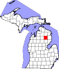
Unincorporated
communitiesCoordinates: 44°39′08″N 84°07′47″W / 44.65222°N 84.12972°W
Categories:- Unincorporated communities in Oscoda County, Michigan
- Census-designated places in Michigan
- County seats in Michigan


Wikimedia Foundation. 2010.