- Rhode Island Route 78
-
Route 78

Westerly Bypass Route information Maintained by RIDOT Length: 4.4 mi (7.1 km)
Connecticut: 0.2 mi
Rhode Island: 4.2 miExisted: 1979 – present Major junctions West end:  Route 2 in Stonington, CT
East end:  US 1 in Westerly, RI
Highway system ←  Route 77
Route 81  →
→←  Route 77
CT Route 79  →
→Route 78, also known as the Westerly Bypass is a two-lane arterial boulevard and expressway between Stonington, Connecticut to Westerly, Rhode Island. The route is about 4.4 miles (7.1 km) long and begins at Connecticut Route 2 in Stonington, crossing into Rhode Island at the Pawcatuck River, where it continues as an expressway to U.S. Route 1 in Westerly. The route was constructed in 1979, after a sixteen year delay. The designation was to become part of the Orient Point–Watch Hill Bridge, but this plan was later dropped. The route was given the memorial name of Veterans Way in 2004.
Contents
Route description
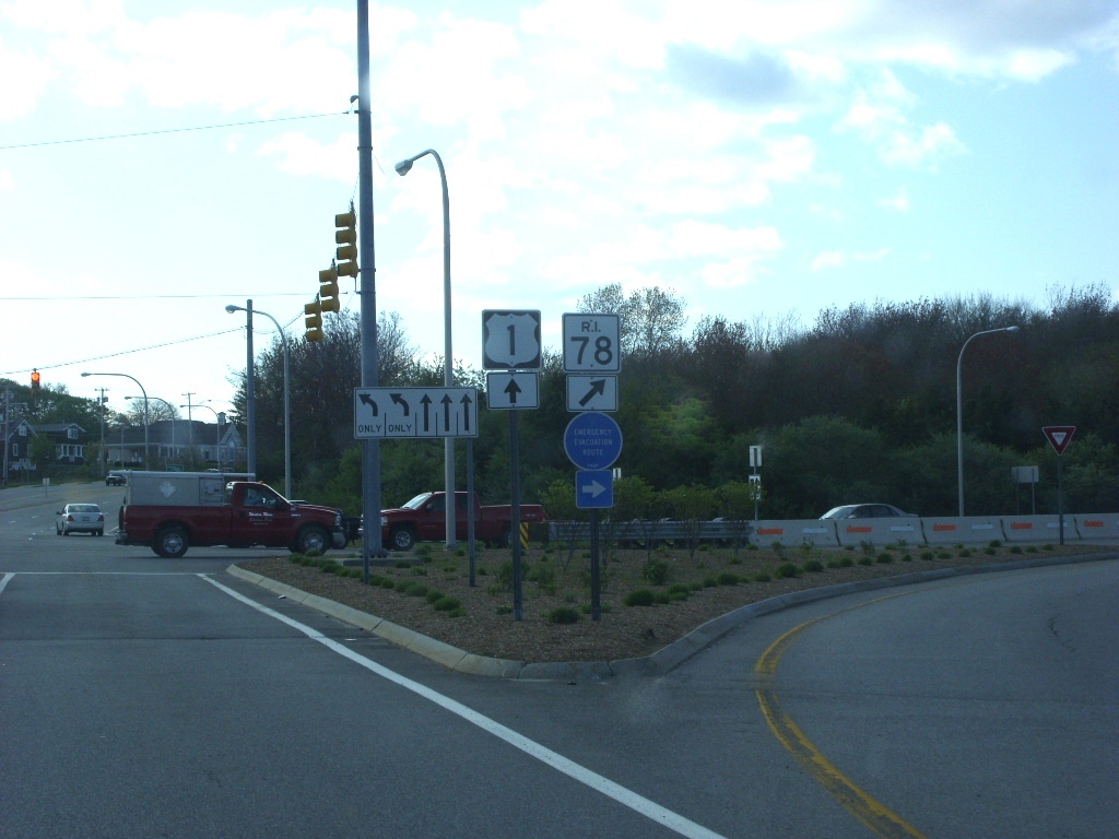
 RI 78 at interchange 5 for RI 91
Route 78 begins at an interchange with Connecticut Route 2 in Stonington. The expressway heads eastward, crossing over the Pawcatuck River and into Rhode Island. Route 78 crosses over White Rock Road and Canal Street, entering the community of Stillmanville. There, the highway comes upon a small, partial interchange with High Street, which connects drivers to Rhode Island Route 3. After crossing over Route 3, Route 78 turns to the south. In the opposite direction, where it turns eastward, there is an interchange with Route 3. The route heads southward through the local development, coming to a partial cloverleaf interchange with Rhode Island Route 91 at Exit 5. The route continues southward, passing Chapman Pond and the route becomes an arterial. The route turns southwest, interchanging partially with U.S. Route 1, where the Route 78 designation ends. The right-of-way continues as Airport Road towards Westerly State Airport.[1]
History
In the mid-1950s, the Rhode Island Department of Public Works (RIDPW) put forward a proposal to create a four-lane "relocation" of Route 3 in Westerly. This relocated highway was to connect with Interstate 95, and when planned, the route was to exist farther east then it does currently.[2] During the late 1950s, the RIDPW moved the location of the bypass to its current location, creating a 4.8 miles (7.7 km) long bypass of Westerly and connecting with Interstate 95 in Stonington, Connecticut. The route was proposed to begin at an interchange with U.S. Route 1 near Westerly State Airport, take an arc expressway and into Connecticut. First estimated to cost $4 million (1959 USD), construction of the new Route 78 Expressway was planned to begin in 1961 and finish in 1963, but lack of funds held off construction for several years.[3]
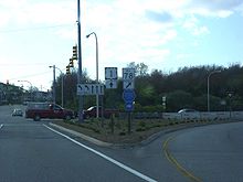 The eastern terminus of Route 78 at US 1 in Westerly, Rhode Island
In 1967, the state highway officials in Connecticut began to collaborate with Rhode Island officials to construct the new Route 78 Expressway in both states. The plan became detailed as Route 78 would start at US 1 in Rhode Island, continue over the Pawcatuck River into Connecticut, where it follow Route 2 over to Interstate 95 where it would form an interchange 91A with the interstate. However, this new interchange and extension were pulled by 1971, due to lack of funding.[4] By 1974, the cost had ballooned to $12.8 million (1974 USD) along with a budget crisis around that time, the two states scaled down the project from at an intersection with US 1 to an intersection with CT 2. The bypass was finally constructed in the late 1970s, and opened to traffic in 1979. After a number of head-on collisions, the Rhode Island Department of Transportation added medians to the highway,[5] and in 2004, the bypass was given the memorial name of Veterans Way, which was proposed in 2002.[6]
In 1961, during the time of the proposals, the New York State Department of Transportation to extend of the Long Island Expressway another 55 miles (89 km) further from Riverhead, New York to Westerly, Rhode Island using a multi-span bridge across the Long Island Sound.[7] The bridge was to extend from Orient Point, New York to Watch Hill, Rhode Island, and although it was never added to the interstate highway plans,[8] the theory of a new bridge was restarted in 1979, with a feasibility study. However, officials from Rhode Island and New York were both uninterested from continuing the project.[9]
Exit list
State County Location Mile Exit Destinations Notes Connecticut New London Stonington 0.0 1  I-95 – New London, Providence, R.I.
Futre interchange 0.2 2 Route 2At-grade intersection; all traffic must exit State line Rhode Island Washington Westerly 3 High Street Exit has no destination signage; eastbound exit and westbound entrance only; to Route 3 4  Route 3 (Ashaway Road) – Ashaway, Hopkinton
Westbound exit and eastbound entrance only 5  Route 91 (Westerly–Bradford Road) – Carolina, Westerly
6 US 1At grade intersection; unnumbered road continues to Westerly State Airport and Misquamicut State Beach 1.000 mi = 1.609 km; 1.000 km = 0.621 mi See also
References
- ^ Yahoo! Inc. Yahoo! Maps – Overview map of Rhode Island Route 78 (Map). Cartography by NAVTEQ. http://maps.yahoo.com/#mvt=h&lat=41.359342&lon=-71.811409&zoom=16&q1=41.392189%2C-71.845141&q2=41.370067%2C-71.804929&q3=41.357602%2C-71.808234. Retrieved July 16, 2009.
- ^ Rhode Island Roads. Rhode Island Department of Public Works. 1956.
- ^ A Highway Program for Rhode Island. Rhode Island Department of Public Works. 1959.
- ^ Construction of Route 78: Public Hearing. Connecticut Department of Transportation. 1970.
- ^ Anderson, Steve (2009). "Rhode Island 78 (Veterans Way)". Eastern Roads (Boston). http://www.bostonroads.com/roads/RI-78/. Retrieved July 16, 2009.
- ^ Prua, Chelsea (April 27, 2004). "It's Official: Route 78 Now Is Called Veterans Way". The Providence Journal.
- ^ Porterfield, Byron (July 9, 1961). "Across the Sound". New York Times.
- ^ A Comprehensive Transportation Study for Proposed Bridge Crossings. Creighton, Hamburg, Incorporated. 1971.
- ^ Long Island Sound Bridge Study. New York State Department of Transportation. 1979.
External links
Freeways in the Providence metropolitan area Interstate highways Other freeways Unbuilt freeways See also Categories:- Numbered routes in Rhode Island
- State highways in Connecticut
- Transportation in New London County, Connecticut
- Two-lane freeways in the United States
- Westerly, Rhode Island


Wikimedia Foundation. 2010.