- Churumuco
-
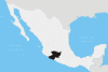
Churumuco is a municipality located in the southeastern part of the Mexican state of Michoacán. The municipality has an area of 1,119.44 square kilometres (1.90% of the surface of the state)[1] and is bordered to the north by the municipality of La Huacana, to the northeast by Turicato, to the south by the state of Guerrero, to the southwest by Huetamo, and to the west by Arteaga. The municipality had a population of 13,801 inhabitants according to the 2005 census.[2]
Its municipal seat is the city of Churumuco de Morelos, which is named after José María Morelos, a Mexican priest and revolutionary rebel leader who led the Mexican War of Independence movement. Morelos served as priest of the town before taking arms.
Churumuco (from the Tarascan word Churumekua) means "Bird's beak" [3].
References
- ^ Michoacán Enciclopedia de los Municipios de México. Retrieved on October 7, 2007
- ^ "2005 Census". INEGI: Instituto Nacional de Estadística, Geografía e Informática. http://www.inegi.gob.mx/est/contenidos/espanol/sistemas/conteo2005/localidad/iter/. Retrieved 2007-10-07.
- ^ Michoacán Municipios de mayor población de Michoacán de Ocampo. Retrieved on October 7, 2007
Coordinates: 18°40′N 101°39′W / 18.667°N 101.65°W
Municipalities
and
(municipal seats)Acuitzio (Acuitzio del Canje) · Aguililla (Aguililla) · Álvaro Obregón (Álvaro Obregón) · Angamacutiro (Angamacutiro de la Unión) · Angangueo · Apatzingán (Apatzingán de la Constitución) · Aporo, Michoacán · Aquila (Aquila) · Ario (Ario de Rosales) · Arteaga (Arteaga) · Briseñas (Briseñas de Matamoros) · Buenavista (Buenavista Tomatlán) · Caracuaro (Caracuaro de Morelos) · Charapan (Charapan) · Charo (Charo) · Chavinda (Chavinda) · Cherán (Cherán) · Chilchota (Chilchota) · Chinicuila (Villa Victoria) · Chucándiro (Chucándiro) · Churintzio (Churintzio) · Churumuco (Churumuco de Morelos) · Ciudad Hidalgo · Coahuayana (Coahuayana de Hidalgo) · Coalcomán de Vázquez Pallares (Coalcomán de Vázquez Pallares) · Coeneo (Coeneo de la Libertad) · Cojumatlán de Régules (Cojumatlán de Régules) · Contepec (Contepec) · Copándaro (Copándaro de Galeana) · Cotija (Cotija de la Paz) · Cuitzeo (Cuitzeo del Porvenir) · Ecuandureo (Ecuandureo) · Epitácio Huerta (Epitácio Huerta) · Erongaricuaro (Erongaricuaro) · Gabriel Zamora (Lombardía) · La Huacana (La Huacana) · Huandacareo (Huandacareo) · Huaniqueo (Huaniqueo de Morales) · Huetamo (Huetamo de Núñez) · Huiramba (Huiramba) · Indaparapeo (Indaparapeo) · Irimbo (Irimbo) · Ixtlán (Ixtlán de los Hervores) · Jacona (Jacona de Plancarte) · Jiménez (Villa Jiménez) · Jiquilpan (Jiquilpan de Juárez) · José Sixto Verduzco (Pastor Ortiz) · Juárez (Benito Juárez) · Jungapeo (Jungapeo de Juárez) · Lagunillas (Lagunillas) · La Piedad (La Piedad) · Lázaro Cárdenas (Lázaro Cárdenas) · Los Reyes (Los Reyes de Salgado) · Madero (Villa Madero) · Maravatío (Maravatío de Ocampo) · Marcos Castellanos (San José de Gracia) · Morelia (Morelia) · Morelos (Villa Morelos) · Múgica (Nueva Italia) · Nahuatzén (Nahuatzén) · Nocupétaro (Nocupétaro de Morelos) · Nuevo Parangaricutiro (Nuevo San Juan Parangaricutiro) · Nuevo Urecho (Nuevo Urecho) · Numarán (Numarán) · Ocampo (Ocampo) · Pajacuarán (Pajacuarán) · Panindicuaro (Panindicuaro) · Paracho (Paracho de Verduzco) · Parácuaro (Parácuaro) · Pátzcuaro · Penjamillo (Penjamillo de Degollado) · Peribán (Peribán de Ramos) · Purépero (Purépero de Echaíz) · Puruándiro (Puruándiro) · Queréndaro (Queréndaro) · Quiroga (Quiroga) · Sahuayo (Sahuayo de Morelos) · San Lucas (San Lucas) · Santa Ana Maya (Santa Ana Maya) · Santa Clara del Cobre · Senguío (Senguío) · Susupuato (Susupuato de Guerrero) · Tacámbaro (Tacámbaro de Codallos) · Tancítaro (Tancítaro) · Tangamandapio (Santiago Tangamandapio) · Tangancícuaro (Tangancícuaro de Arista) · Tanhuato (Tanhuato de Guerrero) · Taretan (Taretan) · Tarímbaro (Tarímbaro) · Tepalcatepec (Tepalcatepec) · Tingambato (Tingambato) · Tingüindín (Tingüindín) · Tiquicheo de Nicolas Romero (Tiquicheo) · Tlalpujahua · Tlazazalca (Tlazazalca) · Tocumbo (Tocumbo) · Tumbiscatío (Tumbiscatío de Ruiz) · Turicato (Turicato) · Tuxpan (Tuxpan) · Tuzantla (Tuzantla) · Tzintzuntzan · Tzitzío (Tzitzío) · Uruapan (Uruapan) · Venustiano Carranza (Venustiano Carranza) · Villamar (Villamar) · Vista Hermosa (Vista Hermosa de Negrete) · Yurécuaro (Yurécuaro) · Zacapu (Zacapu) · Zamora (Zamora de Hidalgo) · Zináparo (Zináparo) · Zinapécuaro (Zinapécuaro de Figueroa) · Ziracuaretiro (Ziracuaretiro) · Zitácuaro (Heroica Zitácuaro)
 Categories:
- Populated places in Michoacán
- Municipalities of Michoacán
- Michoacán geography stubs

Wikimedia Foundation. 2010.