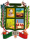
- Coeneo de la Libertad
-
Coeneo de la Libertad 
SealCountry  Mexico
State Michoacán Municipality Coeneo Founded 1530 Government - Municipal President Martin Vargas Time zone CST (UTC-6) - Summer (DST) CDT (UTC-5) Coeneo de la Libertad is a town, the seat of the Coeneo municipality, located in the north central area of the Mexican state of Michoacán. The name Coeneo means "Lugar de Pájaros" (place of birds). Coordinates: 19°49′N 101°35′W / 19.817°N 101.583°W
Contents
History
In the year 1530 Friar Martín de la Coruña was the first to come into contact with the natives of the lands that now make up the present day Coeneo. He quickly gained trust, affection and respect, and convinced the natives to convert to the Catholic faith. However, the Spanish conquistador Nuño de Guzmán attempted to rob the natives of their possessions and abuse them for refusing to comply. This caused a period where the natives went back into the mountains and to destroy the progress that Martín de la Coruña had made. It was until the Friar Jacob Dacian succeeded de la Coruña that dialogue began again. An arrangement was made in 1542 for a few families to reallocate to the location now known as Coeneo due to a scarcity of water around the region. Once the new community was established plans were drafted to construct the town's church, a town square, and a patron was given "La Virgen del Rosario."
Demographics
As of the census[1] of 2005, there were 3616 people residing in the town.
Education
Coeneo enjoys a diverse set of both public and private schools.
- Two pre-elementary schools
- A public elementary school
- A private elementary school - Institucion Educativa y Cultural Coeneo
- A public middle school - Escuela secundaria tecnica #61
- A COBACHE (high school)
- A center for adult education
Economy
The area around Coeneo is centered on agriculture where lentils and corn are the main crops cultivated. Non-agricultural industries are mainly related to construction materials, financial institutions, and small family-operated businesses.
References
External links
Morelia (capital) Municipalities
and
(municipal seats)Acuitzio (Acuitzio del Canje) · Aguililla (Aguililla) · Álvaro Obregón (Álvaro Obregón) · Angamacutiro (Angamacutiro de la Unión) · Angangueo · Apatzingán (Apatzingán de la Constitución) · Aporo, Michoacán · Aquila (Aquila) · Ario (Ario de Rosales) · Arteaga (Arteaga) · Briseñas (Briseñas de Matamoros) · Buenavista (Buenavista Tomatlán) · Caracuaro (Caracuaro de Morelos) · Charapan (Charapan) · Charo (Charo) · Chavinda (Chavinda) · Cherán (Cherán) · Chilchota (Chilchota) · Chinicuila (Villa Victoria) · Chucándiro (Chucándiro) · Churintzio (Churintzio) · Churumuco (Churumuco de Morelos) · Ciudad Hidalgo · Coahuayana (Coahuayana de Hidalgo) · Coalcomán de Vázquez Pallares (Coalcomán de Vázquez Pallares) · Coeneo (Coeneo de la Libertad) · Cojumatlán de Régules (Cojumatlán de Régules) · Contepec (Contepec) · Copándaro (Copándaro de Galeana) · Cotija (Cotija de la Paz) · Cuitzeo (Cuitzeo del Porvenir) · Ecuandureo (Ecuandureo) · Epitácio Huerta (Epitácio Huerta) · Erongaricuaro (Erongaricuaro) · Gabriel Zamora (Lombardía) · La Huacana (La Huacana) · Huandacareo (Huandacareo) · Huaniqueo (Huaniqueo de Morales) · Huetamo (Huetamo de Núñez) · Huiramba (Huiramba) · Indaparapeo (Indaparapeo) · Irimbo (Irimbo) · Ixtlán (Ixtlán de los Hervores) · Jacona (Jacona de Plancarte) · Jiménez (Villa Jiménez) · Jiquilpan (Jiquilpan de Juárez) · José Sixto Verduzco (Pastor Ortiz) · Juárez (Benito Juárez) · Jungapeo (Jungapeo de Juárez) · Lagunillas (Lagunillas) · La Piedad (La Piedad) · Lázaro Cárdenas (Lázaro Cárdenas) · Los Reyes (Los Reyes de Salgado) · Madero (Villa Madero) · Maravatío (Maravatío de Ocampo) · Marcos Castellanos (San José de Gracia) · Morelia (Morelia) · Morelos (Villa Morelos) · Múgica (Nueva Italia) · Nahuatzén (Nahuatzén) · Nocupétaro (Nocupétaro de Morelos) · Nuevo Parangaricutiro (Nuevo San Juan Parangaricutiro) · Nuevo Urecho (Nuevo Urecho) · Numarán (Numarán) · Ocampo (Ocampo) · Pajacuarán (Pajacuarán) · Panindicuaro (Panindicuaro) · Paracho (Paracho de Verduzco) · Parácuaro (Parácuaro) · Pátzcuaro · Penjamillo (Penjamillo de Degollado) · Peribán (Peribán de Ramos) · Purépero (Purépero de Echaíz) · Puruándiro (Puruándiro) · Queréndaro (Queréndaro) · Quiroga (Quiroga) · Sahuayo (Sahuayo de Morelos) · San Lucas (San Lucas) · Santa Ana Maya (Santa Ana Maya) · Santa Clara del Cobre · Senguío (Senguío) · Susupuato (Susupuato de Guerrero) · Tacámbaro (Tacámbaro de Codallos) · Tancítaro (Tancítaro) · Tangamandapio (Santiago Tangamandapio) · Tangancícuaro (Tangancícuaro de Arista) · Tanhuato (Tanhuato de Guerrero) · Taretan (Taretan) · Tarímbaro (Tarímbaro) · Tepalcatepec (Tepalcatepec) · Tingambato (Tingambato) · Tingüindín (Tingüindín) · Tiquicheo de Nicolas Romero (Tiquicheo) · Tlalpujahua · Tlazazalca (Tlazazalca) · Tocumbo (Tocumbo) · Tumbiscatío (Tumbiscatío de Ruiz) · Turicato (Turicato) · Tuxpan (Tuxpan) · Tuzantla (Tuzantla) · Tzintzuntzan · Tzitzío (Tzitzío) · Uruapan (Uruapan) · Venustiano Carranza (Venustiano Carranza) · Villamar (Villamar) · Vista Hermosa (Vista Hermosa de Negrete) · Yurécuaro (Yurécuaro) · Zacapu (Zacapu) · Zamora (Zamora de Hidalgo) · Zináparo (Zináparo) · Zinapécuaro (Zinapécuaro de Figueroa) · Ziracuaretiro (Ziracuaretiro) · Zitácuaro (Heroica Zitácuaro)
 Categories:
- Populated places in Michoacán
- Michoacán geography stubs
Wikimedia Foundation. 2010.
