- Nuevo San Juan Parangaricutiro
-
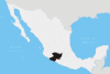
Nuevo San Juan Parangaricutiro, in the Mexican state of Michoacán, is a small village near the Parícutin volcano. The city is called "Nuevo" (Spanish for "New") because the original San Juan Parangaricutiro was destroyed during the formation of the Parícutin volcano in 1943.[1] Along with the village of Parícutin, San Juan Parangaricutiro was buried beneath ash and lava. The tops of cathedrals in old San Juan Parangaricutiro still protrude from the volcanic deposits.
Nuevo San Juan Parangaricutiro is located about 8 kilometers (5.0 mi) west of Uruapan and 16-kilometer (9.9 mi) east of the peak of Parícutin in central Michoacán. The village’s postal code is 60490.
Like many places in Mexico, it is locally known by several unofficial names. "San Juan", "Nuevo San Juan", and "Parangaricutiro" are all variations. San Juan Parangaricutiro is also famously known as Parangaricutirimícuaro, the longest place name word in Mexico. Some believe that “Parangaricutirimícuaro” is an urban legend and does not exist. It is the object of the folklore of many fictitious fables. The word itself is a tongue-twister and it is also used in longer tongue-twisters that include nonsense words similar to Parangaricutirimícuaro.
References
External links
Coordinates: 19°24′N 102°08′W / 19.4°N 102.133°W
Morelia (capital) Municipalities
and
(municipal seats)Acuitzio (Acuitzio del Canje) · Aguililla (Aguililla) · Álvaro Obregón (Álvaro Obregón) · Angamacutiro (Angamacutiro de la Unión) · Angangueo · Apatzingán (Apatzingán de la Constitución) · Aporo, Michoacán · Aquila (Aquila) · Ario (Ario de Rosales) · Arteaga (Arteaga) · Briseñas (Briseñas de Matamoros) · Buenavista (Buenavista Tomatlán) · Caracuaro (Caracuaro de Morelos) · Charapan (Charapan) · Charo (Charo) · Chavinda (Chavinda) · Cherán (Cherán) · Chilchota (Chilchota) · Chinicuila (Villa Victoria) · Chucándiro (Chucándiro) · Churintzio (Churintzio) · Churumuco (Churumuco de Morelos) · Ciudad Hidalgo · Coahuayana (Coahuayana de Hidalgo) · Coalcomán de Vázquez Pallares (Coalcomán de Vázquez Pallares) · Coeneo (Coeneo de la Libertad) · Cojumatlán de Régules (Cojumatlán de Régules) · Contepec (Contepec) · Copándaro (Copándaro de Galeana) · Cotija (Cotija de la Paz) · Cuitzeo (Cuitzeo del Porvenir) · Ecuandureo (Ecuandureo) · Epitácio Huerta (Epitácio Huerta) · Erongaricuaro (Erongaricuaro) · Gabriel Zamora (Lombardía) · La Huacana (La Huacana) · Huandacareo (Huandacareo) · Huaniqueo (Huaniqueo de Morales) · Huetamo (Huetamo de Núñez) · Huiramba (Huiramba) · Indaparapeo (Indaparapeo) · Irimbo (Irimbo) · Ixtlán (Ixtlán de los Hervores) · Jacona (Jacona de Plancarte) · Jiménez (Villa Jiménez) · Jiquilpan (Jiquilpan de Juárez) · José Sixto Verduzco (Pastor Ortiz) · Juárez (Benito Juárez) · Jungapeo (Jungapeo de Juárez) · Lagunillas (Lagunillas) · La Piedad (La Piedad) · Lázaro Cárdenas (Lázaro Cárdenas) · Los Reyes (Los Reyes de Salgado) · Madero (Villa Madero) · Maravatío (Maravatío de Ocampo) · Marcos Castellanos (San José de Gracia) · Morelia (Morelia) · Morelos (Villa Morelos) · Múgica (Nueva Italia) · Nahuatzén (Nahuatzén) · Nocupétaro (Nocupétaro de Morelos) · Nuevo Parangaricutiro (Nuevo San Juan Parangaricutiro) · Nuevo Urecho (Nuevo Urecho) · Numarán (Numarán) · Ocampo (Ocampo) · Pajacuarán (Pajacuarán) · Panindicuaro (Panindicuaro) · Paracho (Paracho de Verduzco) · Parácuaro (Parácuaro) · Pátzcuaro · Penjamillo (Penjamillo de Degollado) · Peribán (Peribán de Ramos) · Purépero (Purépero de Echaíz) · Puruándiro (Puruándiro) · Queréndaro (Queréndaro) · Quiroga (Quiroga) · Sahuayo (Sahuayo de Morelos) · San Lucas (San Lucas) · Santa Ana Maya (Santa Ana Maya) · Santa Clara del Cobre · Senguío (Senguío) · Susupuato (Susupuato de Guerrero) · Tacámbaro (Tacámbaro de Codallos) · Tancítaro (Tancítaro) · Tangamandapio (Santiago Tangamandapio) · Tangancícuaro (Tangancícuaro de Arista) · Tanhuato (Tanhuato de Guerrero) · Taretan (Taretan) · Tarímbaro (Tarímbaro) · Tepalcatepec (Tepalcatepec) · Tingambato (Tingambato) · Tingüindín (Tingüindín) · Tiquicheo de Nicolas Romero (Tiquicheo) · Tlalpujahua · Tlazazalca (Tlazazalca) · Tocumbo (Tocumbo) · Tumbiscatío (Tumbiscatío de Ruiz) · Turicato (Turicato) · Tuxpan (Tuxpan) · Tuzantla (Tuzantla) · Tzintzuntzan · Tzitzío (Tzitzío) · Uruapan (Uruapan) · Venustiano Carranza (Venustiano Carranza) · Villamar (Villamar) · Vista Hermosa (Vista Hermosa de Negrete) · Yurécuaro (Yurécuaro) · Zacapu (Zacapu) · Zamora (Zamora de Hidalgo) · Zináparo (Zináparo) · Zinapécuaro (Zinapécuaro de Figueroa) · Ziracuaretiro (Ziracuaretiro) · Zitácuaro (Heroica Zitácuaro)
 Categories:
- Populated places in Michoacán
- Destroyed cities

Wikimedia Foundation. 2010.