- Okutama, Tokyo
-
Okutama
奥多摩町— Town — 
FlagLocation of Okutama in Tokyo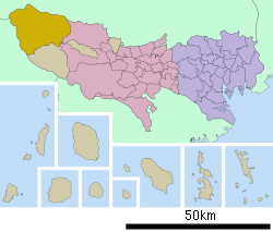

 Okutama
Coordinates: 35°48′N 139°6′E / 35.8°N 139.1°ECoordinates: 35°48′N 139°6′E / 35.8°N 139.1°E Country Japan Region Kantō Prefecture Tokyo Government – Mayor Fumio Kawamura Area – Total 225.63 km2 (87.1 sq mi) Population (September 2011) – Total 6,090 – Density 27/km2 (69.9/sq mi) Time zone Japan Standard Time (UTC+9) City symbols - Tree Cryptomeria - Flower Azalea - Bird Copper Pheasant Phone number 0428-83-2111 Address 215-6, Hikawa, Okutama Town, Nishitama-gun, Tokyo
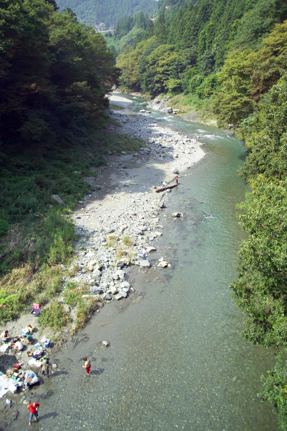
198-0212Website Town of Okutama 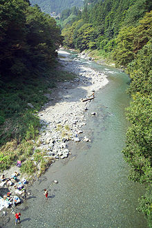 Fishing is popular in Okutama.
Okutama (奥多摩町 Okutama-machi) is a town in Nishitama District, Tokyo. As of August 1, 2007, the town had a population of 6712 people, of which 3280 were men and 3432 were women.[1] With an area of 225.63 km², it is the largest community in Tokyo. Mount Kumotori, Tokyo's highest peak at 2017 m, divides Okutama from the Okuchichibu region of the neighboring Saitama and Yamanashi Prefectures. Tokyo's northernmost and westernmost points lie in Okutama, as does Lake Okutama, an important source of water for Tokyo, situated above the Ogōchi Dam in the town.
Contents
History
Prehistory
People began settling in Okutama at least during the Jomon Period and many archaeological sites have been found with ancient pottery. During this time period, humans hunted and gathered edible plants. However, during the Yayoi Period, humans learned the skill of growing rice, and began moving to the rather flatter lands of present day Okutama. But there is not much evidence for the moving of humans during the Yayoi Period, for 94% of the town was covered by forests and only small flat lands existed.[2]
Edo
During the Edo Period, the area included in present-day Okutama was divided into 16 villages. In each village, there was one being serving as the mayor, another serving as the leader of a particular group, and another serving as a representative for the farmers. Also, entering Mount Takanosu was forbidden for people of low rank during the Edo Period. This was because the people of high rank (government officials and such) hunted for hawks at the mountain, and the officials wanted to keep the hawks for themselves.[2]
Modern Times
Because of the new system of changing and merging areas into prefectures, the Okutama area (not yet a town) became part of Nirayama Prefecture except for Kotaba village, which was merged into Maebashi Han. Maebashi Han was turned into Maebashi Prefecture in 1871, and then became part of Gunma Prefecture. While Kotaba village was turned into part of Maebashi city, the Okutama area was divided into three villages in 1889, due to a new system of dividing areas into towns and villages. The three villages were called Hikawa, Kori, and Ogouchi. In 1940, Hikawa village was renamed Hikawa town. Then in 1955, Hikawa town, Ogouchi village and Kori village were united, and Okutama town is created.[2]
Geography
Located in western Tokyo, the town is very mountainous. The largest municipality in Tokyo, Okutama is also known for having the highest mountain in the prefecture, Mount Kumotori, as well. A large portion of the town is covered by forests, and the upstream of the Tama River is located here.[3]
Mountains
- Mount Kumotori
- Mount Kumotori, at 2017 m is the highest mountain in the Kantō region. Many plants grow here during the summer, most notably the tsuga. From the summit, there is a clear view of Mount Fuji and the Okuchichibu Mountains.[4]
- Mount Mitō
- Because it was forbidden to enter Mount Mitō during the Edo Period, there are still many forests of enormous beech trees. Mount Fuji and Mount Kumotori can be seen from the summit, and it attracts many visitors especially during autumn. It is one of the Three Mountains of Okutama.[5]
- Mount Ōdake
- Mount Ōdake is one of the Three Mountains of Okutama. From the summit at 1266m, Mount Fuji can be seen to the south and Mount Gozen to the west.[6]
- Mount Kawanori
- From Mount Kawanori, all mountains in Okutama can be seen. Also, the Hyakuhiro Waterfall is located here.[7]
- Mount Gozen
- Mount Gozen is well known for its oddly perfectly triangular shape. Like Mount Mitō, it attracts visitors in the fall.
Rivers
- Tama River
- The Tama River, with a length of 138 km, is the longest river in the prefecture. It flows through the entire prefecture, and the upstream of the river is located in Okutama.
- Hinohara River
- The Hinohara River is a rather short and small river located in the western portion of Tokyo.
Lakes
- Lake Okutama
- Lake Shiromaru
- Lake Shiromaru is a rather infamous dam on the Tama River. It has a height of 30.3m, a length of 61.0m, and a volume of 14,161m³.
Surrounding municipalities
- Tokyo
- Saitama Prefecture
- Yamanashi Prefecture
Transportation
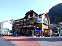 Okutama Station
Rail
The East Japan Railway Company serves the town. The Ōme line, which connects the town with Tachikawa, terminates at Okutama Station.
- East Japan Railway Company (JR East)
- Ōme Line
- Kawai Station, Kori Station, Hatonosu Station, Shiromaru Station, Okutama Station
- Ōme Line
Bus
The Nishi Tokyo Bus Co. carries passengers to Lake Okutama, the Nippara Limestone Cave, Tabayama village and Kosuge village (both in Yamanashi Prefecture) from Okutama Station.
Road
- National Highways
- Highway 139
- Highway 411
- Prefectural Roads
- Tokyo Prefectural Road 184 Okutama-Akiruno
- Tokyo Prefectural Road 204 Nippara Limestone Cave
- Tokyo Prefectural Road 205
- Tokyo Prefectural Road 206 Kawano-Kamikawa
Education
There are two primary schools and two junior high schools in Okutama, all named after the former villages of Kori and Kōrikawa.
- Junior High Schools
- Kōrikawa Intermediate School
- Kori Intermediate School
- Primary Schools
- Kōrikawa Elementary School
- Kori Elementary School
Tokyo Metropolitan Government Board of Education operates Mizuho High School [1] in nearby Mizuho. The school district operates the following high schools in Akiruno:
The school district operates the following high schools in Ōme:
Sister cities
Outside Japan
Notable places
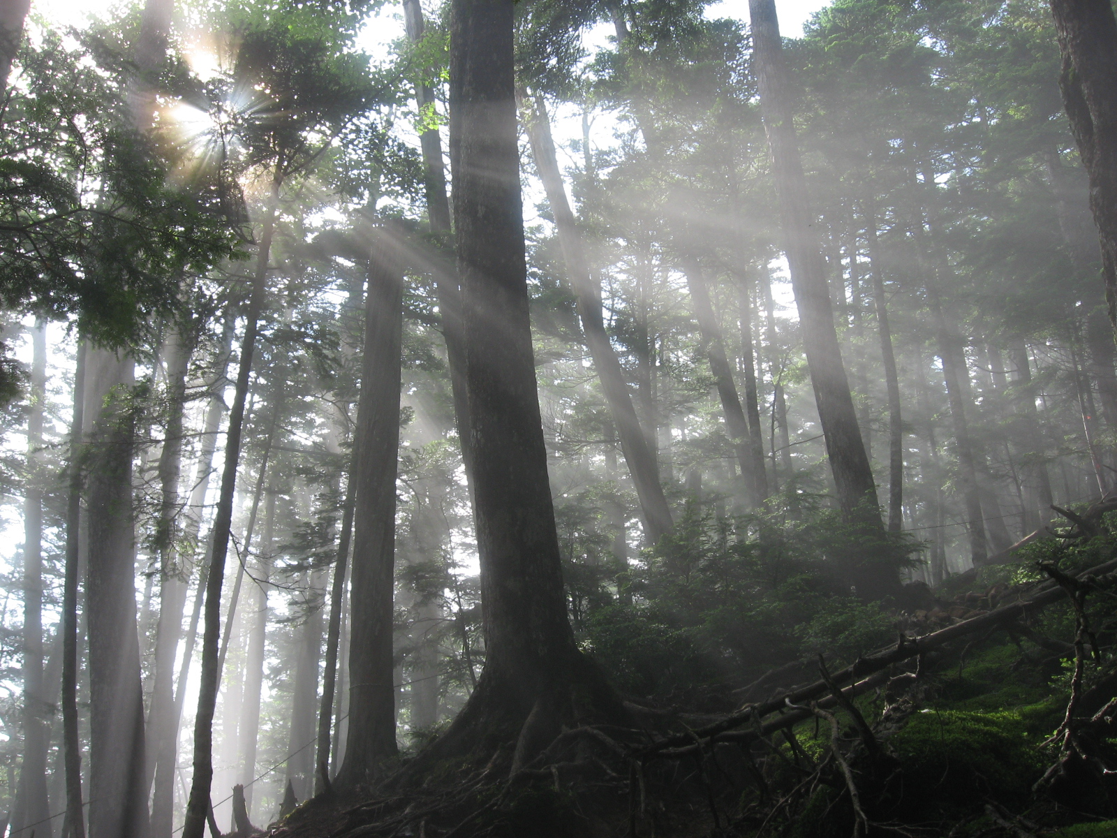
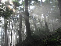 A forest in the Okuchichibu Mountains
All of the town is located in Chichibu-Tama-Kai National Park.
- Lake Okutama
- Lake Okutama plays a major role in providing drinking water for the people of Tokyo. The largest lake in Tokyo, it also has a large dam.[8]
- Mount Takanosu
- During the Edo Period, the people of low rank were forbidden to enter Mount Takanosu, because it was a hawk hunting ground for the government and military officials. Now, it is open to hikers, and has an elevation of 1736.6m.
- Tsurunoyu Onsen
- Until the construction of Ogouchi Dam, there was a spa town for Tsurunoyu Onsen. (It is now at in the depths of the dam.) Now, there are a few inns that use the hot water from the hot spring for their spas. The hot spring is located about 20 minutes by bus from Okutama Station.
- Hyakuhiro Waterfall
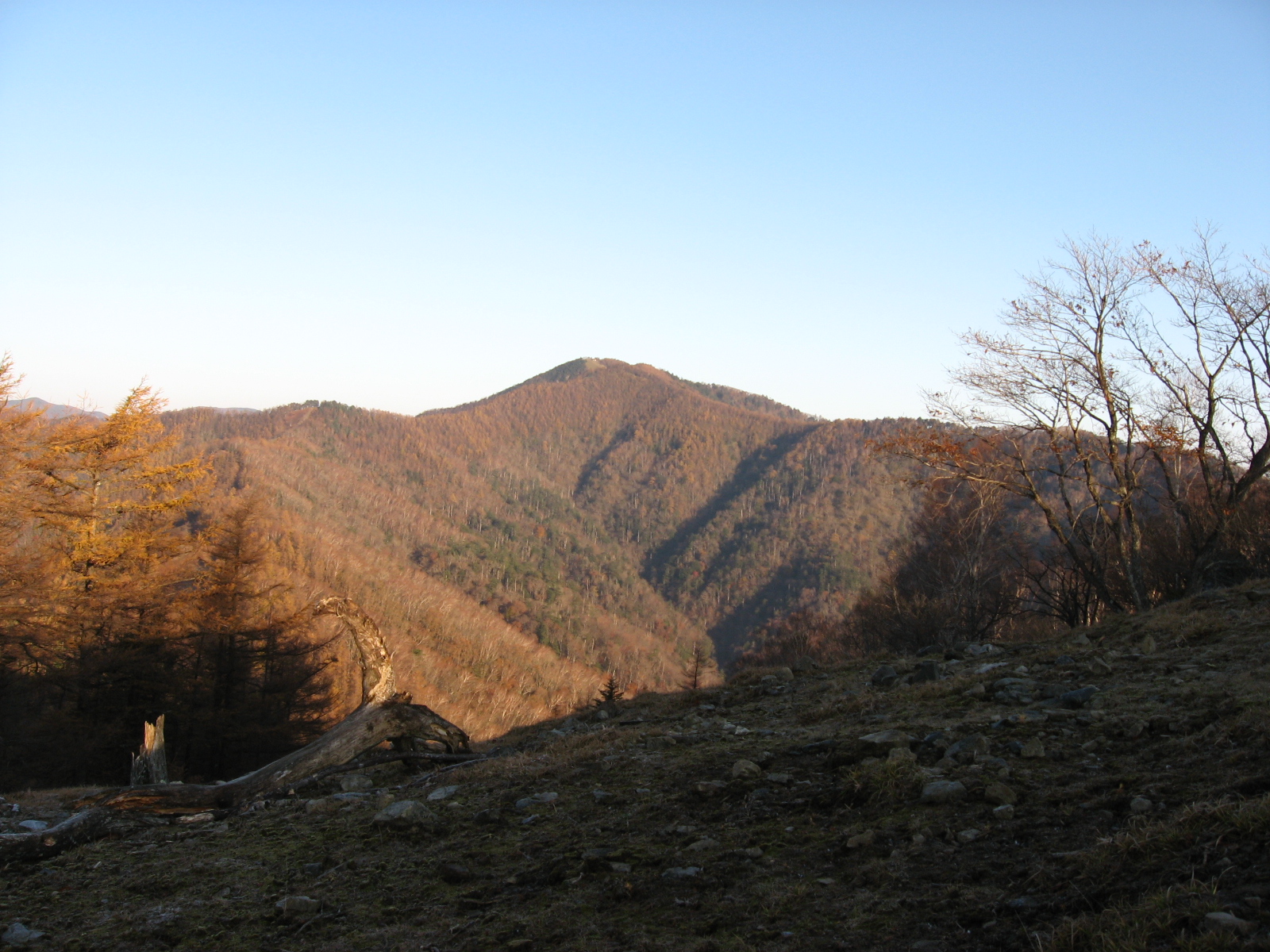
 View of Mount Kumotori from Mount Nanatsuishi
-
- Hyakuhiro Waterfall, with a height of 40m, is a famous waterfall in the Okutama area. Located in Mount Kawanori, it is part of the Nippara River.
- Nippara Cave
- Nippara Cave is the largest limestone cave in the Kantō region, and attracts many visitors from around Japan.
- Okuchichibu Mountains
- The Okuchichibu Mountains stretch from Nagano's Nobeyama region to Okutama and a portion of Saitama Prefecture and Yamanashi Prefecture. The highest mountain is Mount Kurogane (Yamanashi Prefecture), at 2232m, and the lowest is Mount Azumaya (Saitama Prefecture), at 772m.
- Okutama Onsen
- Okutama Onsen is a hot spring located in the town.
See also
References
- ^ 東京都奥多摩町ホームページ
- ^ a b c Introduction to Okutama
- ^ 考える社会科地図 Kangaeru Shakaika Chizu. 四谷大塚出版 Yotsuya-Ōtsuka Shuppan. 2005. p. 113.
- ^ 奥多摩町観光案内-奥多摩トレッキングコース-雲取山
- ^ 奥多摩町観光案内-奥多摩トレッキングコース-御前山・三頭山
- ^ 奥多摩町観光案内-奥多摩トレッキングコース-大岳山・御岳山
- ^ 奥多摩町観光案内-奥多摩トレッキングコース-川苔山
- ^ 楽しく学ぶ小学生の地図帳 Tanoshiku Manabu Shogakusei no Chizucho. 帝国書院 Teikoku-Shoin. 2004. p. 37.
External links
 Media related to Okutama, Tokyo at Wikimedia Commons
- (English) Okutama official website
- (Japanese) Okutama official website
Categories:- Towns in Tokyo
- Western Tokyo
- Mount Kumotori


Wikimedia Foundation. 2010.