- Mawlamyine
-
Mawlamyine
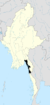
မော်လမြိုင်မြို့Location of Mawlamyine, Myanmar (Burma)
 Mawlamyine
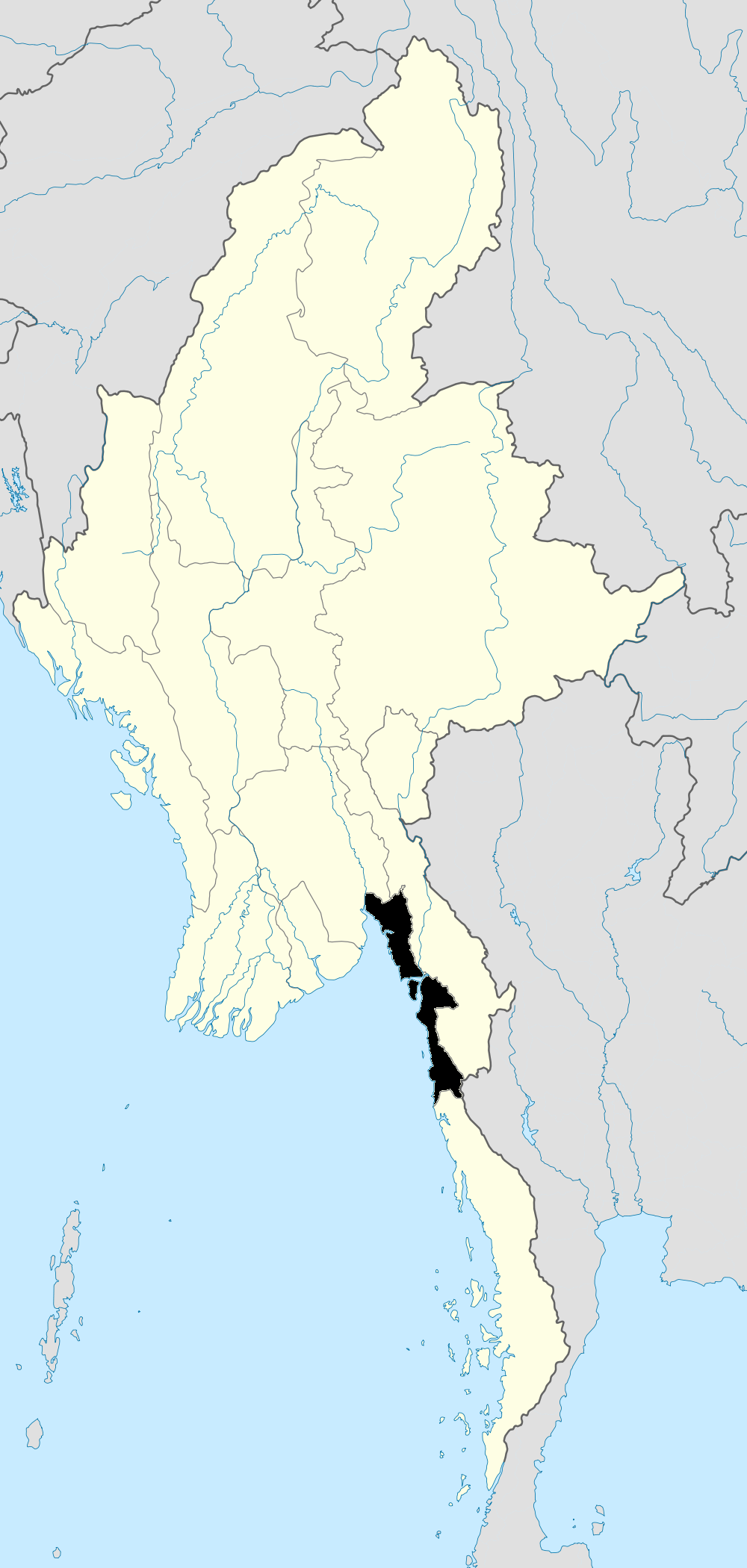
Coordinates: 16°29′N 97°37′E / 16.483°N 97.617°E Country  Burma
BurmaState Mon State District Mawlamyine District Township Mawlamyine Township Population (2010)[1] – Total 525,927 – Ethnicities Mons, Burmans, Chinese, Indians, Karens – Religions Theravada Buddhism, Christianity, Islam, Hinduism Time zone MST (UTC+6.30) Area code(s) 57 [2] Mawlamyine (also spelled Mawlamyaing; Burmese: မော်လမြိုင်မြို့; MLCTS: mau la. mruing mrui.; pronounced [mɔ̀ləmjàiɴ mjo̰]; Mon: မတ်ပလီု pronounced [mòt pəlɜ̀m]; formerly Moulmein) is the fourth largest city of Burma (Myanmar),[1] situated 300 km south east of Yangon and 70 km south of Thaton, at the mouth of Thanlwin (Salween) river. The city of 500,000 is the capital and largest city of Mon State, Myanmar, and is the main trading center and seaport in south-eastern Burma.[3]
Contents
Etymology
The Mon name for Mawlamyine, မတ်ပလိုံ ([mòt pəlɜ̀m]), means "damaged eye.".[4] A Mon king was said to have lost his powerful eye in Mawlamyine.[citation needed] The Burmese name "Mawlamyine" is believed to be a Burmese corruption of the Mon name.
History
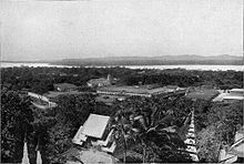 Moulmein and the mouth of the Thanlwin River in the early 1900s.
Mawlamyine was the first capital of British Burma between 1826 and 1852 after the Tanintharyi (Tenassarim) coast, along with Arakan, was ceded to Britain under the Treaty of Yandabo at the end of the First Anglo-Burmese War.[5]
It is probably best known to English speakers through the opening lines of Rudyard Kipling's poem Mandalay:
- "By the old Moulmein pagoda
- Lookin' lazy at the sea
- There's a Burma girl a-settin'
- and I know she thinks o' me".
Mawlamyine is also the setting of George Orwell's famous 1936 memoir Shooting an Elephant.The essay opens with the striking words:
- In Moulmein, in Lower Burma, I was hated by large numbers of people -- the only time in my life that I have been important enough for this to happen to me.
During colonial times, Moulmein had a substantial Anglo-Burmese population; an area of the city was known as 'Little England' due to the large Anglo-Burmese community, many of them engaged in the running of rubber plantations; however nowadays this has dwindled to all but a handful of families as most have left for the UK or Australia.
Geography
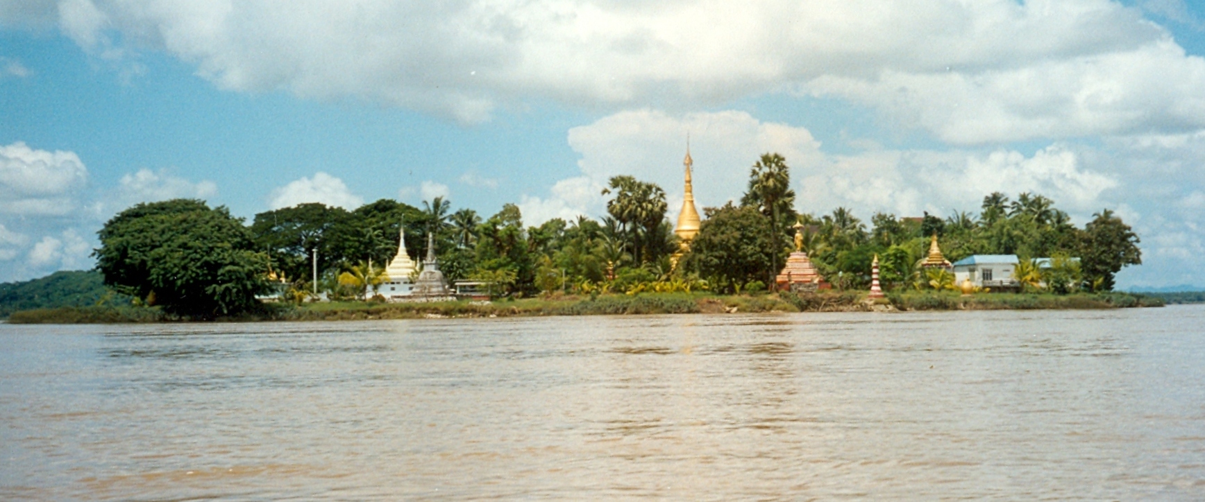
 Shampoo Island near Mawlamyine.
Mawlamyine is situated in the Salween River delta, where the mouth of the Salween is sheltered by Bilugyun Island as it enters the Gulf of Martaban and the Andaman Sea. It is flanked by low hills dotted with ancient pagodas to the east and west.[5]
Transport
Mawlamyine is the main gateway to south-eastern Myanmar. Thanlwin Bridge, the longest road and rail bridge in Myanmar is the most prominent landmark in the area. It stretches a distance of 11,000 feet over the Thanlwin river connecting the country's south eastern region with Yangon.[6] The city is connected to Pa-an in Kayin State and Dawei and Myeik in Tanintharyi Division by road.[7] It was the rail head to Ye, linked to Yangon by rail only from Mottama (Martaban) across the river by ferry, but today connected by the new Thanlwin Bridge (Mawlamyine) opened in April 2006 .[5][8][9]
Mawlamyine Airport has regular flights to Yangon.
Economy
Mawlamyine is famous for its tropical fruits[3] and for its cuisine [5] as indicated in the popular Burmese expression, "Mandalay for the speaking, Yangon for the bragging, and Mawlamyine for the eating".
Mawlamyine has several sawmills and rice mills as teak and rice are transported down the Salween. It was once a busy shipbuilding center and remains an important port. The city also has a solar-powered plant for extracting salt from seawater and a diesel electric plant.[5]
On the night of 1 December 2008, a fire that started from a floating restaurant destroyed the larger of city's two markets called the lower bazaar.[10]
On 27, May 2009, three bomb explosions in Mawlamyine were blamed on terrorists by the authorities; no casualties were reported.[11]
Culture
Mawlamyine is key to communications in Tanintharyi, and being a busy seaport and transport center, it provides a multicultural dimension despite a Buddhist Mon majority. Buddhist cultural dominance is as old as Mawlamyine, but the British annexation in the 19th century introduced Christianity, and St Patrick's School, Mawlamyine (now BEHS-5, Mawlamyine) was opened by the De La Salle Brothers in 1860. Moreover, expansion of trade and commerce in the early 20th century established in Mawlamyine a Hindu culture of India (so-called Galakhar).
Education
Mawlamyine has 13 high schools, and a university. University of Mawlamyine is the major university for the south-eastern region, and offers bachelor's degrees in most arts and science majors. Students who wish to study medicine, engineering or computer science, or any advanced degree need to go to Yangon.
The first international student of Bucknell University, Class of 1864, Maung Shaw Loo - born in 1839 in Moulmein - was also the first native Burmese to study in the United States.[12]
See also
- University of Mawlamyine
- Thanlwin Bridge (Mawlamyine)
- Mawlamyine Airport
- Mon people
- Attaran Bridge (Mawlamyine)
- Sittoung Bridge (Bilin)
References
- ^ a b "Myanmar: largest cities and towns and statistics of their population:calculation 2010" World Gazetteer
- ^ "National Telephone Area Codes". Myanmar Yellow Pages. http://www.myanmar-yellowpages.com/information/page_14.htm.
- ^ a b "Mawlamyine or Moulmein". allmyanmar.com. http://www.allmyanmar.com/Mawlamyine-Moulmein.html. Retrieved 2009-02-03.
- ^ Dictionary of Modern Spoken Mon by H.L. Shorto (1962, Oxford University Press).
- ^ a b c d e "Moulmein". Encyclopedia Britannica online. http://www.britannica.com/EBchecked/topic/394523/Moulmein. Retrieved 2009-02-03.
- ^ "Welcome to Mawlamyine". http://www.mawlamyine.com/. Retrieved 2008-08-30.
- ^ "Myanmar (Burma) Maps - Major country roads". Asterism. http://www.ourweb.info/01/maps/myanmar/. Retrieved 2009-02-03.
- ^ "Train travel in Myanmar(Burma)". seat61.com. http://www.seat61.com/Burma.htm#Yangon%20(Rangoon)%20-%20Mawlamyine. Retrieved 2009-02-03.
- ^ "Mon State". Asterism. http://www.ourweb.info/01/maps/myanmar/state-2.shtml. Retrieved 2009-02-03.
- ^ Lawi Weng. "Fire Destroys Moulmein Market". The Irrawaddy, December 2, 2008. http://www.irrawaddy.org/article.php?art_id=14728. Retrieved 2009-02-03.
- ^ "Explosions Shake Parts of Moulmein". The Irrawaddy, May 28, 2009. http://www.irrawaddy.org/article.php?art_id=15758. Retrieved 2009-05-30.
- ^ "Maung Shaw Loo". Bucknell University. http://www.bucknell.edu/x1384.xml. Retrieved 2009-02-03.
External links
- Photos of Moulmein
- Mawlamyine
- Weather forecast Weather Underground
- Tide table Mobile Geographics
Coordinates: 16°29′05″N 97°37′33″E / 16.48472°N 97.62583°E
Capital:Babugon • Hpehtaw • Hpetkhin • Kawhla • Letpan • Mawlamyine • Mutpun • Ngante • Teyegon • ZegyoMon State Capital: MawlamyineMawlamyine District 
Thaton District Cities and towns Mawlamyine · Bilin · Kyaikmaraw · Chaungzon · Thanbyuzayat · Kyaikkami · Mudon · Ye · Thaton · Paung · KyaiktoCategories:- Mawlamyine
- Township capitals of Burma
- Populated places in Mon State
- Old Cities of Mon people


Wikimedia Foundation. 2010.