- Merom, Indiana
-
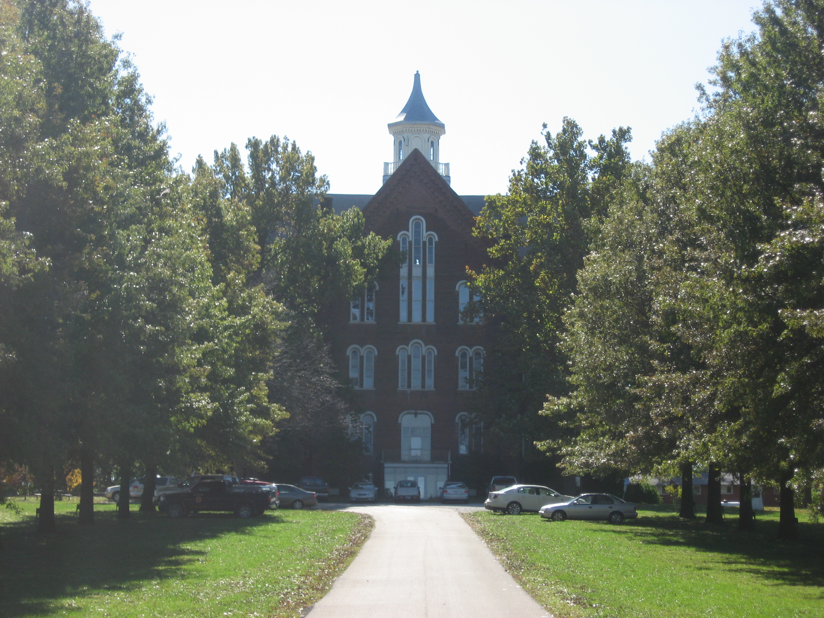
Merom, Indiana — Town — The former Union Christian College building in Merom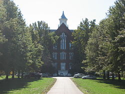 Location of Merom in the state of Indiana
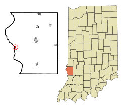
Coordinates: 39°3′25″N 87°34′0″W / 39.05694°N 87.566667°WCoordinates: 39°3′25″N 87°34′0″W / 39.05694°N 87.566667°W Country United States State Indiana County Sullivan Township Gill Area - Total 0.4 sq mi (0.9 km2) - Land 0.4 sq mi (0.9 km2) - Water 0.0 sq mi (0.0 km2) Elevation 548 ft (167 m) Population (2000) - Total 294 - Density 813.7/sq mi (314.2/km2) Time zone Eastern (EST) (UTC-5) - Summer (DST) EDT (UTC-4) ZIP code 47861 Area code(s) 812 FIPS code 18-48474[1] GNIS feature ID 0439023[2] Website http://meromindiana.org/ Merom is a town in Gill Township, Sullivan County, Indiana, United States. The population was 294 at the 2000 census. It is part of the Terre Haute Metropolitan Statistical Area.
Merom's two main attractions are the Bluff Park overlooking the Wabash River and the farm fields of Illinois and the Merom Conference Center, A retreat, conference center and summer camp of the Indiana-Kentucky Conference of the United Church of Christ. Nearby to Merom is Hoosier Energy's Merom Generating Station.
Contents
Geography
Merom is located at 39°3′25″N 87°34′0″W / 39.05694°N 87.566667°W (39.056950, -87.566573)[3].
According to the United States Census Bureau, the town has a total area of 0.4 square miles (1.0 km2), all of it land.
Demographics
As of the census[1] of 2000, there were 294 people, 108 households, and 81 families residing in the town. The population density was 813.7 people per square mile (315.3/km²). There were 135 housing units at an average density of 373.6 per square mile (144.8/km²). The racial makeup of the town was 98.30% White, 0.68% African American, and 1.02% from two or more races. Hispanic or Latino of any race were 0.68% of the population.
There were 108 households out of which 43.5% had children under the age of 18 living with them, 60.2% were married couples living together, 9.3% had a female householder with no husband present, and 25.0% were non-families. 21.3% of all households were made up of individuals and 11.1% had someone living alone who was 65 years of age or older. The average household size was 2.72 and the average family size was 3.12.
In the town the population was spread out with 32.0% under the age of 18, 3.4% from 18 to 24, 32.0% from 25 to 44, 19.0% from 45 to 64, and 13.6% who were 65 years of age or older. The median age was 36 years. For every 100 females there were 101.4 males. For every 100 females age 18 and over, there were 86.9 males.
The median income for a household in the town was $31,528, and the median income for a family was $33,333. Males had a median income of $30,250 versus $20,750 for females. The per capita income for the town was $13,087. About 13.5% of families and 14.5% of the population were below the poverty line, including 11.4% of those under the age of eighteen and 3.6% of those sixty five or over.
References
- ^ a b "American FactFinder". United States Census Bureau. http://factfinder.census.gov. Retrieved 2008-01-31.
- ^ "US Board on Geographic Names". United States Geological Survey. 2007-10-25. http://geonames.usgs.gov. Retrieved 2008-01-31.
- ^ "US Gazetteer files: 2010, 2000, and 1990". United States Census Bureau. 2011-02-12. http://www.census.gov/geo/www/gazetteer/gazette.html. Retrieved 2011-04-23.
External links
 Media related to Merom, Indiana at Wikimedia Commons
Municipalities and communities of Sullivan County, Indiana City 
Towns Carlisle | Dugger | Farmersburg | Hymera | Merom | Shelburn
Townships Unincorporated
communitiesBaker | Baldridge | Benefiel Corner | Bucktown | Campbell Corner | Cass | Curryville | Dodds Bridge | East Shelburn | Fairbanks | Gambill | Glendora | Graysville | Greenville | Hawton | Jericho | Jackson Hill | Merom Station | New Lebanon | Paxton | Pleasantville | Riverton | Riverview | Scotchtown | Scott City | Shiloh | Standard | Stringtown | Wilfred
Categories:- Populated places in Sullivan County, Indiana
- Towns in Indiana
- Terre Haute metropolitan area

Wikimedia Foundation. 2010.