- Curryville, Sullivan County, Indiana
-
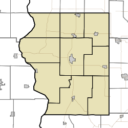
Curryville — Unincorporated town — Sullivan County's location in Indiana Location in Sullivan County, Indiana Coordinates: 39°11′13″N 87°23′33″W / 39.18694°N 87.3925°WCoordinates: 39°11′13″N 87°23′33″W / 39.18694°N 87.3925°W Country United States State Indiana County Sullivan Township Curry Elevation 531 ft (162 m) GNIS feature ID 433256[1] Curryville is an unincorporated town in Curry Township, Sullivan County, Indiana. It is part of the Terre Haute Metropolitan Statistical Area.
Geography
Curryville is located at 39°11′13″N 87°23′33″W / 39.18694°N 87.3925°W.
References
- ^ "Curryville, Indiana". Geographic Names Information System, U.S. Geological Survey. http://geonames.usgs.gov/pls/gnispublic/f?p=gnispq:3:::NO::P3_FID:433256. Retrieved 2010-08-18.
Municipalities and communities of Sullivan County, Indiana City Towns Townships Unincorporated
communitiesBaker | Baldridge | Benefiel Corner | Bucktown | Campbell Corner | Cass | Curryville | Dodds Bridge | East Shelburn | Fairbanks | Gambill | Glendora | Graysville | Greenville | Hawton | Jericho | Jackson Hill | Merom Station | New Lebanon | Paxton | Pleasantville | Riverton | Riverview | Scotchtown | Scott City | Shiloh | Standard | Stringtown | Wilfred
Categories:- Populated places in Sullivan County, Indiana
- Unincorporated communities in Indiana
- Terre Haute metropolitan area
- Indiana geography stubs
Wikimedia Foundation. 2010.


