- Dugger, Indiana
-
Dugger, Indiana — Town — Dugger's community park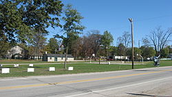 Location in the state of Indiana
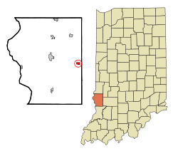
Coordinates: 39°4′15″N 87°15′36″W / 39.07083°N 87.26°WCoordinates: 39°4′15″N 87°15′36″W / 39.07083°N 87.26°W Country United States State Indiana County Sullivan Township Cass Area – Total 0.6 sq mi (1.5 km2) – Land 0.6 sq mi (1.5 km2) – Water 0.0 sq mi (0.0 km2) Elevation 577 ft (176 m) Population (2000) – Total 955 – Density 1,646.5/sq mi (635.7/km2) Time zone EST (UTC-5) – Summer (DST) EST (UTC-5) ZIP code 47848 Area code(s) 812 FIPS code 18-18892[1] GNIS feature ID 0447635[2] Dugger is a town in Cass Township, Sullivan County, Indiana, United States. The population was 955 at the 2000 census. It is part of the Terre Haute Metropolitan Statistical Area.
Contents
History
Dugger was settled in the late 1800s as a coal mining town.
Geography
Dugger is located at 39°4′15″N 87°15′36″W / 39.07083°N 87.26°W (39.070911, -87.260116)[3].
According to the United States Census Bureau, the town has a total area of 0.6 square miles (1.6 km2), all of it land.
Demographics
As of the census[1] of 2000, there were 955 people, 397 households, and 271 families residing in the town. The population density was 1,641.1 people per square mile (635.7/km²). There were 445 housing units at an average density of 764.7 per square mile (296.2/km²). The racial makeup of the town was 98.85% White, 0.21% Native American, 0.31% from other races, and 0.63% from two or more races. Hispanic or Latino of any race were 0.84% of the population.
There were 397 households out of which 29.5% had children under the age of 18 living with them, 54.7% were married couples living together, 10.8% had a female householder with no husband present, and 31.7% were non-families. 28.0% of all households were made up of individuals and 19.4% had someone living alone who was 65 years of age or older. The average household size was 2.41 and the average family size was 2.94.
In the town the population was spread out with 22.9% under the age of 18, 9.5% from 18 to 24, 26.2% from 25 to 44, 24.0% from 45 to 64, and 17.4% who were 65 years of age or older. The median age was 38 years. For every 100 females there were 97.7 males. For every 100 females age 18 and over, there were 92.2 males.
The median income for a household in the town was $31,071, and the median income for a family was $39,583. Males had a median income of $27,039 versus $19,000 for females. The per capita income for the town was $15,255. About 4.6% of families and 7.8% of the population were below the poverty line, including 5.8% of those under age 18 and 9.0% of those age 65 or over.
Tourism
Dugger is now home to the Dugger Coal Museum which contains local photographs and artifacts related to coal mining in and around Dugger and Sullivan County, Indiana.
Just east of Dugger is the Redbird State Riding Area which is owned and operated by the Indiana Department Of Natural Resources. The Redbird mining operation produced 2 million tons of coal, until Redbird closed operations in 1950. Today the former mining land has been converted into camping and for off road sports
The Redbird riding area features 1,200 acres (4.9 km2) of professionally marked, managed and maintained OHV riding trails. Trails range from mild to wild and there is a trail that will fit anyone's skill level. Redbirdsra.com is owned and maintained by the Redbird Foundation.
References
- ^ a b "American FactFinder". United States Census Bureau. http://factfinder.census.gov. Retrieved 2008-01-31.
- ^ "US Board on Geographic Names". United States Geological Survey. 2007-10-25. http://geonames.usgs.gov. Retrieved 2008-01-31.
- ^ "US Gazetteer files: 2010, 2000, and 1990". United States Census Bureau. 2011-02-12. http://www.census.gov/geo/www/gazetteer/gazette.html. Retrieved 2011-04-23.
Municipalities and communities of Sullivan County, Indiana City 
Towns Carlisle | Dugger | Farmersburg | Hymera | Merom | Shelburn
Townships Unincorporated
communitiesBaker | Baldridge | Benefiel Corner | Bucktown | Campbell Corner | Cass | Curryville | Dodds Bridge | East Shelburn | Fairbanks | Gambill | Glendora | Graysville | Greenville | Hawton | Jericho | Jackson Hill | Merom Station | New Lebanon | Paxton | Pleasantville | Riverton | Riverview | Scotchtown | Scott City | Shiloh | Standard | Stringtown | Wilfred
Categories:- Populated places in Sullivan County, Indiana
- Towns in Indiana
- Terre Haute metropolitan area


Wikimedia Foundation. 2010.