- Hymera, Indiana
Infobox Settlement
official_name = Town of Hymera, Indiana
settlement_type =Town
nickname =
mapsize = 250x200px
imagesize =
image_caption =
imagesize =
image_caption =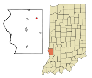
map_caption = Location in the state ofIndiana
mapsize1 =
map_caption1 =
subdivision_type = Country
subdivision_name =United States
area_footnotes =
unit_pref = Imperial
subdivision_type1 = State
subdivision_name1 =Indiana
subdivision_type2 = County
subdivision_name2 = Sullivan
subdivision_type3 = Township
subdivision_name3 = Jackson
government_type =
leader_title =
leader_name =
established_date =
area_magnitude = 1 E6
area_total_km2 = 1.8
area_land_km2 = 1.8
area_water_km2 = 0.0
population_as_of = 2000
population_note =
population_total = 833
population_density_km2 = 459.5
timezone = EST
utc_offset = -5
timezone_DST = EST
utc_offset_DST = -5
area_total_sq_mi = 0.7
area_land_sq_mi = 0.7
area_water_sq_mi = 0.0
elevation_m = 160
elevation_ft = 525
latd = 39 |latm = 11 |lats = 8 |latNS = N
longd = 87 |longm = 18 |longs = 0 |longEW = W
coordinates_display = inline,title
coordinates_type = type:city_region:US-IN
postal_code_type =ZIP code
postal_code = 47855
area_code = 812
blank_name = FIPS code
blank_info = 18-35500GR|2
blank1_name = GNIS feature ID
blank1_info = 0436673GR|3
footnotes =
website =Hymera is a town in and the principal center of Jackson Township, Sullivan County,
Indiana ,United States . The population was 833 at the 2000 census.Geography
According to the
United States Census Bureau , the town has a total area of 0.7square mile s (1.8km² ), all of it land.Demographics
As of the
census GR|2 of 2000, there were 833 people, 331 households, and 228 families residing in the town. Thepopulation density was 1,184.5 people per square mile (459.5/km²). There were 389 housing units at an average density of 553.1/sq mi (214.6/km²). The racial makeup of the town was 99.40% White, 0.24% Native American, and 0.36% from two or more races.There were 331 households out of which 29.3% had children under the age of 18 living with them, 55.6% were married couples living together, 10.3% had a female householder with no husband present, and 31.1% were non-families. 24.8% of all households were made up of individuals and 16.0% had someone living alone who was 65 years of age or older. The average household size was 2.52 and the average family size was 3.02.
In the town the population was spread out with 25.3% under the age of 18, 11.0% from 18 to 24, 27.6% from 25 to 44, 22.8% from 45 to 64, and 13.2% who were 65 years of age or older. The median age was 35 years. For every 100 females there were 101.2 males. For every 100 females age 18 and over, there were 93.8 males.
The median income for a household in the town was $28,938, and the median income for a family was $34,091. Males had a median income of $28,850 versus $16,369 for females. The
per capita income for the town was $13,113. About 13.7% of families and 17.2% of the population were below thepoverty line , including 19.4% of those under age 18 and 15.2% of those age 65 or over.chools
Students from Hymera attend
Hymera Elementary school (grades K-6), andNorth Central High School (grades 7-12) located inFarmersburg, Indiana .Local Attractions
The primary local attractions are
Shakamak State Park , and the Minnehaha Fish and Wildlife Area.History
During pioneer times, the area was settled by the
Methodist s for theBethel Church . A log building once stood within the limits of the present town, where the early settlers assembled for religious worship. OnBusseron Creek was agrist mill erected about 1829. On the westside was one of the firstcoal mine s of the County; it was owned by H. K. and Harvey Wilson. The coal was used chiefly by localblacksmith s. [cite book |editor= Thomas J. Wolfe|others= |title= A History of Sullivan County, Indiana.|year= 1909|publisher= The Lewis Publishing Company|pages= 208-211]Hymera was
plat ted as atownsite about 1870. [cite book |editor= Thomas J. Wolfe|others= |title= A History of Sullivan County, Indiana.|year= 1909|publisher= The Lewis Publishing Company|pages= 208-211]Robert Linn had a
general store on the site now occupied by theOdd Fellows block. For some years the store andpost office , and two or three shops, comprised the business of the place. [cite book |editor= Thomas J. Wolfe|others= |title= A History of Sullivan County, Indiana.|year= 1909|publisher= The Lewis Publishing Company|pages= 208-211]When the post office was established the name Pittsburg was selected by the local community, in honor of
William Pitt who owned the land on which Hymera was founded. However, the name was not accepted by the department. [cite book |editor= Thomas J. Wolfe|others= |title= A History of Sullivan County, Indiana.|year= 1909|publisher= The Lewis Publishing Company|pages= 208-211]The origin of the name Hymera is credited to
John Badders , who waspostmaster . He had an adopted daughter, Mary, who was tall. [cite book |editor= Thomas J. Wolfe|others= |title= A History of Sullivan County, Indiana.|year= 1909|publisher= The Lewis Publishing Company|pages= 208-211] The change of name for the village was accomplished in 1890. In April of that year a petition from nearly all the voters of Pittsburg was laid before the county commissioners asking that the name of the town as recorded on the plat be changed to Hymera. A short time previously, on the opening of the new mine atAlum Cave , the new town laid out there was called New Pittsburg, while the Hymera community in distinction was referred to as Old Pittsburg. The resulting confusion brought about the change in name. About this time a branch line ofrailroad reached up to the coal mines in the vicinity, which led to tremendous growth. In 1902 Hymera was incorporated into a town. That July the first election for town officers was held. [cite book |editor= Thomas J. Wolfe|others= |title= A History of Sullivan County, Indiana.|year= 1909|publisher= The Lewis Publishing Company|pages= 208-211]One of the memorable days in the history of Hymera was the celebration in October 1904, known as
Mitchell Day , in honor of John Mitchell, the president of theUnited Mine Workers of America . The crowd in town was estimated at over seven-thousand. A delegation met Mitchell atTerre Haute, Indiana , and the local procession was made up of the K. of P. Band, labor organizations, and school children. The ceremonies of the day centered about the unveiling of a monument to Nathan Hinkle, the Revolutionary soldier who was buried in the Hymera Cemetery. Hon. James S. Barcus, a great-grandson of Hinkle, delivered an address, and Miss Mamie Asbury, a great-granddaughter, assisted in the unveiling. The monument is fifteen feet high, representing a Revolutionary soldier atparade rest . The other events of the day were held in the Zink Grove, where speeches were made by Rev. A. P. Asbury and Robert W. Miers and John C. Chaney, and the principal address of the afternoon was delivered by Mitchell himself. [cite book |editor= Thomas J. Wolfe|others= |title= A History of Sullivan County, Indiana.|year= 1909|publisher= The Lewis Publishing Company|pages= 208-211]In the fall of 1905 Mitchell was reported to have said that Hymera was the neatest mining town in the United States, with more and better sidewalks according to its size than any town in the county, and many improvements indicating a progressive spirit among the citizens. [cite book |editor= Thomas J. Wolfe|others= |title= A History of Sullivan County, Indiana.|year= 1909|publisher= The Lewis Publishing Company|pages= 208-211]
At the time, there were five church organization, the
Methodist ,Baptist ,Presbyterian ,United Brethren andChristian , the first two having good buildings, while the Presbyterians and U. B. were preparing to build. A five room school building had proved inadequate, and a four room addition was added in the summer of 1905. TheHymera State Bank , which had been organized in December 1903, as the Bank of Hymera, by S. M. Patton and R. I. Ladd, was reorganized as a state bank in January 1906, with Mr. Ladd as President and Mr. Patton, Cashier. [cite book |editor= Thomas J. Wolfe|others= |title= A History of Sullivan County, Indiana.|year= 1909|publisher= The Lewis Publishing Company|pages= 208-211]References
External links
* [http://www.nesc.k12.in.us/hymera/index.htm Hymera Elementary school]
* [http://www.nesc.k12.in.us/nchs/index.php North Central Jr/Sr High School]
Wikimedia Foundation. 2010.