- Curry Township, Sullivan County, Indiana
-
Curry Township — Township — Location in Sullivan County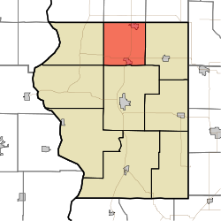
Coordinates: 39°12′51″N 87°23′56″W / 39.21417°N 87.39889°WCoordinates: 39°12′51″N 87°23′56″W / 39.21417°N 87.39889°W Country  United States
State  Indiana
County Sullivan Government - Type Indiana township Area - Total 35.1 sq mi (90.9 km2) - Land 34.85 sq mi (90.27 km2) - Water 0.24 sq mi (0.63 km2) 0.69% Elevation 545 ft (166 m) Population (2000) - Total 3,769 - Density 108.1/sq mi (41.8/km2) ZIP codes 47850, 47879 GNIS feature ID 0453250 Curry Township is one of nine townships in Sullivan County, Indiana, USA. As of the 2000 census, its population was 3,769.[1]
The township is named after William Curry, who was the area's first settler when he arrived there in 1817 from Kentucky.[2]
Contents
Geography
According to the United States Census Bureau, Curry Township covers an area of 35.1 square miles (91 km2); of this, 34.85 square miles (90.3 km2) (99.31 percent) is land and 0.24 square miles (0.62 km2) (0.69 percent) is water.
Cities, towns, villages
Unincorporated towns
- Baldridge at 39°13′23″N 87°22′20″W / 39.2230962°N 87.3722409°W
- Curryville at 39°11′13″N 87°23′33″W / 39.1869853°N 87.3925191°W
- East Shelburn at 39°10′28″N 87°22′47″W / 39.1744856°N 87.3797409°W
- Standard at 39°11′47″N 87°23′21″W / 39.1964297°N 87.3891858°W
- Wilfred at 39°11′12″N 87°21′09″W / 39.1867079°N 87.352518°W
(This list is based on USGS data and may include former settlements.)
Adjacent townships
- Linton Township, Vigo County (north)
- Pierson Township, Vigo County (northeast)
- Jackson Township (east)
- Hamilton Township (south)
- Turman Township (southwest)
- Fairbanks Township (west)
- Prairie Creek Township, Vigo County (northwest)
Cemeteries
The township contains these four cemeteries: Douglas Chapel, Ebenezer, McKinney and West Lawn.
Major highways
Airports and landing strips
- Austin Air Ads Airport
School districts
- Northeast School Corporation
Political districts
- Indiana's 8th congressional district
- State House District 45
- State Senate District 39
References
- United States Census Bureau 2008 TIGER/Line Shapefiles
- United States Board on Geographic Names (GNIS)
- IndianaMap
- ^ United States Census Bureau American FactFinder
- ^ Wolfe, Thomas Jefferson (1909). History of Sullivan County, Indiana. New York, Chicago: Lewis Publishing Company. pp. 43. http://www.archive.org/details/historyofsulliva01wolf.
External links

Prairie Creek Township, Vigo County Linton Township, Vigo County Pierson Township, Vigo County Fairbanks Township 
Jackson Township  Curry Township

Turman Township Hamilton Township Municipalities and communities of Sullivan County, Indiana County seat: Sullivan City 
Towns Townships Unincorporated
communitiesBaker | Baldridge | Benefiel Corner | Bucktown | Campbell Corner | Cass | Curryville | Dodds Bridge | East Shelburn | Fairbanks | Gambill | Glendora | Graysville | Greenville | Hawton | Jericho | Jackson Hill | Merom Station | New Lebanon | Paxton | Pleasantville | Riverton | Riverview | Scotchtown | Scott City | Shiloh | Standard | Stringtown | Wilfred
Categories:- Townships in Sullivan County, Indiana
- Terre Haute metropolitan area

Wikimedia Foundation. 2010.