- North Tuddenham
-
For other places with the same name, see Tuddenham (disambiguation).
Coordinates: 52°35′44″N 1°00′33″E / 52.59553°N 1.00906°E
North Tuddenham 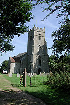
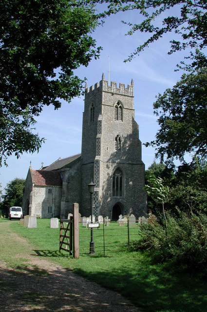
St Mary the Virgin church, North Tuddenham
 North Tuddenham
North Tuddenham shown within NorfolkArea 9.41 km2 (3.63 sq mi) Population 305 - Density 32 /km2 (83 /sq mi) OS grid reference TG039040 Parish North Tuddenham District Breckland Shire county Norfolk Region East Country England Sovereign state United Kingdom Post town NORWICH Postcode district NR9 Police Norfolk Fire Norfolk Ambulance East of England EU Parliament East of England List of places: UK • England • Norfolk North Tuddenham is a civil parish in the English county of Norfolk, it has a parish church, that is named St Mary's[1].
It covers an area of 9.41 km2 (3.63 sq mi) and had a population of 305 in 121 households as of the 2001 census.[2] For the purposes of local government, it falls within the district of Breckland.
North Tuddenham is 3 miles (4.8 km) east of East Dereham, and is close to the A47 road.
Notes
- ^ GENUKI
- ^ Census population and household counts for unparished urban areas and all parishes. Office for National Statistics & Norfolk County Council (2001). Retrieved 20 June 2009.
External links
- GENUKI(tm) page
- Map sources for North Tuddenham
Destinations from North Tuddenham 
Swanton Morley Bylaugh Elsing, Lyng East Dereham 
Hockering  North Tuddenham

Yaxham Mattishall Categories:- Breckland
- Villages in Norfolk
- Civil parishes in Norfolk
- Norfolk geography stubs

Wikimedia Foundation. 2010.