North Lopham

North Lopham

Coordinates: 52°24′09″N 0°59′29″E / 52.40259°N 0.99139°E / 52.40259; 0.99139

North Lopham
North Lopham Church - geograph.org.uk - 355219.jpg
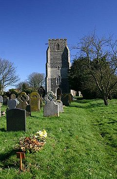
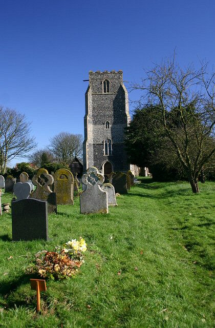
St Andrew's Church, North Lopham
North Lopham is located in Norfolk
North Lopham

 North Lopham shown within Norfolk
Area  8.17 km2 (3.15 sq mi)
Population 605 
    - Density  74 /km2 (190 /sq mi)
OS grid reference TM035824
Parish North Lopham
District Breckland
Shire county Norfolk
Region East
Country England
Sovereign state United Kingdom
Post town DISS
Postcode district IP22
Police Norfolk
Fire Norfolk
Ambulance East of England
EU Parliament East of England
Website http://freespace.virgin.net/brian.frith/council.htm
List of places: UK • England • Norfolk

North Lopham is a civil parish in the English county of Norfolk. It covers an area of 8.17 km2 (3.15 sq mi) and had a population of 605 in 240 households as of the 2001 census.[1] For the purposes of local government, it falls within the district of Breckland.

Notes

  1. ^ Census population and household counts for unparished urban areas and all parishes. Office for National Statistics & Norfolk County Council (2001). Retrieved 20 June 2009.


Wikimedia Foundation. 2010.

Игры ⚽ Нужно сделать НИР?

Look at other dictionaries:

  • North Elmham — Coordinates: 52°44′55″N 0°56′23″E / 52.74856°N 0.93972°E / 52.74856; 0.93972 …   Wikipedia

  • North Pickenham — Coordinates: 52°37′39″N 0°45′13″E / 52.6275°N 0.753611°E / 52.6275; 0.753611 …   Wikipedia

  • North Tuddenham — For other places with the same name, see Tuddenham (disambiguation). Coordinates: 52°35′44″N 1°00′33″E / 52.59553°N 1.00906°E / 52.59553; 1.0090 …   Wikipedia

  • A1066 road — UK road routebox road= A1066 length mi= length km= direction= start= Thetford destinations= end= Diss construction date= completion date= junctions= The A1066 is a road in Great Britain which is predominantly in Norfolk, though it briefly… …   Wikipedia

  • Dereham — Coordinates: 52°40′56″N 0°56′26″E / 52.682199°N 0.940445°E / 52.682199; 0.940445 …   Wikipedia

  • List of civil parishes in Norfolk — This is a list of civil parishes in the county of Norfolk, England. It is broken down by the seven local authority districts that make up the county.BrecklandBreckland is entirely parished, and comprises the following parishes:*Ashill… …   Wikipedia

  • Mileham — Coordinates: 52°44′15″N 0°50′02″E / 52.73751°N 0.83397°E / 52.73751; 0.83397 …   Wikipedia

  • Colkirk — Coordinates: 52°48′04″N 0°50′32″E / 52.80108°N 0.84223°E / 52.80108; 0.84223 …   Wikipedia

  • Mattishall — Coordinates: 52°39′31″N 1°02′05″E / 52.6585°N 1.03466°E / 52.6585; 1.03466 …   Wikipedia

  • Oxborough — Coordinates: 52°34′53″N 0°34′15″E / 52.5814°N 0.5708°E / 52.5814; 0.5708 …   Wikipedia

Share the article and excerpts

Direct link
Do a right-click on the link above
and select “Copy Link”