- Cranwich
-
Coordinates: 52°31′18″N 0°37′28″E / 52.52179°N 0.62444°E
Cranwich 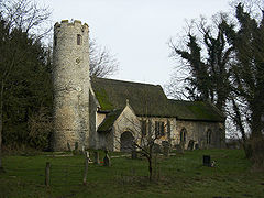
Cranwich St Mary
 Cranwich
Cranwich shown within NorfolkArea 7.38 km2 (2.85 sq mi) Population 60 - Density 8 /km2 (21 /sq mi) OS grid reference TL781947 Parish Cranwich District Breckland Shire county Norfolk Region East Country England Sovereign state United Kingdom Post town THETFORD Postcode district IP26 Police Norfolk Fire Norfolk Ambulance East of England EU Parliament East of England List of places: UK • England • Norfolk Cranwich is a village and civil parish in the English county of Norfolk, about 2 miles north west of Mundford. It covers an area of 7.38 km2 (2.85 sq mi) and had a population of 60 in 24 households as of the 2001 census.[1] For the purposes of local government, it falls within the district of Breckland.
Its church, St Mary's, is one of 124 existing round-tower churches in Norfolk.
The village is referenced in the film Lesbian Vampire Killers, but is renamed "Cragwich", but still remains in the general Norfolk area.
Notes
- ^ Census population and household counts for unparished urban areas and all parishes. Office for National Statistics & Norfolk County Council (2001). Retrieved 20 June 2009.
External links
Categories:- Villages in Norfolk
- Civil parishes in Norfolk
- United Kingdom church stubs
- Norfolk geography stubs


Wikimedia Foundation. 2010.