- North Eastern Province (Kenya)
-
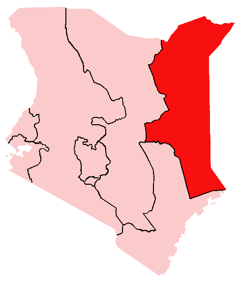
North Eastern Province — Province — Location in Kenya.
Coordinates: 1°0′N 40°15′E / 1°N 40.25°ECoordinates: 1°0′N 40°15′E / 1°N 40.25°E Country  Kenya
KenyaNo. of districts: 10 Capital Garissa Area – Total 126,902 km2 (48,997.1 sq mi) Population (1999) – Total 962,143 Time zone EAT (UTC+3) The North Eastern Province is one of the seven administrative provinces in Kenya outside of Nairobi. The provincial capital is the town of Garissa, near the Coast Province. The overall population is 2,385,572 (in 2010) .[1] and its land area is 126,902 km².[2][3] Formerly known as the Northern Frontier District (NFD), the North Eastern Province covers most of northeastern Kenya. The region is and has historically been primarily inhabited by ethnic Somalis[4] and the Sakuye Oromos, accounting for the bulk of Kenya's Cushite ethnic minority.
Contents
History
Throughout much of the 20th century, the North Eastern Province used to be a part of British East Africa. However, after the dissolution of the former British colonies in East Africa, Britain granted administration of the region to Kenyan nationalists despite a) an informal plebiscite demonstrating the overwhelming desire of the region's population to join the newly-formed Somali Republic,[5] and b) the fact that the NFD was and still is almost exclusively inhabited by ethnic Somalis.[6][7][8]
Led by the Northern Province People's Progressive Party (NPPPP), Somalis in the NFD vigorously sought union with the Somali Republic to the north.[9] In response, the Kenyan government enacted a number of repressive measures designed to frustrate their efforts:
Somali leaders were routinely placed in preventive detention, where they remained well into the late 1970s. The North Eastern Province was closed to general access (along with other parts of Kenya) as a "scheduled" area (ostensibly closed to all outsiders, including members of parliament, as a means of protecting the nomadic inhabitants), and news from it was very difficult to obtain. A number of reports, however, accused the Kenyans of mass slaughters of entire villages of Somali citizens and of setting up large "protected villages" -- in effect concentration camps. The government refused to acknowledge the ethnically based irredentist motives of the Somalis, making constant reference in official statements to the shifta (bandit) problem in the area.[4]
Climate and Habitat
Mandera Climate chart (explanation) J F M A M J J A S O N D 13523436252436268335262433250322403223133232342443342436342493523Average max. and min. temperatures in °C Precipitation totals in mm Imperial conversion J F M A M J J A S O N D 095730.297770.997793.395790.991770907509073091730.193751.793751.493750.49573Average max. and min. temperatures in °F Precipitation totals in inches North Eastern Province is the third largest province in Kenya and has thirteen constituencies represented in the Kenya National Assembly.
The region is home to a rare type of antelope called the Hirola, which is classified as an endangered species. The NFD's pastoralists also possess livestock in excess of 2-3 millions.
The climate of the North Eastern Province is semi-arid and hot. Rain falls infrequently, usually only around April or October, and quite sporadically from year to year. Combined with hot temperatures and extreme evaporation, this makes the region best suited to nomadic pastoralism based on the Arabian camel, which is well adapted to surviving in hot, dry habitats.
There are no rivers of any significance in the region, though there are a few tributaries of the Jubba River near the Somali border, which very rarely have any water in them. Consequently, there is little or no possibility of irrigation-based development, and pastoralists rely exclusively on wells to water their stock and for domestic use.
60-70% of all livestock in Kenya comes from the North Eastern Province, and is sometimes exported to the Middle East as well as elsewhere in Asia.
The region is also abundant with wildlife, although figures show diminishing numbers of the endangered Hirola and Gazelles, Giraffe population.
The biggest airport in the area is the Wajir Airport, formerly a military airport.
Districts
District Capital Garissa Garissa Ijara Ijara Wajir Wajir Mandera Mandera After 2007
District[10] Capital Fafi Bura Garissa Garissa Ijara Masalani Mandera Central El Wak Mandera East Mandera Mandera West Takaba Wajir East Wajir Wajir North Bute Wajir South Habaswein Wajir West Griftu See also
References
- ^ [1]
- ^ Welcome to Kenya National Bureau of Statistics
- ^ [2]
- ^ a b Rhoda E. Howard, Human Rights in Commonwealth Africa, (Rowman & Littlefield Publishers, Inc.: 1986), p.95
- ^ David D. Laitin, Politics, Language, and Thought: The Somali Experience, (University Of Chicago Press: 1977), p.75
- ^ Africa Watch Committee, Kenya: Taking Liberties, (Yale University Press: 1991), p.269
- ^ Women's Rights Project, The Human Rights Watch Global Report on Women's Human Rights, (Yale University Press: 1995), p.121
- ^ Francis Vallat, First report on succession of states in respect of treaties: International Law Commission twenty-sixth session 6 May-26 July 1974, (United Nations: 1974), p.20
- ^ Bruce Baker, Escape from Domination in Africa: Political Disengagement & Its Consequences, (Africa World Press: 2003), p.83
- ^ Ministry of State for Provincial Administration and National Security
External links
Categories:- Provinces of Kenya
- North Eastern Province (Kenya)
- Disputed territories in Africa
Wikimedia Foundation. 2010.