- Nanyuki
-
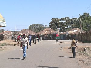
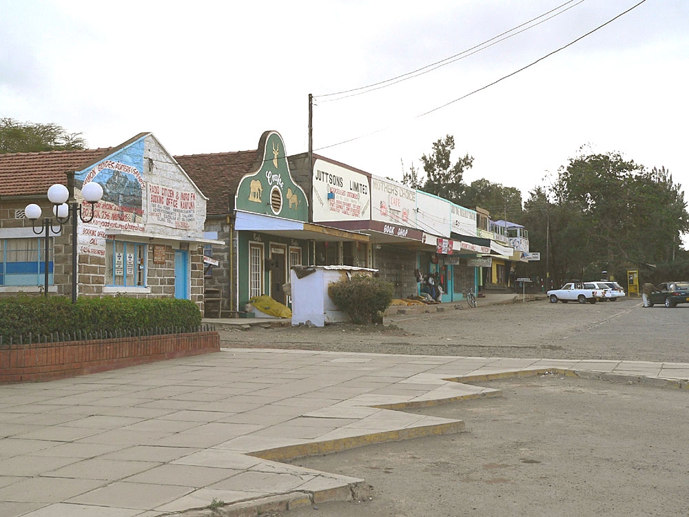
Nanyuki, Kenya Nanyuki main street Location in Kenya
 Nanyuki, Kenya
Coordinates: 0°01′N 37°04′E / 0.017°N 37.067°E Country  Kenya
KenyaRegion Rift Valley County Laikipia County Government - Mayor of Nanyuki Cllr. Isaac Mathenge Population (1999) - Total 31,577 Nanyuki is a market town in central-east Rift Valley region of Kenya lying northwest of Mount Kenya along the A2 road and at the terminus of the branch railway from Nairobi. It is situated just north of the Equator (0° 01' North). It was founded in 1907 by British settlers, some of whose descendants still live in and around the town. Nanyuki is currently the main airbase of the Kenya Air Force. The British Army also keeps a base at The Nanyuki Show Ground (NSG) from where it conducts yearly desert and jungle training exercises on the mountain and in the arid areas to the north. Nanyuki is the capital of Laikipia County. In addition to a town hall, therefore, it also houses the county headquarters.
Contents
History
The town was started by British settlers during in the early days of colonial Kenya in 1907. Some of their descendants still live in or around the town. The town is today multi-cultural and is the market center for farms, ranches, game parks and wildlife conservancies in the region. It's also the base for people seeking to climb Mount Kenya, the most famous landmark in the country. The Equator line passes 6.5 km (4 mi) south of this town.
Economy & Overview
 Majengo quarter
Nanyuki municipality had an urban population of 31,577 in 1999 ([1]). Most members of the population earn their money through trade. Shops in the town supply many farms, ranches and game parks in a wide circle. Originally, most shops were owned by Indians, who still form a sizable part of the population. Climbers and backpackers visit Nanyuki on their way to or from Mount Kenya along the Sirimon and Burguret routes and many other tourists pass through the town. Nanyuki therefore has many hotels, of which Mount Kenya Safari Club and Sportsman’s Arms Hotel are the most prominent and best known. Other hotels include Lion’s Court, Equatorial Hotel, Mount Kenya Paradise Hotel and Joskaki Hotel. The oldest restaurant in town is The Marina and it is still fairly popular. Several years ago, a restaurant was opened south of Nanyuki built inside a huge tree. Named “Trout Tree Restaurant” its main attraction is obviously trout prepared in various ways. Patrons can also visit the trout breeding installation at the foot of the tree. Another notable restaurant is "Barneys" located at Nanyuki Civil Airfield, once the base of the No. 1340 Flight RAF, which flew Harvards during the Mau Mau Uprising.
There is little large-scale industry in Nanyuki. There used to be a textile factory, Mount Kenya Textile (Mountex) Mills. The British management deteriorated over the years, which largely contributed to its bankruptcy in 1978. Years later, the factory, which had remained more or less intact, was bought by an Asian businessman, an inhabitant of Nanyuki. Some textile is now produced. There have also been a number of sawmills in Nanyuki. However, with the almost total ban on tree felling on Mount Kenya, these either closed down or are now eking out a difficult existence. Recently, large horticultural operations have come to Nanyuki.
A park lies in the centre of the town and two rivers, the Nanyuki and Liki Rivers, pass through it. The Equator passes through the southern part of Nanyuki. One crosses it when approaching Nanyuki on the A2 from the south. This spot is popular with tourists who have themselves photographed there. Some people are usually at hand to show them the supposed effect of the Coriolis force, which they say makes draining water swirl clockwise or anticlockwise depending on whether one is on the northern or southern hemisphere, though as noted in the article about the Coriolis force, the effect is detectable only in the laboratory and the "demonstrations" at the equato are merely engaging diversions.
Nanyuki can be reached by air. Its airport lies 6.5 km (4 mi) south of the town and is served by light aircraft along the highway to Nairobi . There is a regular air service by Air Kenya, which is very convenient for businessmen and tourists. The town is also reachable using the all weather road from Nairobi. Tourists can visit a number of parks and reserves in the vicinity of Nanyuki, the most obvious one being Mount Kenya National Park. Others are Sweetwaters Game Reserve, Lewa Wildlife Conservancy, Samburu National Reserve and Shaba National Reserve.
Art exhibitions, plays and musicals are regularly held at the Lily Pond Arts Centre
Nanyuki has some of the cleanest water in Kenya since the water supply source is a river on Mt. Kenya. The entire water system is gravity fed, from the supply to the sewer system.
Academic institutions in Nanyuki include Nanyuki High School, Moi Equator Girls' High School, St Christopher's School (formerly the Beehive School), Braeburn International School Nanyuki, Nanyuki Primary School, Mary Immaculate Primary School, Brickwoods High School, Nkando Primary School, Inooro Secondary School, Mt. Kenya Secondary School and others.
The current mayor of Nanyuki is Isaac Mathenge of PNU [1]
Images
-
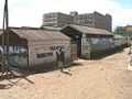
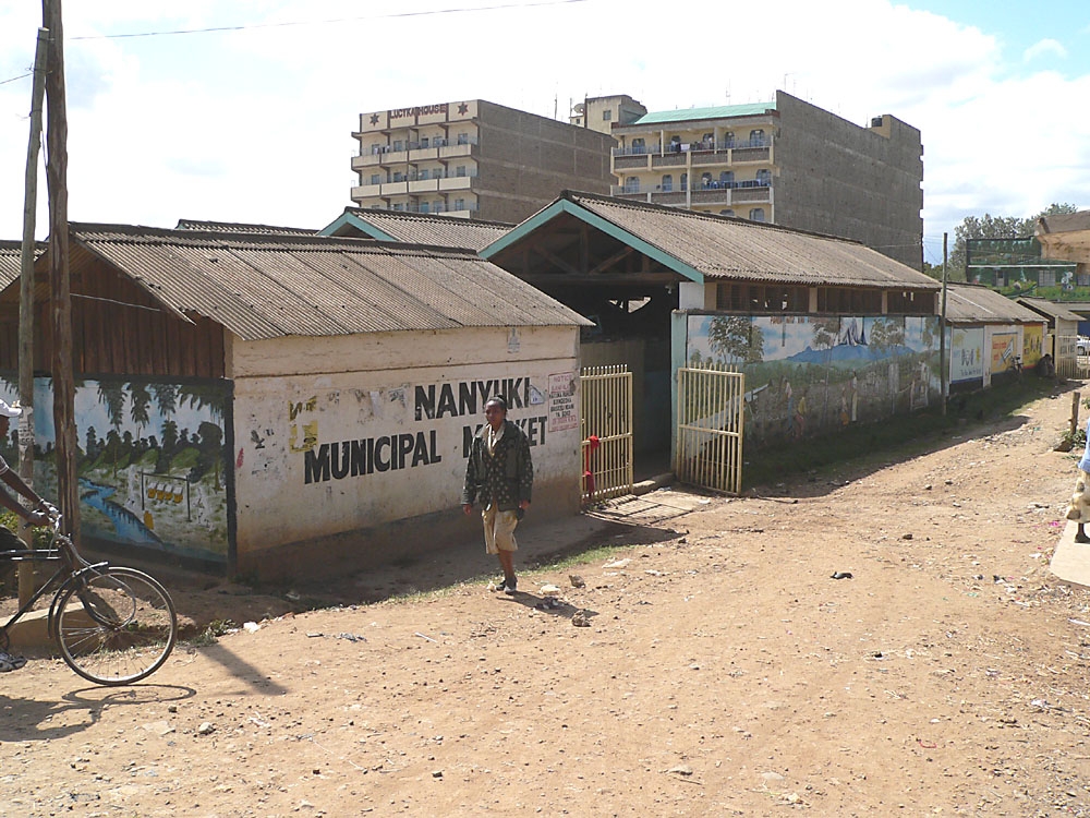
Municipal market
-
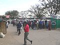
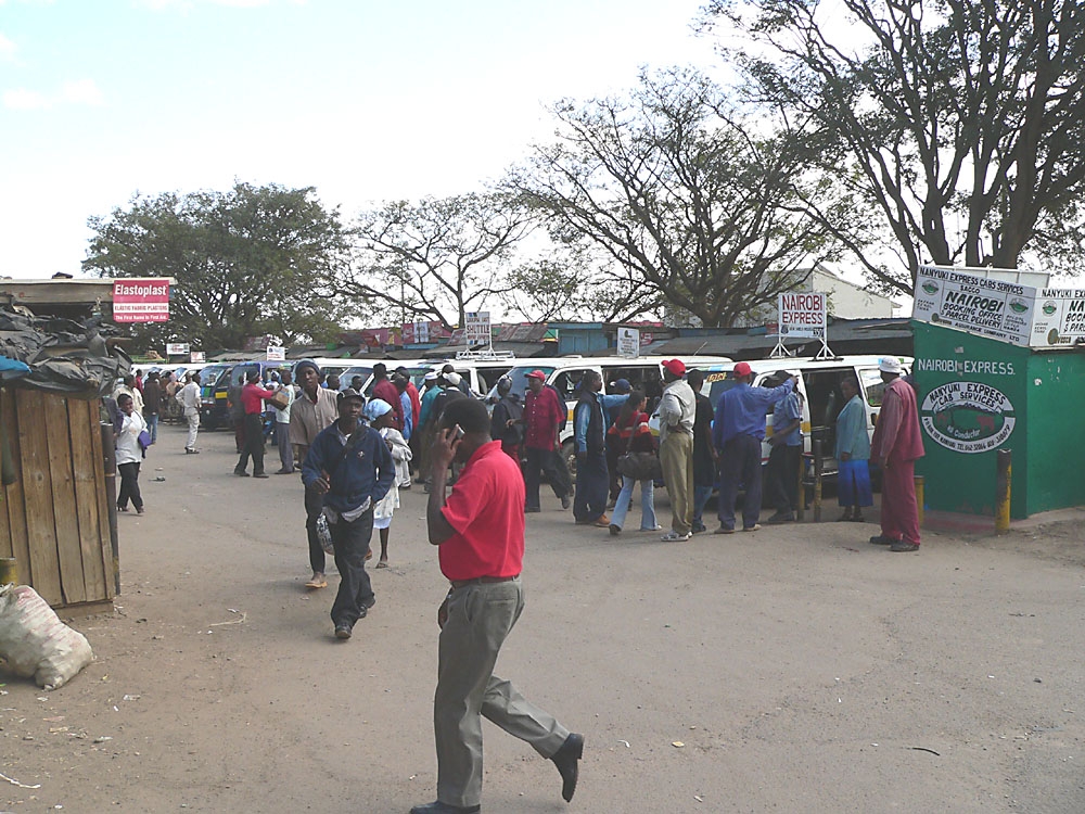
Matatu stage (bus station)
-
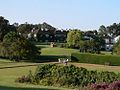
Mount Kenya Safari Club
See also
References
- ^ The Standard, July 9, 2009: PNU dominates Central civic polls
Lily Pond Arts Centre - Nanyuki Coordinates: 00°01′N 37°04′E / 0.017°N 37.067°E
http://www.facebook.com/pages/Nanyuki/109692282382543
Categories:- Laikipia District
- Populated places in Rift Valley Province
-


Wikimedia Foundation. 2010.