- Nanyuki Airport
-
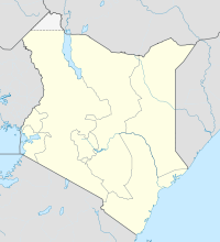
Nanyuki Airfield IATA: NYK – ICAO: HKNY Location of Nanyuki Airport in Kenya
Placement on map is approximateSummary Airport type Public, Civilian Owner Kenya Airports Authority Operator Tropic Air Kenya Serves Nanyuki, and Northern Kenya Location Nanyuki,  Kenya
KenyaElevation AMSL 6,250 ft / 1,905 m Coordinates 00°02′42″N 37°01′48″E / 0.045°N 37.03°E Runways Direction Length Surface ft m 3,900 1,200 Asphalt Nanyuki Airfield is an airport Kenya.
Contents
Location
Nanyuki Airfield, (IATA: NYK, ICAO: HKNY), is located in Laikipia County, Laikipia District, Rift Valley Province, in the town of Nanyuki, in the Kenyan East Rift Valley.
Located on the western foot hills of Mount Kenya, it lies only 8 kilometres (5.0 mi), south of the Equator. It is approximately 140 kilometres (87 mi), by air, north of Nairobi International Airport, the country’s largest civilian airport.[1] The geographic coordinates of this airport are:0° 2' 42.00"N, 37° 1' 48.00"E (Latitude:0.045000; Longitude:37.030000).
Overview
Situated at 1,905 metres (6,250 ft) above sea level, the airport has a single asphalt runway which measures 1,200 metres (3,900 ft) in length.[2]
Nanyuki Airfield is a government-owned, privately leased airfield, serving private and commercial air operators. With only one landing strip, the airfield handles mostly small light single engine aircraft and some larger twin aircraft. Most traffic through Nanyuki is routing from Nairobi, carrying tourists to Mara Serena Airport, Samburu Airport, Laikipia, Lewa and Meru. The airfield is leased by Tropic Air Kenya, offering air charter and helicopter services.
Airlines and destinations
Airlines Destinations Airkenya Nairobi - Wilson, Mara Serena Airport, Samburu Airport East African Safari Air Nairobi - Jomo Kenyatta Kenya Airways Nairobi - Jomo Kenyatta Tropic Air Kenya Laikipia, Samburu, Meru, Maasai Mara Fly 540 Nairobi - Wilson Airport Services
Nanyuki Airfield is open from 6am to 6pm daily, with all traffic reporting to the Nanyuki Air Traffic controller. Aircraft fuel is usually available. Barney’s Restaurant is open from 8am to 5pm daily, serving hot and cold drinks, breakfast, lunch and snacks. The gift shop is also open daily, selling African arts, crafts and gifts.
History and Development
In the late 1960’s the Nanyuki Airfield was originally situated along the Nanyuki - Rumuruti Road. This was a grass airfield, mainly used by small single engine, privately owned aircraft. During the 1970’s the site was purchased by the Kenya government for military and official business – and named the Laikipia Air Base.
The new civil airfield for Nanyuki was allocated along the Nanyuki – Naro Moru road about 10 kilometres (6.2 mi), out of Nanyuki town, and was named Nanyuki Civil Airfield. At the time, the airfield was almost entirely used by privately owned small light single engine aircraft. The premises consisted of a tarmac airfield and a small caretakers hut.
In the early 1990’s the airfield became home to Tropic Air Kenya – a small air charter company operating single engine Cessna aircraft and helicopters. Its is also a key airport for Air Kenya, East African Safari Air, and Fly540 who operate daily schedule services linking with Nairobi, Lewa, Laikipia, Samburu, Meru and the Maasai Mara.
Offices and aircraft facilities have been built, and in order to accommodate the many thousands of passengers that pass through the airfield each year, Tropic Air Kenya established a waiting area, with a restaurant (Barney’s), shop and toilet facilities.
External links
- Location of Nanyuki Airport At Google Maps
- Website of Kenya Airports Authority
- List of Airports In Kenya
- Airkenya Routes
See also
- Nanyuki
- Laikipia District
- Rift Valley Province
- Kenya Airports Authority
- Kenya Civil Aviation Authority
- List of airports in Kenya
References
Coordinates: 0°02′42″N 37°01′48″E / 0.045000°N 37.030000°E
Categories:- Airports in Kenya
- Laikipia District
- Rift Valley Province
Wikimedia Foundation. 2010.

