- Concepción Province, Chile
-
Concepción Province
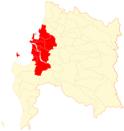
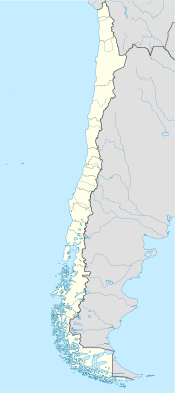
Provincia de Concepción— Province — Location in the Biobío Region Location in Chile Coordinates: 36°58′S 72°56′W / 36.967°S 72.933°WCoordinates: 36°58′S 72°56′W / 36.967°S 72.933°W Country Chile Region Biobío Capital Concepción Boroughs Government – Type Provincial – Governor Eric Aedo Jeldres Area[1] – Total 3,439.3 km2 (1,327.9 sq mi) Population (2002 Census)[1] – Total 912,889 – Density 265.4/km2 (687.5/sq mi) – Urban 879,854 – Rural 33,035 Sex[1] – Men 441,953 – Women 470,936 Time zone CLT [2] (UTC-4) – Summer (DST) CLST [3] (UTC-3) Area code(s) 56 + 41 Website Government of Concepción Concepción Province (Spanish: Provincia de Concepción) is one of four provinces of the Chilean region of Biobío (VIII). Its capital, Concepción, is part of the Greater Concepción conurbation, the nation's second largest metropolitan area after Santiago.
Contents
Administration
As a province, Concepción is a second-level administrative division of Chile, governed by a provincial governor who is appointed by the president.
Communes
The province comprises twelve communes, each governed by a municipality consisting of an elected alcalde and municipal council.
Geography and demography
According to the 2002 census by the National Statistics Institute (INE), the province spans an area of 3,439.3 km2 (1,328 sq mi)[1] and had a population of 912,889 inhabitants (441,953 men and 470,936 women), giving it a population density of 265.4 /km2 (687 /sq mi). It is the second most populated province after the more than five times larger Santiago Province (pop. 4,668,473). Of these, 879,854 (96.4%) lived in urban areas and 33,035 (3.6%) in rural areas. Between the 1992 and 2002 censuses, the population grew by 8.5% (71,444 persons).[1]
References
- ^ a b c d e (Spanish) "Territorial division of Chile" (PDF). National Statistics Institute. 2007. http://www.ine.cl/canales/chile_estadistico/territorio/division_politico_administrativa/pdf/dpa_completa.pdf. Retrieved 18 March 2011.
- ^ "Chile Time". WorldTimeZones.org. http://www.world-time-zones.org/zones/chile-time.htm. Retrieved 26 September 2010.
- ^ "Chile Summer Time". WorldTimeZones.org. http://www.world-time-zones.org/zones/chile-summer-time.htm. Retrieved 26 September 2010.
Provinces of Chile Aisén • Antártica Chilena • Antofagasta • Arauco • Arica • Biobío • Cachapoal • Capitán Prat • Cardenal Caro • Cauquenes • Cautín • Chacabuco • Chañaral • Chiloé • Choapa • Coihaique • Colchagua • Concepción • Copiapó • Cordillera • Curicó • El Loa • Elqui • General Carrera • Huasco • Iquique • Isla de Pascua • Limarí • Linares • Llanquihue • Los Andes • Magallanes • Maipo • Malleco • Marga Marga • Melipilla • Ñuble • Osorno • Palena • Parinacota • Petorca • Quillota • Ranco • San Antonio • San Felipe de Aconcagua • Santiago • Talagante • Talca • Tamarugal • Tierra del Fuego • Tocopilla • Última Esperanza • Valdivia • Valparaíso< Communes and municipalities in Biobío Region > Ñuble Province Bulnes · Chillán · Chillán Viejo · Cobquecura · Coelemu · Coihueco · El Carmen · Ninhue · Ñiquén · Pemuco · Pinto · Portezuelo · Quillón · Quirihue · Ránquil · San Carlos · San Fabián · San Ignacio · San Nicolás · Treguaco · Yungay
Concepción Province Concepción · Coronel · Chiguayante · Florida · Hualpén · Hualqui · Lota · Penco · San Pedro de la Paz · Santa Juana · Talcahuano · ToméBiobío Province Alto Biobío · Antuco · Cabrero · Laja · Los Ángeles · Mulchén · Nacimiento · Negrete · Quilaco · Quilleco · San Rosendo · Santa Bárbara · Tucapel · YumbelArauco Province Categories:
Wikimedia Foundation. 2010.


