- Curanilahue
-
Curanilahue — city and Commune — 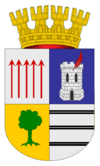
Coat of armsLocation of the Curanilahue commune in the Biobío Region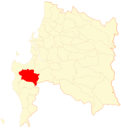 Location in Chile
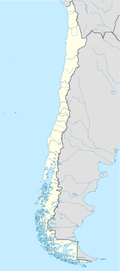
 Curanilahue
Coordinates (city): 37°28′35″S 73°20′40″W / 37.47639°S 73.34444°WCoordinates: 37°28′35″S 73°20′40″W / 37.47639°S 73.34444°W Country Chile Region Biobío Province Arauco Government[1][2] – Type Municipality – Alcalde Ahimalec Benítez Silva (PDC) Area[3] – Total 994.3 km2 (383.9 sq mi) Population (2002 Census)[3] – Total 31,943 – Urban 30,126 – Rural 1,817 Demonym Curanilahuino Sex[3] – Men 16,115 – Women 15,828 Time zone CLT (UTC−4) – Summer (DST) CLST (UTC−3) Area code(s) 56 + 41 Website Municipality of Curanilahue Curanilahue is a Chilean commune and city in Arauco Province, Biobío Region.
Contents
Demographics
According to the 2002 census of the National Statistics Institute, Curanilahue spans an area of 994.3 km2 (384 sq mi) and has 31,943 inhabitants (16,115 men and 15,828 women). Of these, 30,126 (94.3%) lived in urban areas and 1,817 (5.7%) in rural areas. Between the 1992 and 2002 censuses, the population fell by 5% (1,688 persons).[3]
Administration
As a commune, Curanilahue is a third-level administrative division of Chile administered by a municipal council, headed by an alcalde who is directly elected every four years. The 2008-2012 alcalde is Ahimalec Benítez Silva (PDC).[1][2]
Within the electoral divisions of Chile, Curanilahue is represented in the Chamber of Deputies by Manuel Monsalve (PS) and Iván Norambuena (UDI) as part of the 46th electoral district, (together with Lota, Lebu, Arauco, Los Álamos, Cañete, Contulmo and Tirúa). The commune is represented in the Senate by Victor Pérez Varela (UDI) and Mariano Ruiz -Esquide Jara (PDC) as part of the 13th senatorial constituency (Biobío-Coast).
References
- ^ a b (Spanish) "Asociación Chilena de Municipalidades". http://www.munichue.cl/. Retrieved 23 February 2011.
- ^ a b (Spanish) "Municipality of Curanilahue". http://www.munichue.cl/. Retrieved 23 February 2011.
- ^ a b c d (Spanish) "National Statistics Institute". http://www.ine.cl/canales/chile_estadistico/censos_poblacion_vivienda/censo_pobl_vivi.php. Retrieved 8 September 2010.
External links
- (Spanish) Municipality of Curanilahue
< Communes and municipalities in Biobío Region > Ñuble Province Bulnes · Chillán · Chillán Viejo · Cobquecura · Coelemu · Coihueco · El Carmen · Ninhue · Ñiquén · Pemuco · Pinto · Portezuelo · Quillón · Quirihue · Ránquil · San Carlos · San Fabián · San Ignacio · San Nicolás · Treguaco · Yungay
Concepción Province Concepción · Coronel · Chiguayante · Florida · Hualpén · Hualqui · Lota · Penco · San Pedro de la Paz · Santa Juana · Talcahuano · ToméBiobío Province Alto Biobío · Antuco · Cabrero · Laja · Los Ángeles · Mulchén · Nacimiento · Negrete · Quilaco · Quilleco · San Rosendo · Santa Bárbara · Tucapel · YumbelArauco Province Categories:- Communes of Chile
- Biobío Region
- Populated places in Arauco Province


Wikimedia Foundation. 2010.