- Curicó Province
-
Curicó Province
Provincia de Curicó— Province — Location in the Maule Region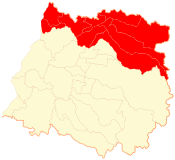 Location in Chile
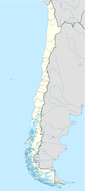
 Curicó Province
Coordinates: 34°57′S 71°06′W / 34.95°S 71.1°WCoordinates: 34°57′S 71°06′W / 34.95°S 71.1°W Country Chile Region Maule Capital Curicó Communes Government – Type Provincial – Governor Area[1] – Total 7,280.9 km2 (2,811.2 sq mi) Population (2002 Census)[1] – Total 244,053 – Density 33.5/km2 (86.8/sq mi) – Urban 157,876 – Rural 86,177 Sex[1] – Men 122,835 – Women 121,218 Time zone CLT [2] (UTC-4) – Summer (DST) CLST [3] (UTC-3) Area code(s) 56 + 75 Website Government of Curicó Curicó Province (Spanish: Provincia de Curicó) is one of four provinces of the central Chilean region of Maule (VII). Its capital is the city of Curicó. It lies between the provinces of Colchagua and Talca and extends from the Pacific to the Argentine frontier, spanning an area of 7,280.9 km2 (2,811 sq mi). According to the 2002 census, the population was 244,053.[1]
Contents
Administration
As a province, Curicó is a second-level administrative division of Chile, governed by a provincial governor who is appointed by the president.
Communes
The province is composed of nine communes, each governed by a municipality consisting of an alcalde and municipal council.
History
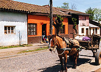 Molina, Curicó province
The region is named for the Curis one of the tribes of Picunche or Promaucaes settled along the rivers of the central valley flowing into the Mataquito River, around the modern city of Curicó. Others tribes were the Tenu along the Teno River (the modern Rauco and Teno communes) to the north. To the south were the Gualemo along the Lontué River the modern Molina commune. Along the Mataquito were the tribes centered on the modern towns of Palquibudi in Sagrada Familia commune, La Huerta in Hualañé commune and Lora in Licantén commune. On the coast north of the river, the Vichuquén in the commune of the same name [4].
The province was created in 1865. Formerly it was part of the Colchagua Province. In 1974, because of a regionalisation process in Chile during the Augusto Pinochet regime executed by CONARA (Comisión Nacional de Reforma Administrativa in Spanish, National Commission of Administrative Reform in English), the province was reshaped, taking place in the recently created Maule Region.
Geography and ecology
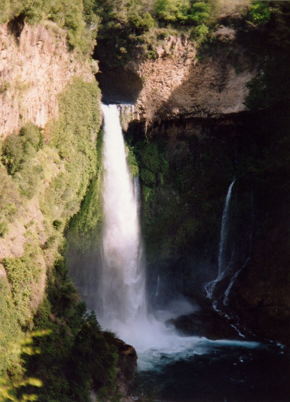
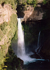 Inside of the Chilean Central Valley, Bride's Veil Waterfall
The eastern and western sections of Curicó Province are mountainous, and are separated by the fertile valley of central Chile. The provincial capital is Curicó, on the Mataquito River, 194 km south of Santiago. In some of the mountainous areas of the province is found the endangered Chilean Wine Palm, Jubaea chilensis, whose southern range is generally defined by the northern Maule Region, e.g. Curicó Province; historically, this endemic Chilean palm had a much wider distribution.[5]
Demography
According to the 2002 census by the National Statistics Institute (INE), the province spans an area of 7,280.9 km2 (2,811 sq mi)[1] and had a population of 244,053 inhabitants (122,835 men and 121,218 women), giving it a population density of 33.5 /km2 (87 /sq mi). Between the 1992 and 2002 censuses, the population grew by 10.6% (23,396 persons).[1]
See also
- Chilean Wine Palm
References
- ^ a b c d e f (Spanish) "Territorial division of Chile" (PDF). National Statistics Institute. 2007. http://www.ine.cl/canales/chile_estadistico/territorio/division_politico_administrativa/pdf/dpa_completa.pdf. Retrieved 18 March 2011.
- ^ "Chile Time". WorldTimeZones.org. http://www.world-time-zones.org/zones/chile-time.htm. Retrieved 2010-07-28.
- ^ "Chile Summer Time". WorldTimeZones.org. http://www.world-time-zones.org/zones/chile-summer-time.htm. Retrieved 2010-07-28.
- ^ Thomas Guevara, Historia de Curicó, Capítulo I, 1891
- ^ C. Michael Hogan, 2008
Sources
- Thomas Guevara, Historia de Curicó, Alicante : Biblioteca Virtual Miguel de Cervantes, 2000 Originally published in 1891.
- C. Michael Hogan (2008) Chilean Wine Palm: Jubaea chilensis, GlobalTwitcher.com, ed. Nicklas Stromberg
Provinces of Chile Aisén • Antártica Chilena • Antofagasta • Arauco • Arica • Biobío • Cachapoal • Capitán Prat • Cardenal Caro • Cauquenes • Cautín • Chacabuco • Chañaral • Chiloé • Choapa • Coihaique • Colchagua • Concepción • Copiapó • Cordillera • Curicó • El Loa • Elqui • General Carrera • Huasco • Iquique • Isla de Pascua • Limarí • Linares • Llanquihue • Los Andes • Magallanes • Maipo • Malleco • Marga Marga • Melipilla • Ñuble • Osorno • Palena • Parinacota • Petorca • Quillota • Ranco • San Antonio • San Felipe de Aconcagua • Santiago • Talagante • Talca • Tamarugal • Tierra del Fuego • Tocopilla • Última Esperanza • Valdivia • Valparaíso< Communes and municipalities in Maule Region > Curicó Province 
Talca Province Constitución · Curepto · Empedrado · Maule · Pelarco · Pencahue · Río Claro · San Clemente · San Rafael · TalcaLinares Province Cauquenes Province External links
- (Spanish) Official website (Gobernación de Curicó)
Categories:


Wikimedia Foundation. 2010.