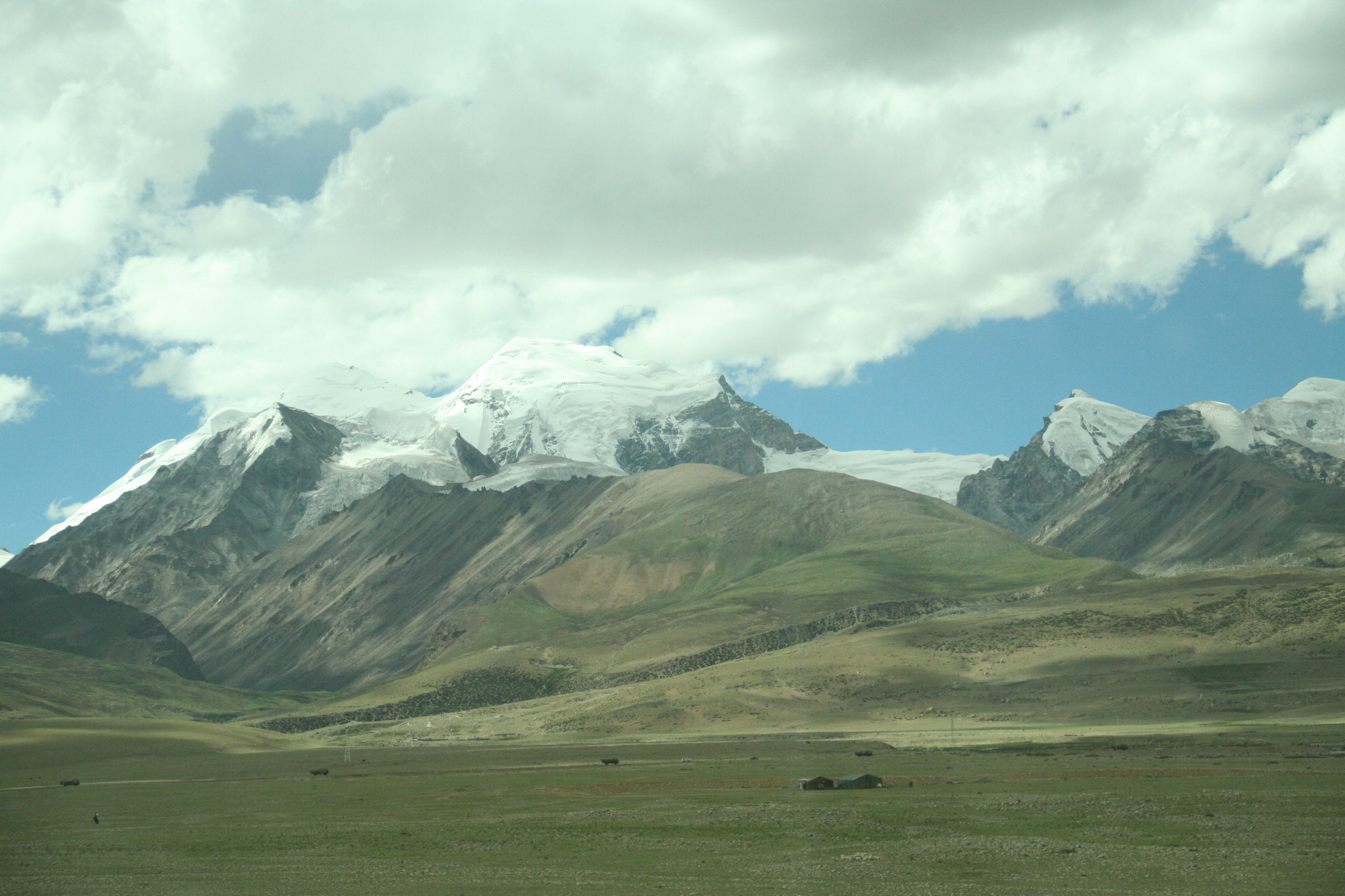
- Tanggula Mountains
-
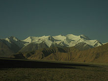 Tanggula Mountains viewed from Qinghai
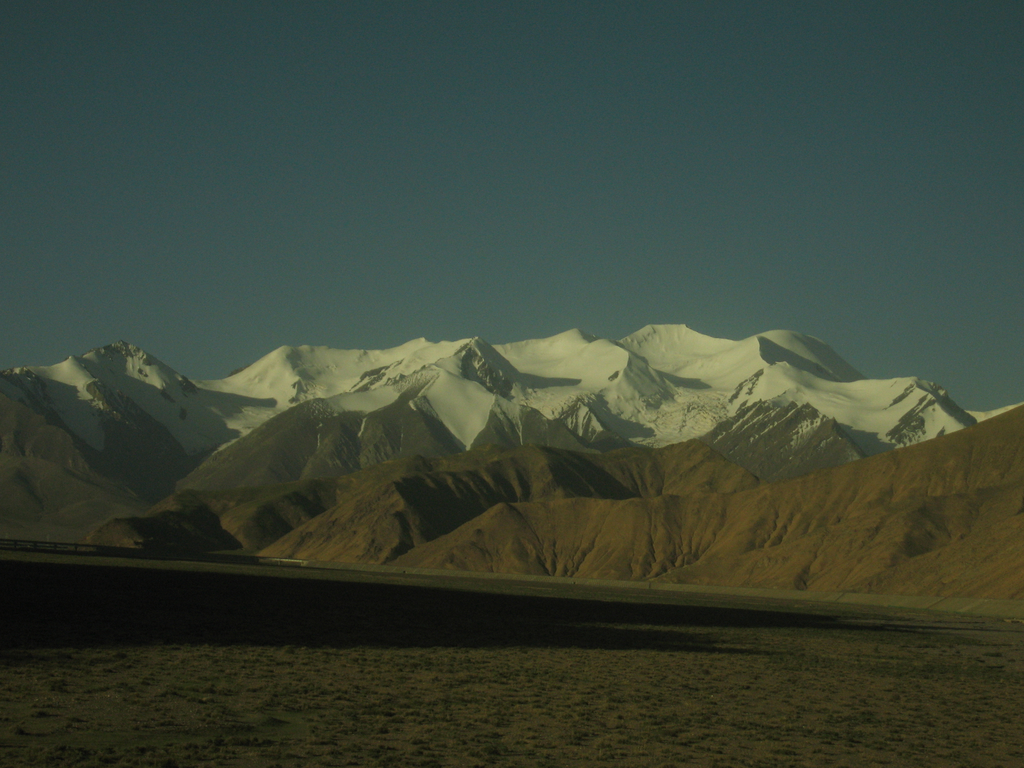
 Tanggula Mountains from the Qinghai-Tibet Railway.
Tanggula Mountains (Chinese: 唐古拉山脉; pinyin: Tánggǔlā shānmài; also called Dangla Mountains, Tibetan: གདང་ལ་།, Wylie: gdang la, ZYPY: Dang La; officially Tanggula (Dangla) Shanmai) are a mountain range in the central part of the Tibetan Plateau.[1] Administratvely, the western part of the range is in Nagqu Prefecture of the Tibet Autonomous Region; the highest, central part, in the border area of Nagqu Prefecture and Tanggula Town of the Qinghai Province; and the eastern section, in the border area of Nagqu and the Yushu Tibetan Autonomous Prefecture of Qinghai.
The elevations of the main ridge average more than 5,000 m. The Yangtze River originates in this mountain range and Peak Geladandong (at 6,621 metres, located within Tanggula Town) is the tallest peak in the range.[2]
The Qinghai-Tibet Highway and the Qinghai-Tibet Railway cross the Tanggula Mountains at Tanggula Mountain Pass. This is the highest point of the Qinghai-Tibet Railway, and the highest point of any railway in the world, at 5,072 meters above sea level.[3] On account of the snow and occasional road accidents, highway closures and concomitant traffic delays are not uncommon.[4]
The mountains lie within the Tibetan Plateau alpine shrub and meadows ecoregion.[5]
The Tanggula (Tanglha) Range is a dividing range between the basin of the Yangtze River in the north and the endorheic basins of north-eastern Tibet in the south. This range should not be confused with the Nianqing Tangula (Nyainqêntanglha), which is located a few hundreds of kilometers further south, separating those endorheic basins from the Yarlung Tsangpo (Brahmaputra) River basin of southern Tibet.
See also
- Tanggula Pass
- Tanggula railway station
- Tibetan Plateau
- Geladandong
- Nyenchen Tanggula Mountains
Notes
- ^ "Tanggula Mountains". Encyclopedia Britannica. http://www.britannica.com/eb/article-9071164/Tanggula-Mountains. Retrieved 2007-07-03.
- ^ "Desperate Times at the Headwaters of the Yangtze". Archived from the original on 2007-10-09. http://web.archive.org/web/20071009153623/http://www.hkctp.com.hk/eng/magazine/281/Nature.asp. Retrieved 2007-07-03.
- ^ "New height of world's railway born in Tibet". China View. http://news.xinhuanet.com/english/2005-08/24/content_3397297.htm. Retrieved 2007-07-03.
- ^ Plateau traffic jam
- ^ Olson, D. M, E. Dinerstein, et al (2001). "Terrestrial Ecoregions of the World: A New Map of Life on Earth". BioScience 51 (11): 933–938. doi:10.1641/0006-3568(2001)051[0933:TEOTWA]2.0.CO;2. http://gis.wwfus.org/wildfinder/.
Coordinates: 33°30′00″N 91°04′12″E / 33.5°N 91.07°E
Mountain ranges of China Ailao Mountains · Altai Mountains · Argu Tagh · Changbai Mountains · Daba Mountains · Dabie Mountains · Dalou Mountains · Daxue Mountains · Dzungarian Alatau · Greater Khingan · Helan Mountains · Hengduan Mountains · Himalayas · Jiuling Mountains · Jiuyi Mountains · Karakoram · Kunlun Mountains · Lesser Khingan · Luoxiao Mountains · Lüliang Mountains · Huangshan · Jingshan Mountains · Mount Lang · Min Mountains · Mufu Mountains · Nanling Mountains · Pamir Mountains · Qian Mountains · Qin Mountains · Qionglai Mountains · Taihang Mountains · Tarbagatai Mountains · Tian Shan · Tanggula Mountains · Wanda Mountains · Wudang Mountains · Wuling Mountains · Wuyi Mountains · Xuefeng Mountains · Yengisogat · Yin Mountains · Yunling Mountains · Zhongtiao Mountains Landforms of China
Qinghai topics General Geography Cities • Tibetan Plateau • Yellow River • Yangtze River • Mekong River • Tanggula Mountains • Kunlun Mountains • Qinghai Lake • Qaidam Basin • Sanjiangyuan National Nature ReserveEducation Qinghai University • Qinghai Normal University • Qinghai University for Nationalities • Qinghai Medical CollegeCulture Cuisine LiangfenVisitor attractions Categories:- Geography of Tibet
- Mountain ranges of China
- Tibet geography stubs
Wikimedia Foundation. 2010.