- Pennsylvania Route 118
-
PA Route 118
Route information Maintained by PennDOT Length: 42.33 mi[1] (68 km) Existed: 1928 – present Major junctions West end:  PA 405 in Hughesville
 PA 42 near Unityville
 PA 487 near Fairmount Springs
East end:  PA 415 in Dallas Township
Location Counties: Lycoming, Columbia, Luzerne Highway system Roads in Pennsylvania
Interstate • US • State • Legislative←  PA 117
US 119  →
→Route 118 (designated by the Pennsylvania Department of Transportation as SR 118) is a 42.33-mile (68.12 km) long state route located in northeastern Pennsylvania. The western terminus of the route is at PA 405 in Hughesville. The eastern terminus is at PA 415 in Dallas. The road is known briefly as East Water Street from its western terminus to its intersection with 6th Street in Hughesville, where it becomes Lairdsville Road for 12 miles (19 km) until crossing PA 42 near Unityville. It joins PA 487 for one mile (1.6 km) in Red Rock, where it passes through the southern part of Ricketts Glen State Park.
Contents
Route description
Lycoming County
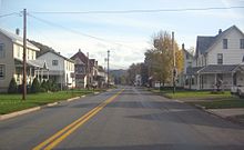
 The western terminus of Route 118 is at Route 405 in Hughesville
Route 118 begins at an intersection with Route 405 (Main Street) in the center of Hughesville in Lycoming County. The route progresses southeastward through the borough as East Water Street. The local street crosses a long stretch of commercial businesses before reaching North Fifth Street, where it turns to the east and crosses over Muncy Creek. After crossing the river, Route 118 changes names to Lairdville Road and the surroundings become residential. The route there turns to the southeast once again, paralleling a long distance with Gregg Run Road. The surroundings quickly change to farmland, and Route 118 continues east through woodlands that begins soon after. At the intersection with Old Lairdsville Road, the route turns to the northeast until a short clearing, where the highway intersects with L Harman Road. At that intersection, the route turns to the southeast once again.[2]
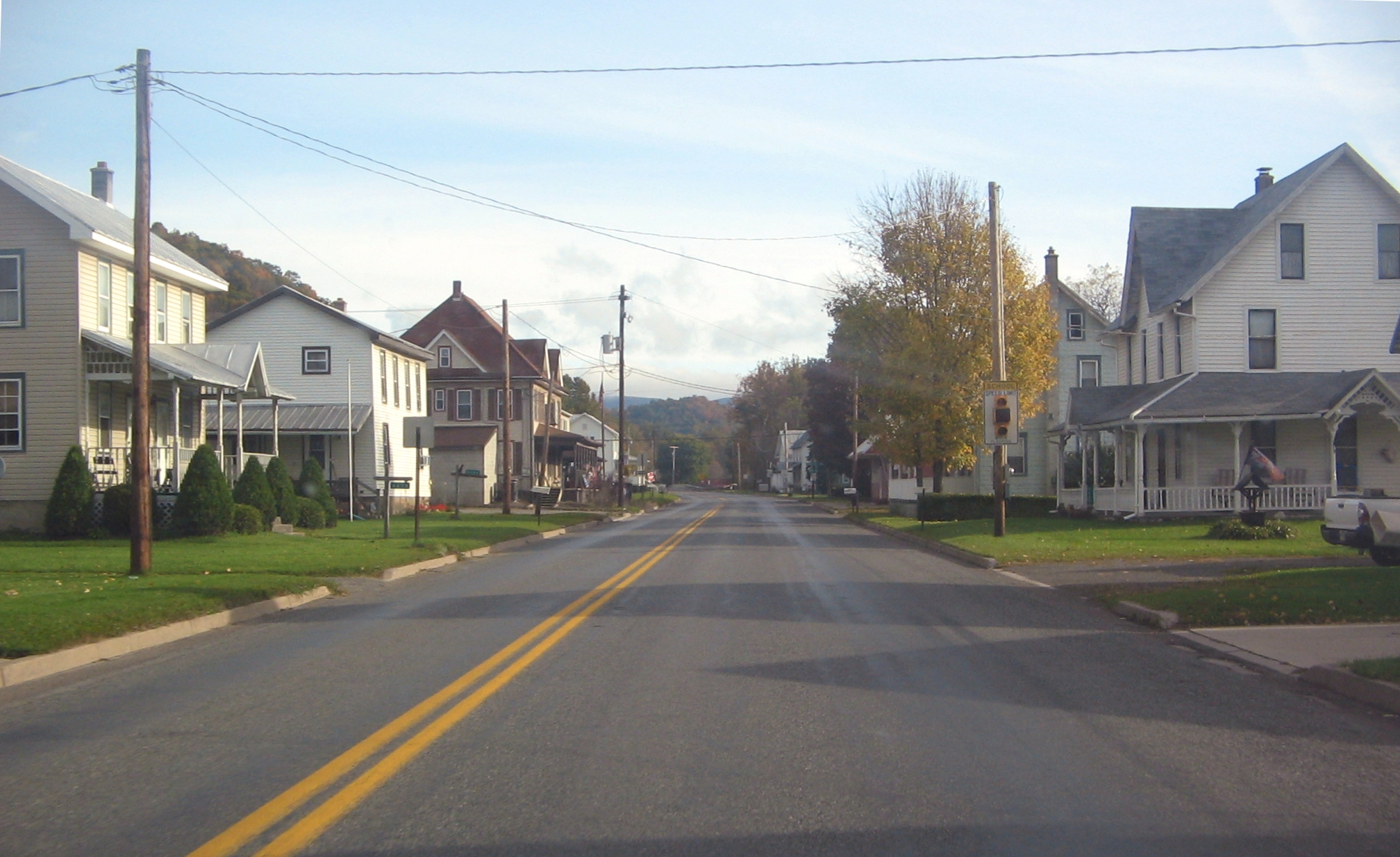
 Route 118 as a two-lane road through the village of Lairdsville
Heading through now Moreland Township, the woodlands soon give way in favor of open fields, where the route intersects with Neuhard and Stan Warn Roads. There, Route 118 turns even further to the southeast and makes a large bend to the northeast later on, where the highway enters the hamlet of Frenchtown. The highway leaves the rural hamlet to the northeast, paralleling Old Lairdsville Road, which soon merges back in. The highway continues, leaving the fields for more woodlands, paralleling an old alignment of Route 118. A short distance after the old alignment stops paralleling, Route 118 breaks free of the woodlands in favor of the village of Lairdsville. Through Lairdsville, the highway passes a long stretch of residential homes and intersects with Dark Hollow Road. At Dark Hollow Road, Route 118 leaves Lairdsville and enters the rural segments of Franklin Township.[2]
 Route 118 at the junction with Route 239 in Jordan Township
Heading to the northeast through Franklin Township, Route 118 retains the name of Lairdsville Road, re-enters the nearby woods and makes a gradual curve back to the southeast. This soon returns to the northeast progression and the highway follows a sporadic stretch of eastern directions, entering Jordan Township. Entering the hamlet of Biggerstown, Route 118 curves eastward and intersects with Route 42. There the Lairdsville Road name ends, and Route 118 continues to the northeast through Jordan Township. The surroundings remain a mix of fields and woodlands, entering the hamlet of Richarts Grove. Richarts Grove has several residents far off the main highway, but has an intersection with North Woods Road, which connects to nearby Route 239. Route 118 continues northeast through the sporadic changes in surroundings before nearing the Columbia County line. Still in Lycoming County, Route 118 enters the hamlet of Divide, where it intersects at a cross with Route 239. After the intersection, both Route 239 and Route 118 enter Columbia County, heading different directions.[2]
Columbia County
Working its way away from Route 239, Route 118 heads to the northeast through now Jackson Township. The highway continues through the woodlands as a two-lane road, until intersecting with Mountain Road, where the woodlands give way to fields once again. After the intersection with Saddle Brook Road, another long patch of woodlands begins. Route 118, continuing eastward soon comes to another clearing, where it intersects with the northern terminus of Camp Lavigne Road (Quadant Route 4049).[2] After intersecting with Schoolhouse Road, the highway re-enters the woodlands, crossing over several bodies of water and turns northeast into Sugarloaf Township. Through Sugarloaf Township, Route 118 parallels several side streets, including Township Road 737, which provides access to one residence. Passing to the south and north of two ponds, the highway begins a parallel and soon merges with Route 487. Route 118 and Route 487 head eastward through Sugarloaf Township, crossing the line into Luzerne County.[2]
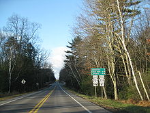
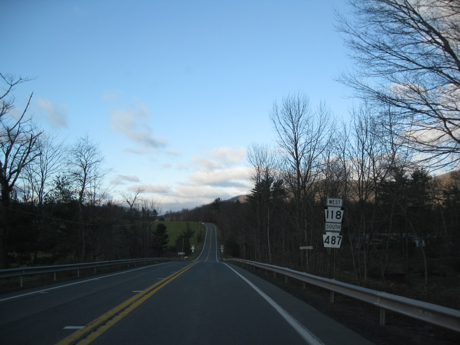
 Route 118 and Route 487 along the concurrency in Columbia and Luzerne Counties
Luzerne County
After entering Luzerne County, Route 118 and Route 487 intersect with County Line Road as they go through the hamlet of Fairmount Springs, a part of Fairmount Township. After entering the small hamlet of Red Rock, Route 487 forks to the north along Red Rock Mountain Road while Route 118 turns to the northeast and enters Ricketts Glen State Park. The highway heads eastward through the dense forestry of the park, crossing over Kitchen Creek. Right after leaving the park, Route 118 enters a large clearing, where Bethel Hill Road forks to the southeast. The highway winds through more dense woods, passing several roadside residences until turning to the northeast at Maransky Road. Route 118 soon enters the hamlet of Kyttle, where it intersects with the Kyttle Pike.[2]
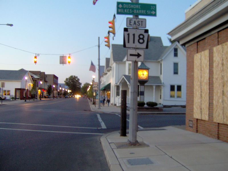
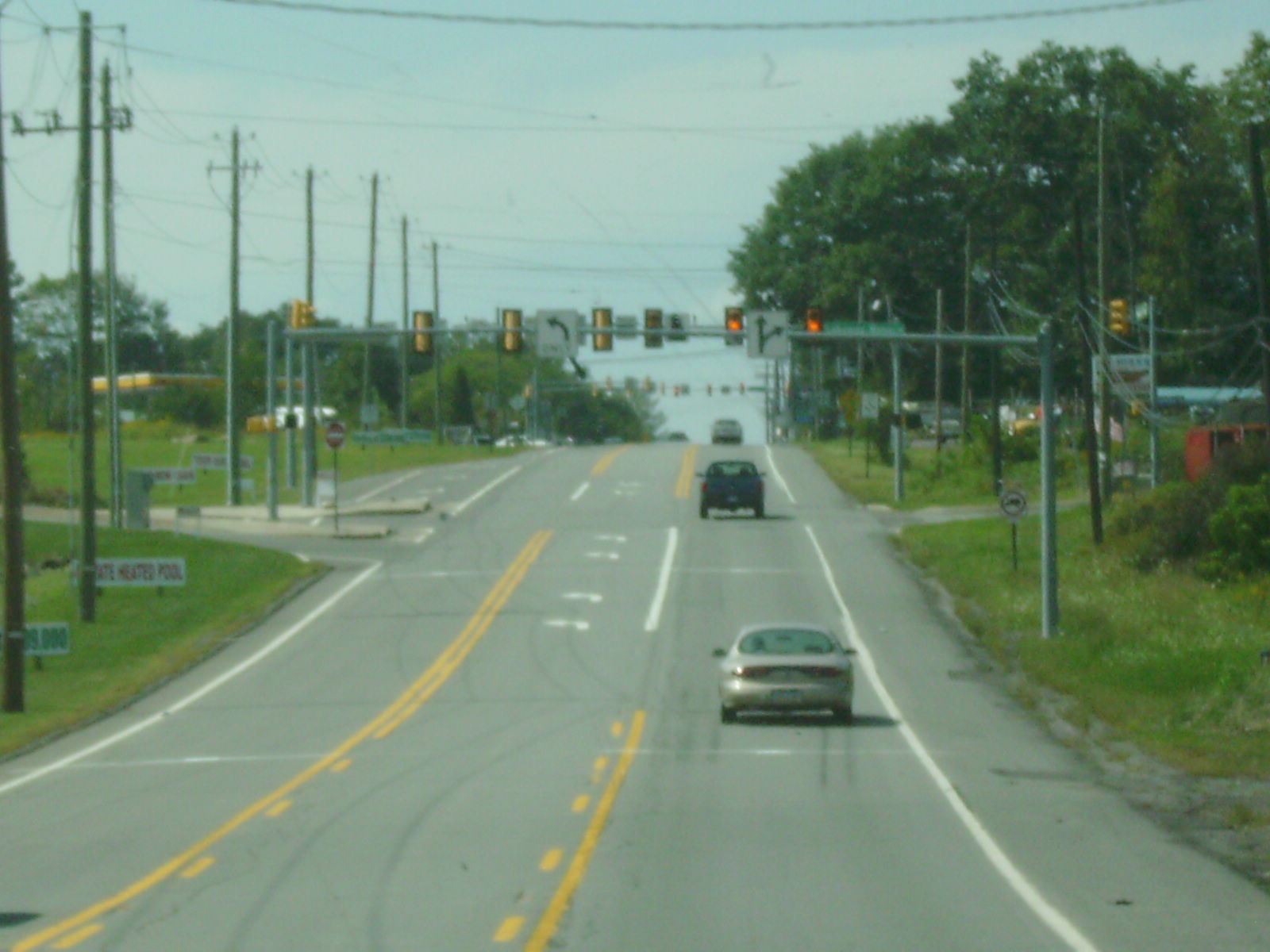
 The eastern terminus of Route 118 in Dallas Township as viewed from Route 415
Kyttle is a small hamlet of few residences and large fields, and Route 118 intersects with Mooretown Road as it enters Ross Township. Through Ross Township, residences become more common in the mix of fields and forests, along with the nearby alignment of Old State Road. At the intersection with Harris Pond Road, Route 118 passes to the south of the hamlet of Fades, turning southeastward into the hamlet of Pikes Creek. Through the small downtown of Pikes Creek, Route 118 turns eastward at Gordon Road and intersects with Route 29. After Route 29, Route 118 passes some local businesses and leaves Pikes Creek, following a long stretch of residences and soon into fields.[2]
Route 118 heads further to the northeast, paralleling Cornell Road into a long stretch of farmhouses and silos and into the community of Meeker. In Meeker, the highway intersects with Loyalville Road, where it turns southeastward once again until Fedor Road, where it returns to the northeast progression. Route 118 heads back into the dense forestry, entering Lehman Township, where an old alignment of Route 115 forks near the hamlet of Lehman. Through the hamlet portion, Route 118 passes a long stretch of houses and several side streets. The route continues northeast, and while the fields become more evident once again, Route 118 passes the Lehman Golf Club. Route 118 soon enters Dallas Township and the hamlet of Back Mountain, where a large farm is visible for the short distance to the eastern terminus, an intersection with Route 415 (Memorial Highway) in Back Mountain.[2]
Major intersections
County Location Mile[1] Destinations Notes Lycoming Hughesville 0.00 PA 405 (Main Street)Western terminus Jordan Township 12.24 PA 4216.37  PA 239
Columbia Sugarloaf Township 23.64 PA 487 southWestern terminus of concurrency with PA 487 Luzerne Fairmount Township 24.47 PA 487 northEastern terminus of concurrency with PA 487 Pikes Creek 35.73  PA 29
PA 29Dallas Township 42.33 PA 415 (Memorial Highway)Eastern terminus 1.000 mi = 1.609 km; 1.000 km = 0.621 mi References
- ^ a b Yahoo! Inc. Yahoo! Maps – Overview map of Pennsylvania Route 118 (Map). Cartography by NAVTEQ. http://maps.yahoo.com/#mvt=m&lat=41.31206&lon=-76.338514&zoom=11&q1=41.24121%2C-76.72428&q2=41.249648%2C-76.524123&q3=41.272367%2C-76.451854&q4=41.287541%2C-76.316499&q5=41.289476%2C-76.301392&q6=41.305854%2C-76.096429&q7=41.341903%2C-75.992788. Retrieved May 11, 2011.
- ^ a b c d e f g h Microsoft. Map of Overview map of Pennsylvania Route 118 – Bing Maps (Map). Cartography by NavTEQ, Inc. http://www.bing.com/maps/#Y3A9cXc2NXd6OG01cDI0Jmx2bD0xOSZzdHk9YiZydHA9cG9zLjQxLjI0MTI0OTgxNDkxODE0Xy03Ni43MjQyNTUzMDA1OTQzNF9fX19hX35wb3MuNDEuMjQ5Njk0ODIzOTI5NzRfLTc2LjUxNzczODM3NTcyNjkyX25lYXIlMjAxMjQzMCUyMFNSLTExOCUyQyUyMFVuaXR5dmlsbGUlMkMlMjBQQSUyMDE3Nzc0X19fYV9+cG9zLjQxLjMwNTU0MTI4MTg0NDcyNV8tNzYuMDQ3NzIzMTgwNDM3NjFfbmVhciUyMDI5MDYlMjBTdGF0ZSUyMFJvdXRlJTIwMTE4JTJDJTIwRGFsbGFzJTJDJTIwUEElMjAxODYxMl9fX2FffnBvcy40MS4zNDIzNzA5MzMzNDYxNzRfLTc1Ljk5MjU3NjY5Nzg0MTI2X25lYXIlMjBNZW1vcmlhbCUyMEh3eSUyQyUyMERhbGxhcyUyQyUyMFBBJTIwMTg2MTJfX19hXyZtb2RlPUQmcnRvcD0wfjB+MH4=. Retrieved May 11, 2011.
External links
- Kitsko, Jeffrey J. (2011). "PA 118". Pennsylvania Highways. http://www.pahighways.com/state/PA101-150.html#PA118. Retrieved May 11, 2011.
- Prince, Adam J. (2002). "PA 118". State-Ends.com. http://www.state-ends.com/paends/state/118.html. Retrieved May 11, 2011.
Roads of the Wyoming Valley Interstate Highways Expressways U.S. Routes Pennsylvania Routes Categories:- State highways in Pennsylvania
- Transportation in Luzerne County, Pennsylvania
- Transportation in Lycoming County, Pennsylvania
- Transportation in Columbia County, Pennsylvania


Wikimedia Foundation. 2010.