- Bălăuşeri
-
Bălăuşeri
Balavásár— Commune — Location of Bălăuşeri Location of Bălăuşeri
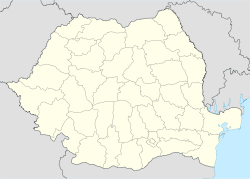
 Bălăuşeri
BalavásárCoordinates: 46°24′0″N 24°41′0″E / 46.4°N 24.683333°ECoordinates: 46°24′0″N 24°41′0″E / 46.4°N 24.683333°E Country  Romania
County Mureş County Status Commune Government - Mayor Sagyebo Istvan Population (2002) - Total 5,064 Time zone EET (UTC+2) - Summer (DST) EEST (UTC+3) Bălăuşeri (Hungarian: Balavásár; Hungarian pronunciation: [bɒlɒvaːʃaːr]) is a commune in Mureş County, Romania composed of six villages:
- Agrişteu / Egrestő
- Bălăuşeri
- Chendu / Nagykend
- Dumitreni / Szentdemeter
- Filitelnic / Fületelke
- Senereuş / Szénaverős
Contents
History
The village was in the northern reaches of Küküllő County in Transylvania, just over the border from the Székely Land; the county was split in the 1876 administrative reform, and thereafter the village belonged to Kis-Küküllő County in the Kingdom of Hungary. After the 1920 Treaty of Trianon, it became part of Romania along with the rest of Transylvania.
Demographics
According to the 2002 Census the commune has a population of 5,064 of which 3,404 (67.22%) are Hungarians, 905 (17.8%) Romanians, 742 (14.6%) Roma and 13 Germans. Bălăuşeri village has a population of 1228 people.
See also
- List of Hungarian exonyms (Mureş County)
References
Categories:- Communes in Mureș County
- Székely communities


Wikimedia Foundation. 2010.