- Cliffe, Kent
-
Coordinates: 51°27′43″N 0°29′51″E / 51.4619°N 0.4975°E
Cliffe 
 Cliffe shown within Kent
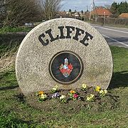
OS grid reference TQ7347976679 Parish Cliffe and Cliffe Woods District Medway Shire county Kent Region South East Country England Sovereign state United Kingdom Post town ROCHESTER Postcode district ME3 Dialling code 01634 Police Kent Fire Kent Ambulance South East Coast EU Parliament South East England UK Parliament Rochester and Strood List of places: UK • England • Kent Cliffe (sometimes known as Cliffe-at-Hoo) is a village on the Hoo peninsula in Kent, England, reached from the Medway Towns by a three-mile journey along the B2000. Situated upon a low chalk escarpment overlooking the Thames marshes, Cliffe offers the adventurous rambler views of Southend-on-Sea and London. It forms part of the parish of Cliffe and Cliffe Woods in the borough of Medway.
In 774 Offa, King of Mercia, built a rustic wooden church dedicated to St Helen, a popular Mercian saint who was by legend the daughter of Coel ('Old king Cole') of Colchester.
Cliffe is cited in early records as having been called Clive and Cloveshoo (Cliffe-at-Hoo).
Contents
The ancient Saxon town of Cloveshoo
Clovesho, or Clofeshoch, was an ancient Saxon town, in Mercia and near London,[1] where the Anglo-Saxon Church is recorded as holding the important Councils of Clovesho between 742 and 825. These had representation from the archbishopric of Canterbury and the whole English church south of the Humber.
The location of Cloveshoo has never been successfully identified however, although Cliffe could have been the location.
1200—1800
St Helen's church at Cliffe was built about 1260 and was constructed in the local style of alternating layers of Kent ragstone and squared black flint. It is one of the largest parish churches in Kent, and the only dedicated to St Helen, the size of the church revealing its past importance.
Above the porch is a muniments room containing important historical documents.
During the 14th century Cliffe was the site of a farm owned by the monks of Christ's Church, Canterbury, when the village had a population of about 3,000.
In the late Middle Ages the village of Cliffe supported a port, which thrived until a disastrous fire in 1520 stifled its growth, marking a period of decline, accentuated by the silting of the marshes of the Thames estuary. Nevertheless, during the 16th century, Cliffe-at-Hoo was still considered a town. However, by the middle of the 19th century the population had slumped to about 900.
In 1824, construction of the Thames and Medway Canal was begun, providing work for able-bodied villagers and other labourers who came to the area, increasing the population once again.
The canal project was a short-lived enterprise, however, superseded by the development of the railways, but the route, including the Higham and Strood tunnel (2.25 miles in length, in two sections) was used by South Eastern Railway from 1845, bringing a branch line to Cliffe in 1882.
Henry Pye
Even in 1895 the number of people contracting malaria was high but casualties begun reducing sharply after the farmer, Henry Pye, came to the area and systematically begun the drainage of the farmland and marshes thus eliminating the fever. He drained such a large area of the marsh and so improved the grazing pastures that he was called 'King of the Hundreds'.
Henry Pye was an innovator in farming practices promoting the use of Aveling and Porter steam engines, locally built in Rochester, for use in ploughing and threshing. In 1878, with other farmers Pye met with the South Eastern Railway Company and petitioned for a railway to be built, resulting in the establishment of the 'Hundred of Hoo Railway Company'. The first part of the line was opened in March 1882, running from Cliffe to Sharnal Street.
Victorian Cliffe
The rise of the Kent cement industry brought a new prosperity to the ancient settlement during the Victorian era.
Alfred Francis (second son of Charles), with his son, established the firm of Francis and Co. at the Nine Elms office at Vauxhall, London, and then built the cement works at Cliffe in about 1860. Francis and Co instituted the Nine Elms cement works . These works were built on Cliffe marsh, to the west of the village where the chalk cliffs came almost to within a mile of the River Thames. The area also proved a useful source of clay.
Alfred Francis died in 1871, but in partnership his son continued to produce 'Portland, Roman, Medina, and Parian cement, Portland stucco and Plaster of Paris', also shipping chalk, flints and fire bricks, from the site.
The riverside location provided ease of transport and wharves were duly built at the mouth of Cliffe creek. A canal was constructed from the works, which gave its name to a tavern built nearby, now long demolished but remembered as the Canal Tavern.
1870-1 saw further developments to the cement works, which were rebuilt and extended, with an elaborate tramway added. Methods of extracting the chalk were basic, involving the labourer being suspended by a rope (around his waist) secured at the cliff top, from which position he would hack out the chalk, so that it fell to the ground below to be collected in a waiting railway wagon.
Further to the north of the Francis and Co works near the river, an explosive works (Curtis & Harvey) opened in 1901. Over the factories' 20-year history 16 people were to lose their lives in explosions.
Francis and Co was taken over about 1900 by the British Portland Cement Company, but after the Great War the cement works began to decline, and was finally phased out in 1920-1.
By 1901 the population of Cliffe had exceeded three thousand.
Alpha cement works
Near the Francis works in 1910 began the Alpha Cement works, part of the Thames Portland Cement Company. The Alpha works were about a mile from the river and included a Goshead aerial cableway which ran alongside the road constructed by the soldiers of Cliffe fort, then disused.
Alpha continued after the closure of the Francis works, which it took over in 1934. With this amalgamation an additional railway was added in 1935 to replace the cableway, linking the works with the quayside next to the fort.
The Alpha site, however, became exhausted by 1950, and further digging led to extensive flooding, as quarrying exceeded the depth of the water table. These quarries, still flooded, offer havens for wildlife, and are among the few surviving that have not been used for rubbish infill or otherwise developed.
A second quarry was begun to the north of Salt Lane, which is still the main access road to Cliffe from the cement works area, on the very edge of the marshes.
By the late 1950s the cement industry in the area was owned by the APCM, which had added a further railway line to the Hundred of Hoo railway, giving the cement manufacturers direct access to the main railway network. The works at Cliffe shut on April 1st 1970, with no further space available for quarrying, but the APCM recreation ground in the centre of the village has remained a valuable open space, with pitches for football, cricket, tennis and bowls.
In 1970 the cement industry was replaced by the Marinex gravel company, whose fleet of ships dredged gravel from the Thames estuary.
The chalk quarry to the south side of Salt Lane is now a wildfowl reserve. In addition, it offers fishing and diving. The water is around fifty to sixty feet deep in parts and divers explore the bed of the old quarry and other underwater features www.bucklandlake.com
Cliffe Rectory
Old Cliffe Rectory is some two miles inland from St Helen's Church, supposedly to preserve its inhabitants from the malaria on the marshes. It has housed two chancellors of the exchequer, two archbishops, three deans and 11 archdeacons. Nicholas Heath, Bishop of Rochester and Bishop of Worcester also lived at the rectory. The 'living' at Cliffe in the 17th century was described as 'one of the prizes of the church'.
Susanna, the daughter of Samuel Annesley, who married the Reverend Samuel Wesley, father of John Wesley, founder of the Wesleyans, also lived at Cliffe Rectory.[citation needed]
The new rectory is within sight of the church.
Rye Farm
The Grade II-listed barn at Rye Farm, in Common Lane, Cliffe dates from the 1570s. It is described as a 16th-century Grade II barn "with archaic details." Beneath its present asbestos roof is a timber framed three bay barn with weatherboarded walls and a traditional hipped roof. It includes an ancient wagon porch.
Cliffe Fort
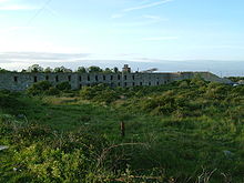
Cliffe Fort is a Royal Commission fort built in the 1860s on the edge of the marshes to protect against invasion via the Thames. A Brennan Torpedo station was added in 1890, the rails of which are still visible at low water, and was used as an anti-aircraft battery in World War II. It is now inside a gravel extraction site and is inaccessible and very overgrown, but can be viewed from the riverside path.
Cliffe airport
Main article: Thames estuary airportIn 2002 the government identified a site at Cliffe as the leading contender among potential sites for a new airport for London.[2] In December 2003 the government decided against the Cliffe proposal on the grounds that the costs of a coastal site were too high, and there was a significant risk that the airport would not be well used.[3]
The Hans Egede
A prominent feature where the marshes meet the river for many years, The Hans Egede was a wooden, auxiliary 3-masted ship, built in 1922 by J. Th. Jorgensen at Thuro, Denmark. It was reported damaged by fire on 21 August 1955 and towed to Dover where the fire was extinguished.
In 1957 she passed into the ownership of the Atlas Diesel Co. and was towed out of Dover by the tug Westercock. She then spent some years in the Medway as a coal and/or grain hulk. She was then towed to Cubitt Town on the Thames. As the tug Fossa from Gravesend was towing her up Sea Reach the strain on the structure, which had become weakened over the years, proved too much, causing her to take in water and sink. After grounding on the Blyth Sands she was beached at Cliffe.
Film and media
Cliffe marshes stood in for the paddy fields of Vietnam in Stanley Kubrick's 1987 film Full Metal Jacket.[4]
References
- Perry Haines RSPB.
- Shamel Hundred. D.S. Worsdale.
- Adrian Gray, Isle of Grain Railways
Notes
- ^ Bede, ed. Plummer, II, 214.
- ^ Scott Wilson (2002). Preliminary site search of options for new airport capacity to serve the south east and east of England: final report and appendices. DfT. http://www.dft.gov.uk/about/dftpubdatabase/pubs2002/prelimsitesearchfinalreprtappen/.
- ^ "The Future of Air Transport" (pdf). 2003-12-01. http://www.dft.gov.uk/about/strategy/whitepapers/air/. Retrieved 2009-01-16.[dead link]
- ^ http://www.mattanddebz.com/full-metal-jacket/http://www.fast-rewind.com/locations_fullmetaljacket.htm.
External links
- Cliffe and Cliffe Woods Parish Council
- Cliffe village website
- Buckland Lake website
- Listed Buildings on the site of the proposed airport at Cliffe
- Cliffe Fort
Towns and villages in the Unitary authority of Medway in Kent, England Allhallows · Borstal · Brompton · Chatham · Chattenden · Cliffe · Cliffe Woods · Cooling · Cuxton · Frindsbury · Frindsbury Extra · Gillingham · Halling · Hempstead · High Halstow · Hoo St Werburgh · Isle of Grain · Lordswood · Rochester · Rainham · Rainham Mark · St Mary Hoo · St Mary's Island · Stoke · Strood · Twydall · Upnor · Wainscott · Walderslade · WigmoreCategories:- Medway
- Villages in Kent
Wikimedia Foundation. 2010.


