- Halling, Kent
-
Coordinates: 51°21′05″N 0°26′29″E / 51.35142°N 0.44133°E
Halling 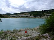
Halling Lake
 Halling
Halling shown within KentPopulation 2,700 OS grid reference TQ701642 Unitary authority Medway Ceremonial county Kent Region South East Country England Sovereign state United Kingdom Post town Rochester Postcode district ME2 1.. Dialling code 01634 Police Kent Fire Kent Ambulance South East Coast EU Parliament South East England UK Parliament Rochester & Strood List of places: UK • England • Kent Halling is a village on the North Downs in the northern part of Kent, England, covering 7.1 square kilometres of land. Consisting of Lower Halling, Upper Halling and North Halling, it is scattered over some 3 miles (5 km) along the River Medway parallel to the Pilgrims' Way running over Kent.
The origin of the name is uncertain. The following have been proposed at various times: Halls land (Belonging to Hall), Heall land (From Old English, Hall Manor), Heallgemot (the court of the Lord of the Manor), Heallingas (Comrades sharing the same hall).
Contents
Early history
Halling Man, a Neolithic skeleton discovered in 1912 behind the existing railway station, is the earliest indication of activity in Halling. There is evidence of Roman settlement indicated by a number of burials from the period as well as Roman tiles. The first written record dates from the 8th century. In the Charter for Halling (765-785 AD) Ecgberht II of Kent granted to St. Andrews of Rochester, "ten sulings at Halling with rights to pasture swine in five districts".
Modern Halling
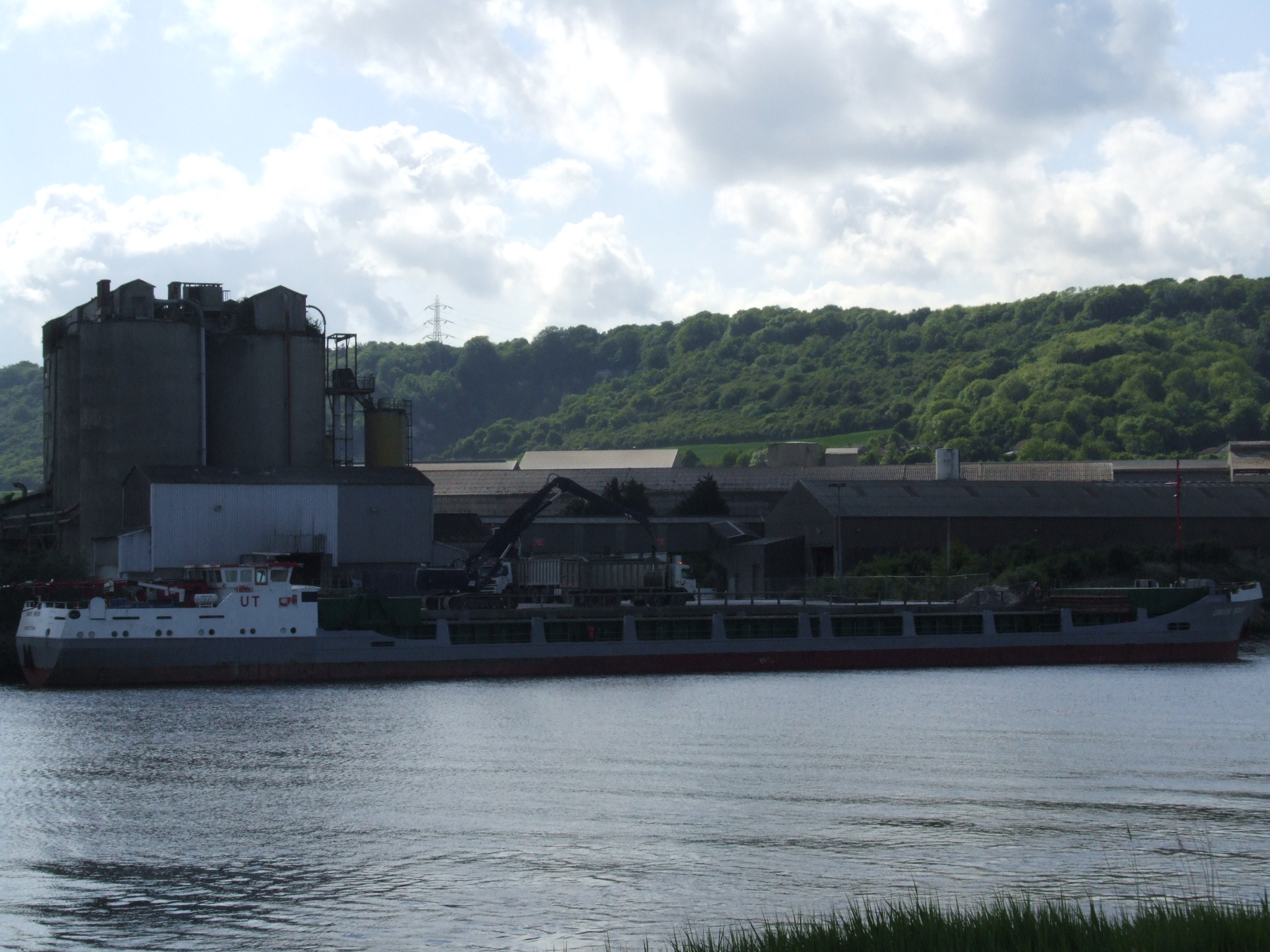
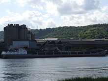 Union Moon unloading at Halling cement works
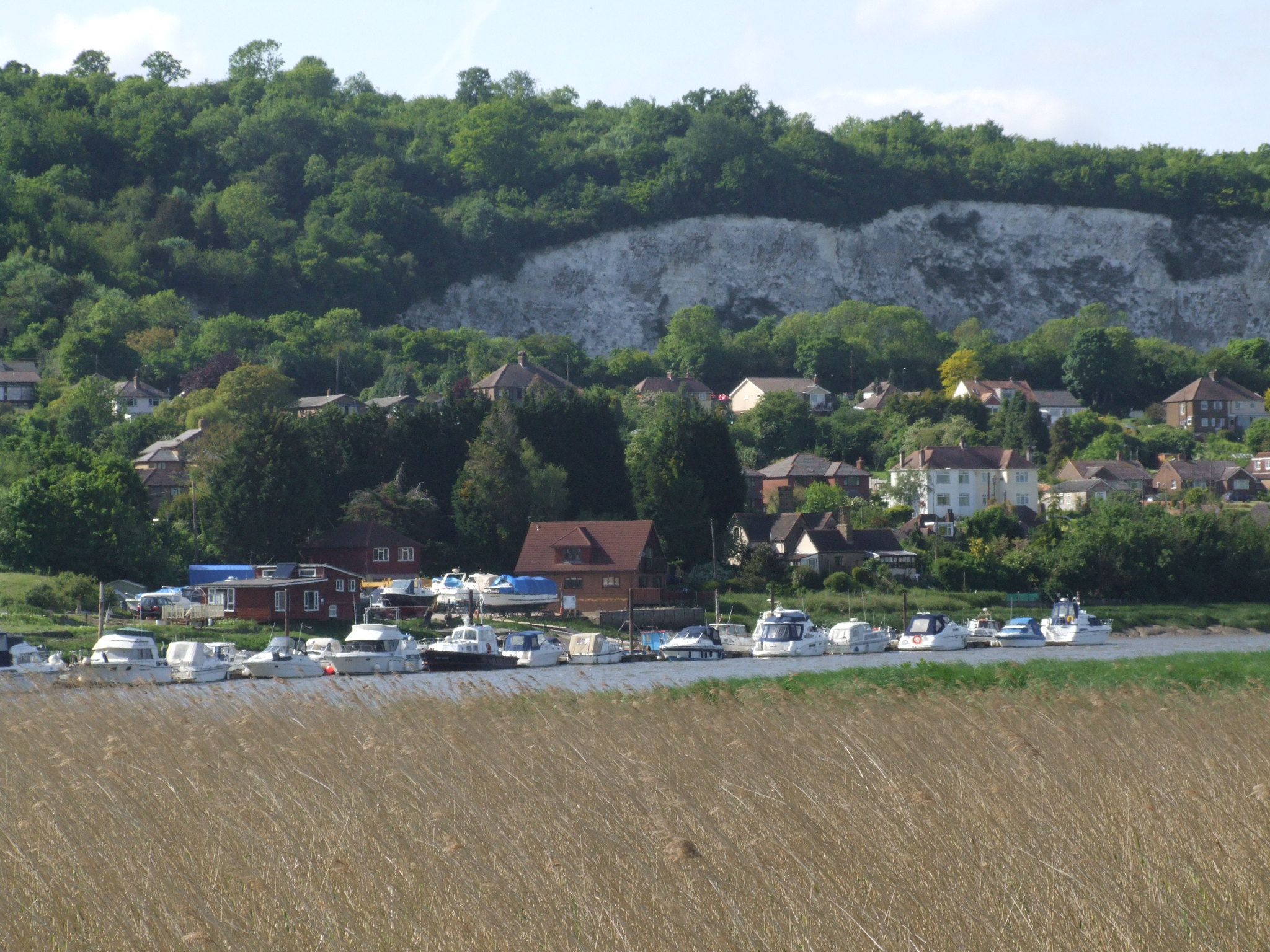
 From Wouldham Marshes, over the Medway to houses in North Halling, with cliffs of Bore's Hole and May Wood to the top left.
Halling had a small industrial existence, with two chalk mining and processing factories, however these have all now been shut and the last chimney stack was demolished in 2010.
Since before World War II, quarries have been dug in Halling, at first by hand, for the extraction of chalk for cement manufacture. The chalk was mainly shipped out of the area on barges using the river Medway.
It is connected to the other villages and towns along the Medway by the Medway Valley railway line, running from Tonbridge and Maidstone to Strood. Also there are good road links as the village sits between the M20 and the M2.
The chalk quarrying industry in Halling had a great influence, including the building of the majority of the village houses, the support of many families and the improvement of its road and railway connections. However, although the area of these activities did spread into what is Green Belt land, some of these areas have now been returned to the community or built on. Parts of the village are controlled by the Green Belt area, limiting growth of industrial and residential areas alike.
Despite the influence of the chalk industry in the past in Halling, modern technology, practices and the closure of the factories have meant that there are now very few if any workers required. Instead, the working population of the village mainly commutes to London and nearby towns.
Services and features
The village has a church, Post Office, fire station, two pubs, a small convenience store, two youth/community centres, General Practice and primary school. In addition to this, Upper Halling has both a pumping station (built recently, after a Victorian one was converted into accommodation), filter beds and small underground reservoir and spring.
It is also home to the Bishop's Palace, which came from the early powers and luxuries given to Christian Bishops. It is now a ruin, and publicly accessible. There are also a number of old World War II defences that are situated along the Riverside and evidence of the old ferry crossing from behind the church to the other side of the river.
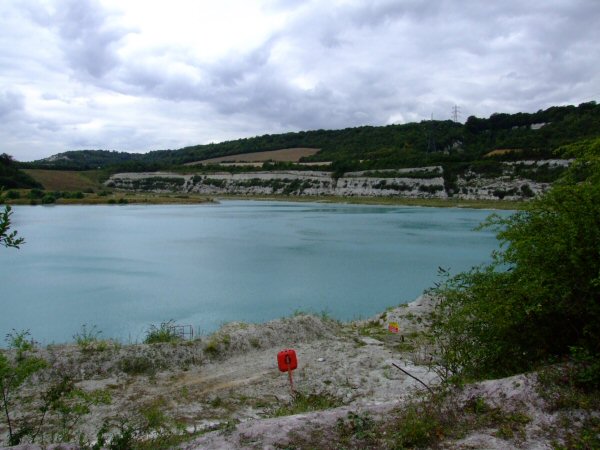
One of Halling's most distinguishing features is the large blue lake, which was dug due to the chalk quarrying efforts. Its blue colour comes from the suspension of chalk particles in the water. It is fed by a large spring, one of which is tapped to provide the local water supply. The water is so clean at extraction that the only chemical additions made by the water company are those of the minimum government levels.
A satellite* view of Halling and its lake.
References
- Fielding, Rev. C. H. Memories of Malling and Its Valley. Henry C. H. Oliver (Publisher), 1893.
- Igglesden, Charles. A Saunter Through Kent with Pen and Pencil. The Offices of The Kentish Express, Kent, 1903.
- Gowers, Edwards and Church, Derek. Across the Low Meadow. E.S. Gowers & D. Church, 1979.
External links
Famous residents
Matthew Romero Loft
Nathan Oliver Lewis
Towns and villages in the Unitary authority of Medway in Kent, England Allhallows · Borstal · Brompton · Chatham · Chattenden · Cliffe · Cliffe Woods · Cooling · Cuxton · Frindsbury · Frindsbury Extra · Gillingham · Halling · Hempstead · High Halstow · Hoo St Werburgh · Isle of Grain · Lordswood · Rochester · Rainham · Rainham Mark · St Mary Hoo · St Mary's Island · Stoke · Strood · Twydall · Upnor · Wainscott · Walderslade · WigmoreCategories:- Medway
- Villages in Kent

Wikimedia Foundation. 2010.