- 2007–08 South Pacific cyclone season
-
2007–08 South Pacific cyclone season 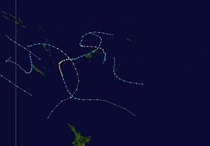
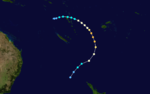
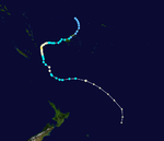
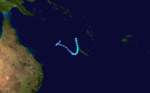
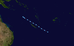
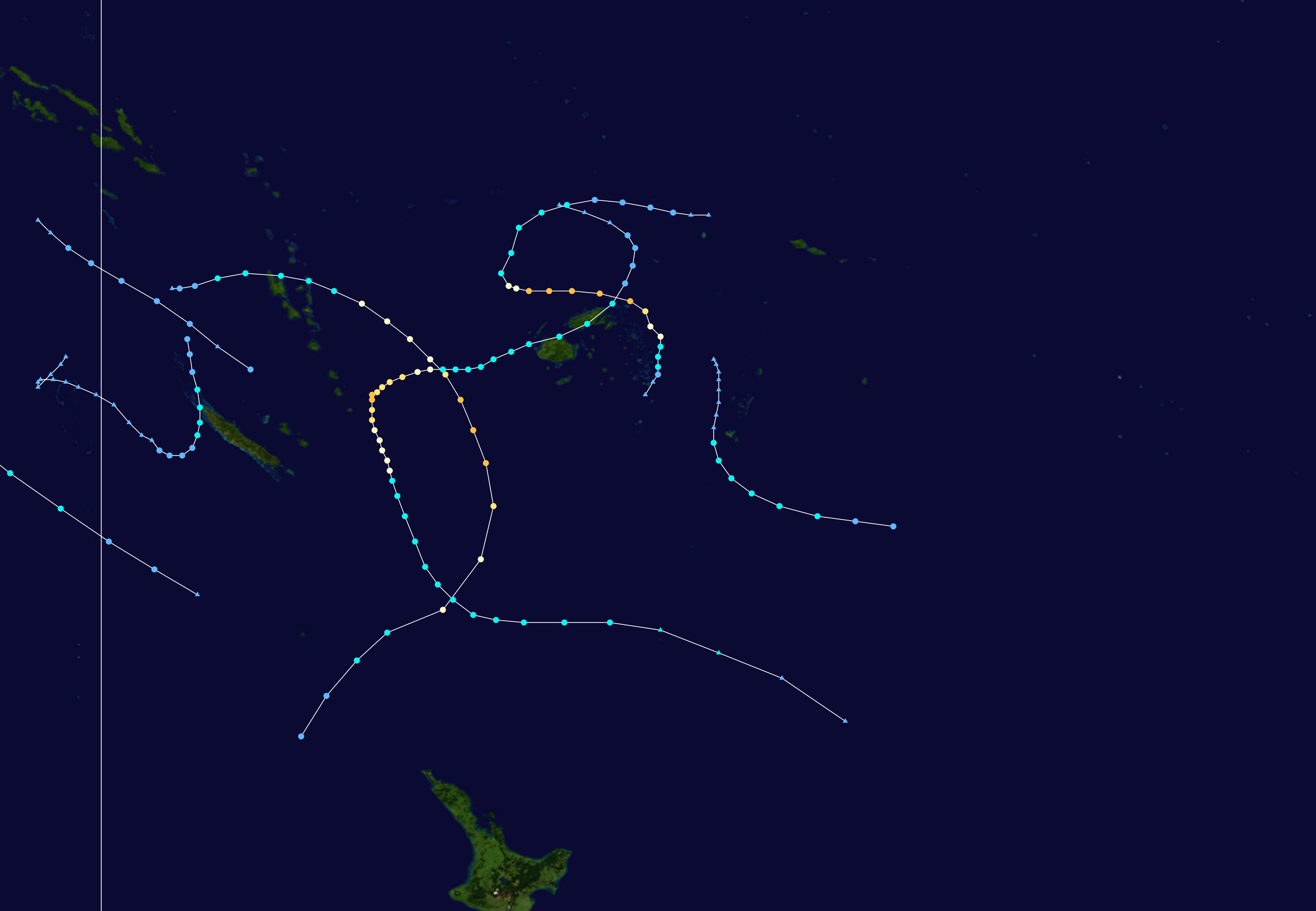
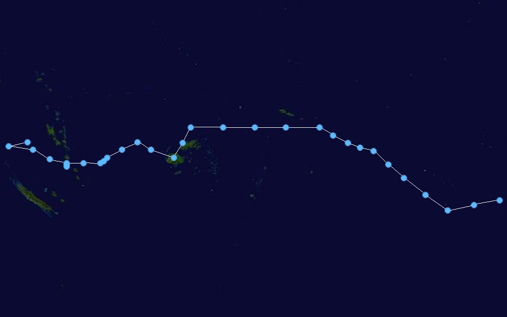
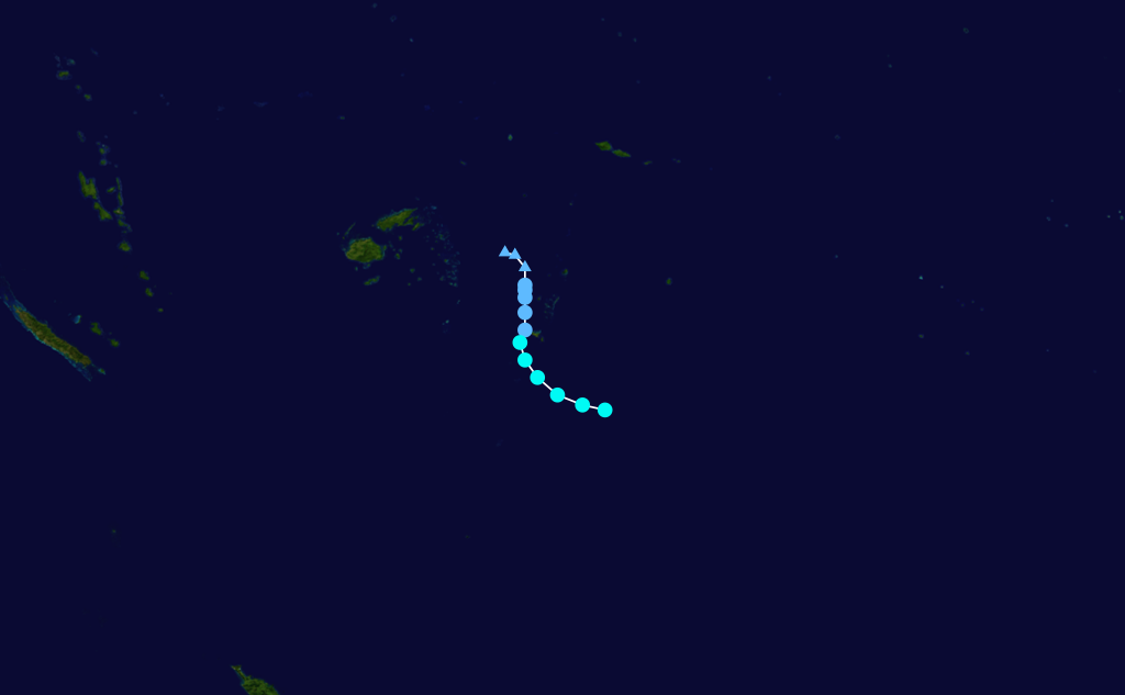
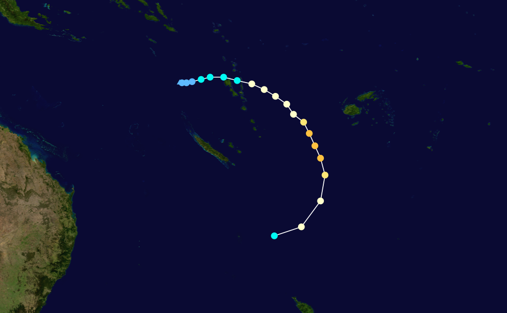
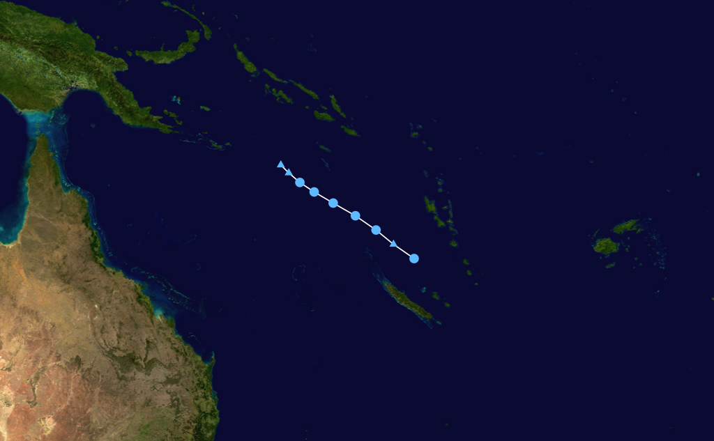
Season summary mapFirst storm formed: October 17, 2007 Last storm dissipated: April 19, 2008 Strongest storm: Daman – 925 hPa (mbar), 185 km/h (115 mph) (10-minute sustained) Total disturbances: 16 Total depressions: 15 Tropical cyclones: 4 Severe tropical cyclones: 3 Total fatalities: 5 direct, 3 indirect Total damage: $46 million (2008 USD) South Pacific cyclone seasons
2005–06, 2006–07, 2007–08, 2008–09, 2009–10Related articles: - Timeline of the 2007-08 South Pacific cyclone season
- 2007–08 South-West Indian Ocean cyclone season
- 2007–08 Australian region cyclone season
The 2007–08 South Pacific cyclone season was one of the least active tropical cyclone seasons on record, with only four tropical cyclones occurring within the South Pacific Ocean to the east of 160°E.[1][2] The season officially ran from November 1, 2007 until April 30, 2008, although the first cyclone, Tropical Depression 01F, developed on October 17. The most intense tropical cyclone of the season was Severe Tropical Cyclone Daman, which reached a minimum pressure of 925 hPa (27.32 inHg) as it affected Fiji. After the season had ended, the names Daman, Funa, and Gene were retired from the tropical cyclone naming lists.[3]
During the season, tropical cyclones were officially monitored by the Regional Specialized Meteorological Center (RSMC) in Nadi, Fiji, and the Tropical Cyclone Warning Centers (TCWC) in Wellington, New Zealand. Throughout the season the United States Navy also monitored the basin and issued unofficial warnings, through its Joint Typhoon Warning Center (JTWC).[4] Tropical cyclones that were located between 160°E and 120°W as well as the Equator and 25°S were monitored by RSMC Nadi while any that moved to the south of 25°S between 160°E and 120°W were monitored by TCWC Wellington. During the season the JTWC issued warnings on any tropical cyclone that was located between 160°E and the American coast. RSMC Nadi and TCWC Wellington both used the Australian Tropical Cyclone Intensity Scale, and estimated windspeeds over a 10-minute period during the season, while the JTWC estimated sustained windspeeds over a 1-minute period.
Seasonal forecasts
Source/Record Season/Date TC STC Average activity (1969-70 – 2005-06) 8 4 Record high activity 1997-98 16 7 Record low activity 1994-95 3 1 Activity during the season 4 3 During October 2007, both RSMC Nadi and New Zealand's National Institute of Water and Atmospheric Research (NIWA), issued forecasts for a near to below average season, due to the presence of a weak La Niña event. As a result of these conditions, neither agency predicted how many tropical cyclones would develop but noted that on average 6-8 cyclones could be expected to develop during a weak La Nina season. According to RSMC Nadi, Fiji was likely to be affected by one to two tropical cyclones, while two to three were likely to pass through Fiji's Exclusive Economic Zone. According to NIWA there was an average risk of a tropical cyclone coming within 550 km (340 mi) of Tuvalu, Fiji, Tonga, Tokelau, Wallis and Futuna, and Northern New Zealand, while the risks for the Solomon Islands, Vanuatu, New Caledonia, Samoa and Niue were variable and uncertain. All other islands faced a reduced risk off being affected by a tropical cyclone.[5][6]
Seasonal summary

On October 17, RSMC Nadi reported that Tropical Depression 01F had developed about 670 km (420 mi) to the west of the Solomon Islands.[7] Over the next few days, the depression moved slowly towards the east, before RSMC Nadi issued their final advisory on 01F early on October 19, as it had become sheared and had weakened into a tropical low.[8] After 01F weakened into a tropical low pressure system and dissipated the basin remained quiet until November 20 when Tropical Disturbance 02F developed into a tropical depression. After developing into a tropical depression, 02F remained weak and unorganized before rapidly dissipating during November 22. RSMC Nadi also reported during November 22, that a weak tropical disturbance had developed on the edge of the basin about 280 km (170 mi) to the south of Honiara, on the Solomon Island of Guadalcanal.
Storms
Tropical Depression 01F
Tropical depression (Australian scale) 

Duration October 17 – October 19 Intensity Winds unknown, 1000 mbar (hPa) On October 17, RSMC Nadi reported that Tropical Disturbance 01F, had developed about 670 km (420 mi) to the southeast of the Solomon Island of Guadalcanal.[9] Later that day, as the disturbance moved towards the east in an area of low vertical windshear, it developed into a weak tropical depression.[7] However according to RSMC Nadi the low level circulation center had become difficult to locate as the disturbance was situated under an upper level ridge of high pressure.[7] During the next day, as the disturbance continued to move towards the east the upper level ridge of high pressure moved off the depression and started to shear the system.[10] On October 19, RSMC Nadi issued their final advisory on the system as it had become sheared and weakened into a tropical low.[11]
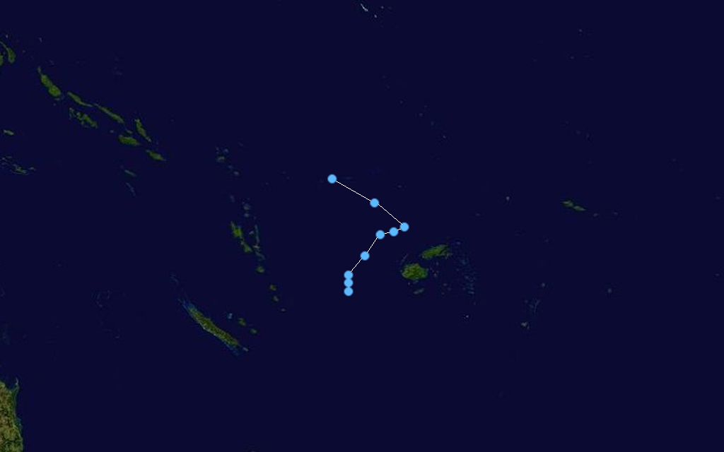
Tropical Depression 02F
Tropical depression (Australian scale) 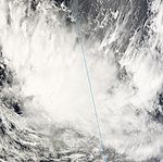

Duration November 20 – November 22 Intensity Winds unknown, 1001 mbar (hPa) Early on November 20, RSMC Nadi reported that a tropical disturbance had formed within the South Pacific Convergence Zone, about 900 km (560 mi) to the northeast of Suva, on the Fijian island of Viti Levu.[12][13] During that day the disturbance moved towards the south and was designated as Tropical Depression 02F, despite convection surrounding the system remaining poorly organized.[14] Over the next couple of days convection surrounding the depression remained unorganized as the system moved towards the south into an area of strong vertical windshear and cooler sea surface temperatures.[15][16] RSMC Nadi then issued their final advisory on they system late on November 22, as it rapidly dissipated in an area of strong vertical windshear to the south of Fiji.[16] 02F brought fresh to strong winds to Fiji between November 22 - 23, the depression also dragged the convergence zone over Fiji, which led to an episode of significant widespread rain.[13]
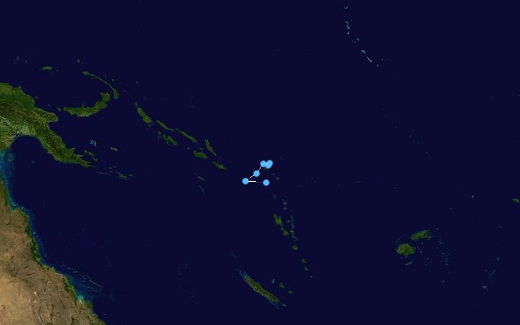
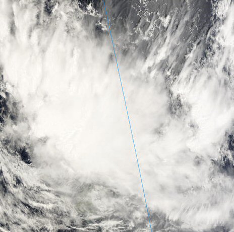
Tropical Depression 03F
Tropical depression (Australian scale) 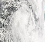

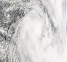
Duration November 22 – December 2 Intensity Winds unknown, 999 mbar (hPa) During November 22, RSMC Nadi reported that a weak tropical disturbance had developed on the edge of the basin, about 240 km (150 mi) to the southeast of Honiara, on the Solomon Island of Guadalcanal. Over the next couple of days the disturbance moved towards the southeast into the South Pacific basin, before it was designated as Tropical Disturbance 03F on November 24 while located about 400 km (250 mi) to the northeast of Port Vila on the Vanuation island of Efate. During that day convection surrounding the disturbance became more organized before RSMC Nadi reported during November 25 that the disturbance had developed into a tropical depression. Over the next couple of days the depression moved towards the east and weakened into a tropical disturbance, before on November 29 it was relocated to a position that was about 390 km (240 mi) to the southeast of Pago Pago.
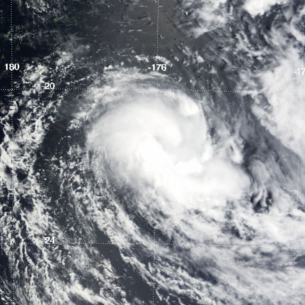
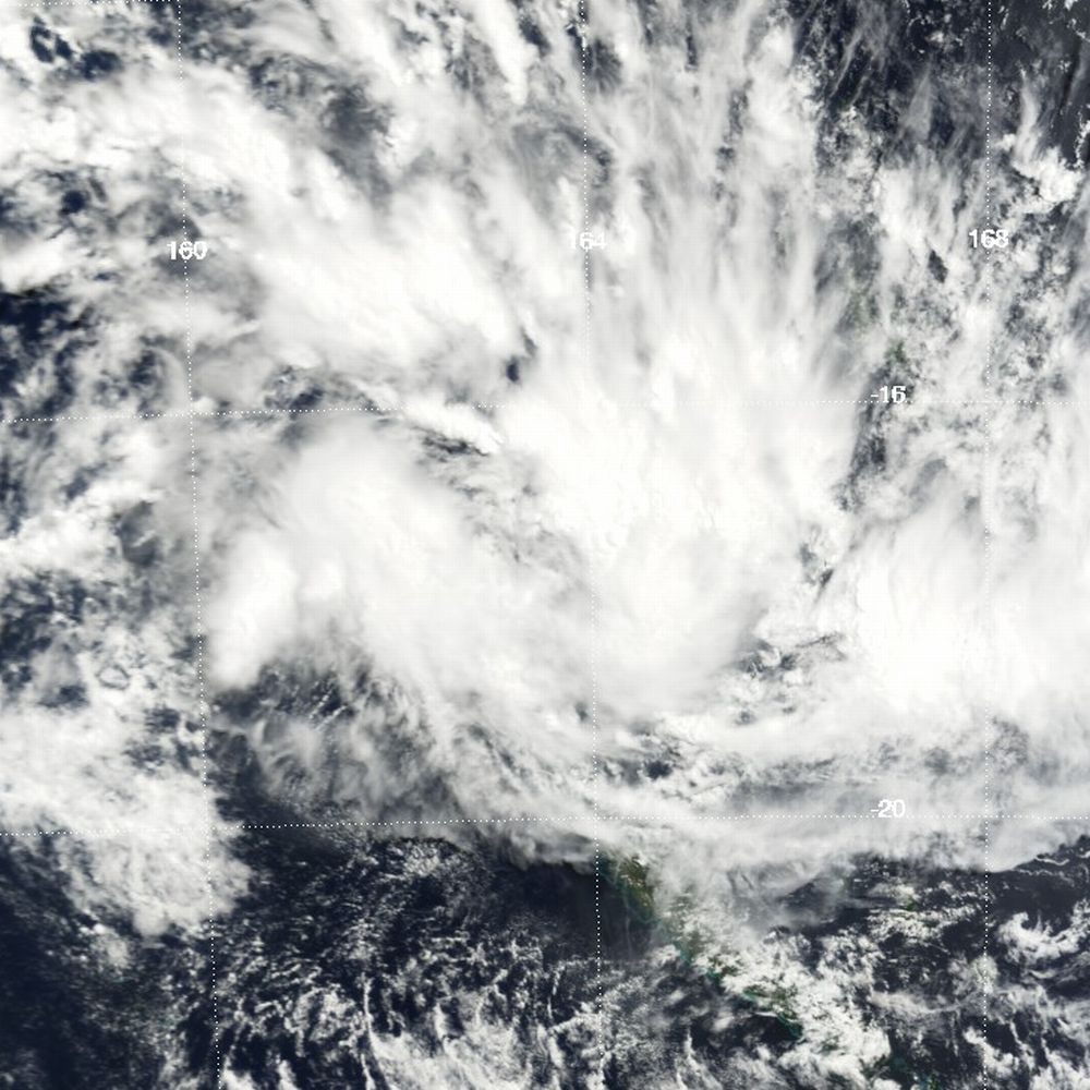
Severe Tropical Cyclone Daman
Category 4 severe tropical cyclone (Australian scale) Category 3 tropical cyclone (SSHS) 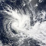

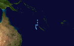
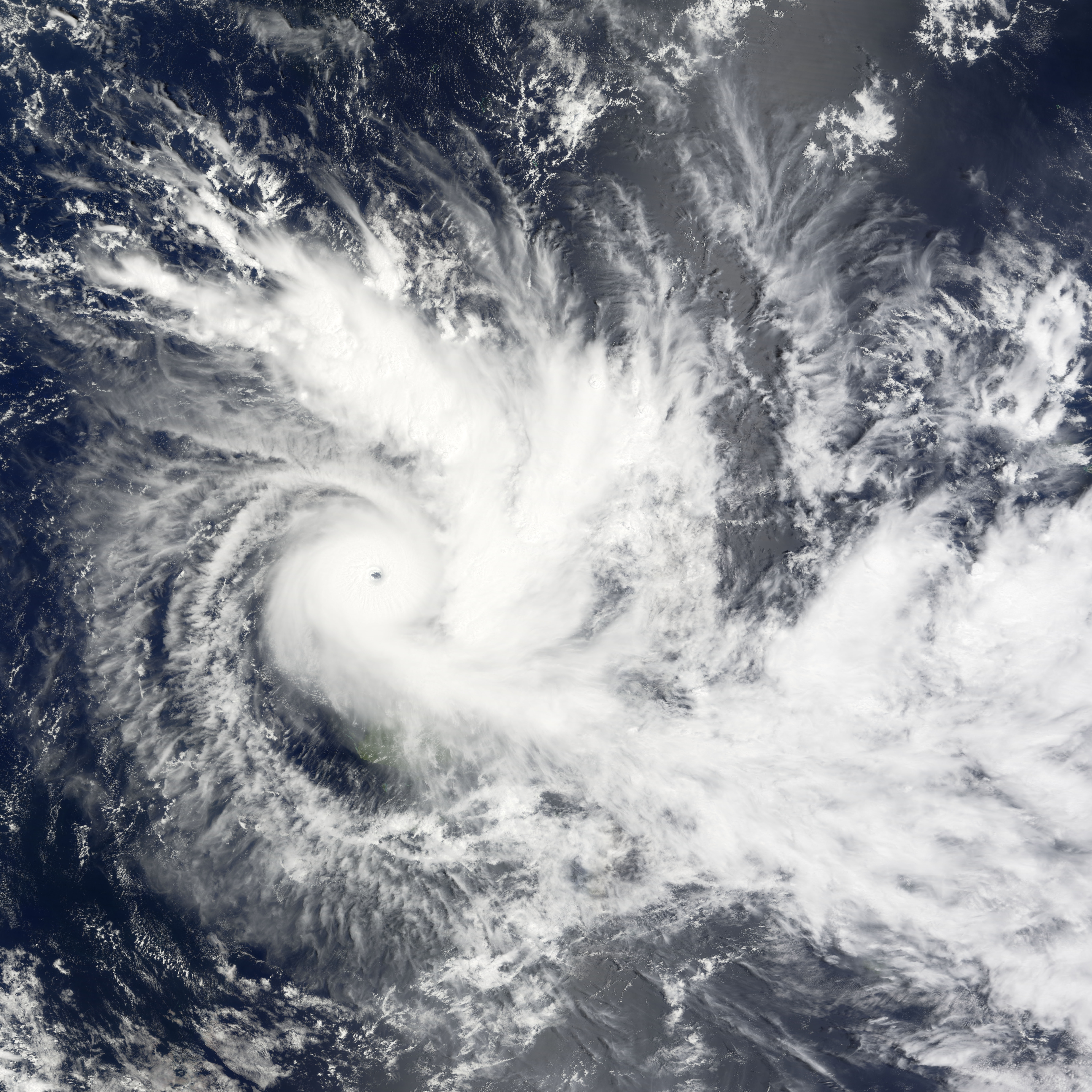
Duration December 3 – December 10 Intensity 185 km/h (115 mph) (10-min), 925 mbar (hPa) Cyclone Daman was the strongest cyclone of the season. On December 3, the Regional Specialized Meteorological Centre (RSMC) in Nadi, Fiji, upgraded a tropical disturbance, located to the west of the Solomon Islands, to Tropical Depression 04F. On December 5, as the depression moved towards the west into the Fijian archipelago, both the Joint Typhoon Warning Center (JTWC) and RSMC Nadi upgraded it to Cyclone Daman. On December 7 the cyclone reached its peak intensity with winds of 185 km/h, (115 mph 10-minute sustained) which made Daman a Category 4 cyclone on the Australian Tropical Cyclone Intensity Scale. Later that day Daman also reached its peak intensity by 1-minute means with winds of 205 km/h (125 mph) which made it a Category 3 tropical cyclone on the Saffir-Simpson Hurricane Scale.[17][18][19] Early on December 8, Cyclone Daman brushed by the Fijian island of Cikobia, causing damage to housing, crops and vegetation.[20] Daman then weakened the next day into a tropical depression and dissipated on December 10.[19]
Tropical Depression 05F
Tropical depression (Australian scale) 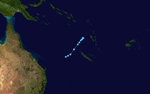
Duration December 11 – December 14 Intensity 45 km/h (30 mph) (10-min), 1000 mbar (hPa) Early on December 11, an area of disturbed weather near American Samoa was upgraded to Tropical Depression 05F by RSMC Nadi based on a QuikScat Pass.[21] However, it did not develop any further as it affected the Southern Cook Islands Group. RSMC Nadi issued their last Tropical Disturbance Summary on December 14.[22]
Tropical Disturbance 06F
Tropical disturbance (Australian scale) 
Duration December 26 – December 28 Intensity 35 km/h (25 mph) (10-min), 1006 mbar (hPa) Early on December 26, an area of disturbed weather near the southern Cook Islands was upgraded to Tropical Disturbance 06F.[23] However the disturbance did not develop any further due to the system moving in to cooler waters.[24] RSMC Nadi issued their last Tropical Disturbance Summary on December 28.[25]
Tropical Cyclone Elisa
Category 2 tropical cyclone (Australian scale) Tropical storm (SSHS) 

Duration January 7 – January 11 Intensity 95 km/h (60 mph) (10-min), 980 mbar (hPa) At 1800 UTC on January 7, RSMC Nadi reported that a poorly organized Tropical Depression 07F, had developed within a slow moving trough of low pressure about 600 km (370 mi), to the east of Suva, Fiji.[1] The JTWC then started to monitor 07F during January 8 and reported that convection was displaced to the south of the systems well defined low level circulation center, however an upper level low was preventing convection directly forming over the center.[26][27] Over the next couple of days, the depression slowly developed further as it moved towards the south in an area of hostile vertical windshear.[1][26] RSMC Nadi and the JTWC then reported at 0000 UTC on January 10 that 07F had developed into a tropical cyclone with RSMC Nadi naming it Elisa while located about 55 km (35 mi) to the southwest of Nuku’alofa, Tonga.[1][26] During that day as windshear relaxed, Elisa intensified further, before RSMC Nadi and the JTWC reported at 1800 UTC that the cyclone had reached its peak sustained windspeeds of 95 km/h (60 mph), equivalent to a category 2 tropical cyclone or a tropical storm.[19][26] During January 11, Elisa recurved towards the southeast into an region of cooler waters and stronger windshear, as a result the cyclone weakened into a depression, with RSMC Nadi and the JTWC issuing their final advisories later that day.[19][26] Elisa brought heavy rain to Tonga and Niue, and damaged several fruit bearing trees in Tongatapu and Eua.[1] High seas and a high surf moved several small vessels and fishing boats ashore in Nuku’alofa.[28]
Tropical Depression 08F
Tropical depression (Australian scale) 
Duration January 9 – January 14 Intensity 45 km/h (30 mph) (10-min), 998 mbar (hPa) On January 9, RSMC Nadi designated a low pressure area northeast of Vanuatu as Tropical Depression 08F.[29] The depression moved eastwards over the next few days but did not intensify any further.[30] RSMC Nadi then downgraded the depression to a tropical disturbance early on January 14 and then released their final tropical disturbance summary.[31][32]
Tropical Depression 09F
Tropical depression (Australian scale) 

Duration January 12 – January 13 Intensity 35 km/h (25 mph) (10-min), 999 mbar (hPa) Late on January 12, a Tropical Disturbance in the southern-central Pacific located about 400 nautical miles (740 km) southwest of Pago Pago was designated as Tropical Depression 09F by RSMC Nadi.[33] However it lay in a highly sheered environment and as it moved southwards it never became any more organized.[33] The last Tropical disturbance summary was issued by RSMC Nadi on Tropical depression 09F late on January 13.[34]
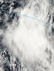
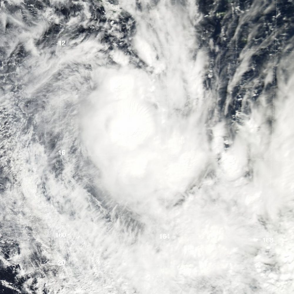
Severe Tropical Cyclone Funa
Category 4 severe tropical cyclone (Australian scale) Category 3 tropical cyclone (SSHS) 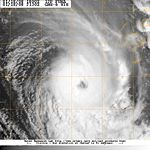
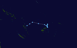
Duration January 14 – January 21 Intensity 175 km/h (110 mph) (10-min), 930 mbar (hPa) On January 14, a tropical disturbance formed in the south-western pacific ocean, near the islands of Vanuatuan islands.[35] Early the next day RSMC Nadi upgraded it to a Tropical Depression and designated it as 10F.[36] Early the next day the Joint Typhoon Warning Center issued a Tropical Cyclone Formation Alert on the developing depression.[37]
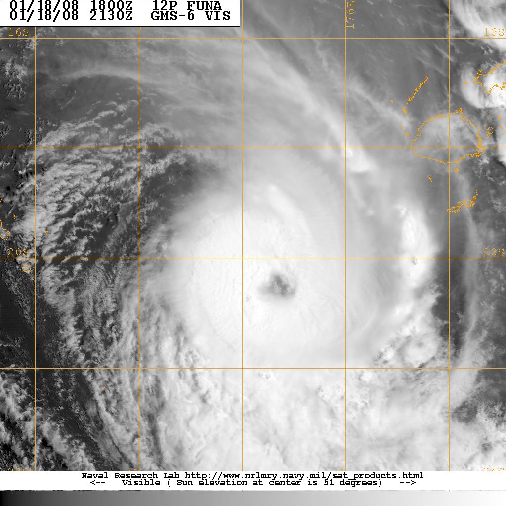
Early on January 16, the depression had intensified enough to be classed as a Tropical Cyclone with RSMC Nadi naming the cyclone as Funa [38] The JTWC then started to issue warnings on Funa designating it as tropical cyclone 12P later that day.[39] It then started to move eastwards and passed very near the next day to the northern tip of Aurora Island, Vanuatu with wind speeds of 55 knots (102 km/h) which made Funa a category two cyclone on the Australian scale.[30]
After leaving Vanuatu, Funa intensified slowly becoming a Category 3 severe Tropical cyclone on January 18 and then early the next day it reached its peak wind speeds of 95 knots (176 km/h) which the same as a category 4 cyclone according the Southern Pacific Cyclone Scale.[40][41] The JTWC measured Funa's peak winds at 105 knots (194 km/h).[42] The storm then moved into TCWC Wellington area of responsibility it started to weaken and then became extra tropical the next day with the JTWC issuing their final advisory on January 20, with TCWC Wellington downgrading it to a low later that day.[30][43]
Tropical Depression 11F
Tropical depression (Australian scale) 

Duration January 19 – January 24 Intensity 75 km/h (45 mph) (10-min), 999 mbar (hPa) RSMC Nadi identified a Tropical Disturbance in the southern Central Pacific Ocean located to the east of Pago Pago on January 19 and started to issue summaries on it.[44] The next day it intensified into a tropical depression and was designated the number 11F by RSMC Nadi.[45] However the tropical depression did not strengthen any further as it moved southwards towards the edge of RSMC Nadi's area of responsibility with TCWC Wellington.[30] Late on January 23 RSMC Nadi issued its last warnings on 11F as the depression had moved into TCWC Wellingtons area of responsibility.[46] However the next day the system became extra tropical as it was about southwest of Tonga'tapu.[30]
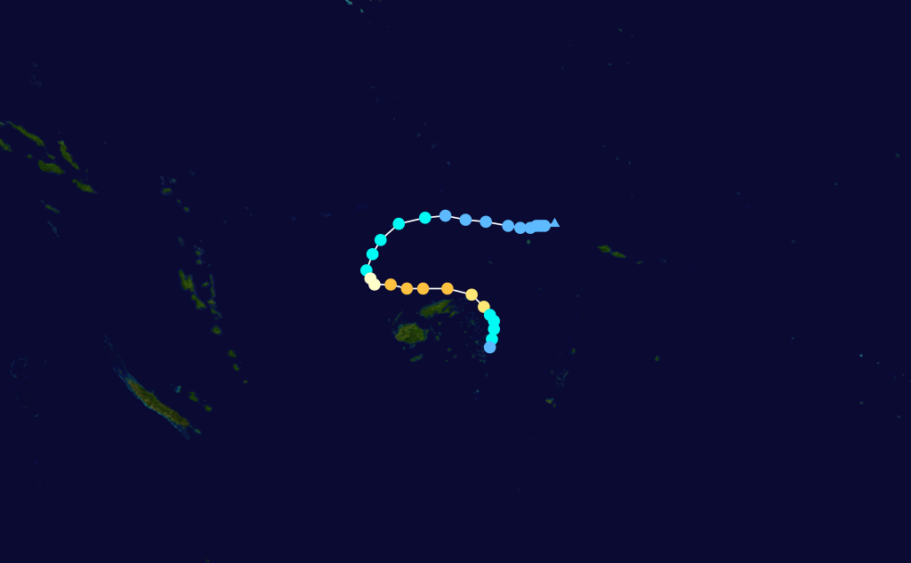
Severe Tropical Cyclone Gene
Category 3 severe tropical cyclone (Australian scale) Category 3 tropical cyclone (SSHS) 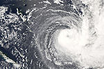
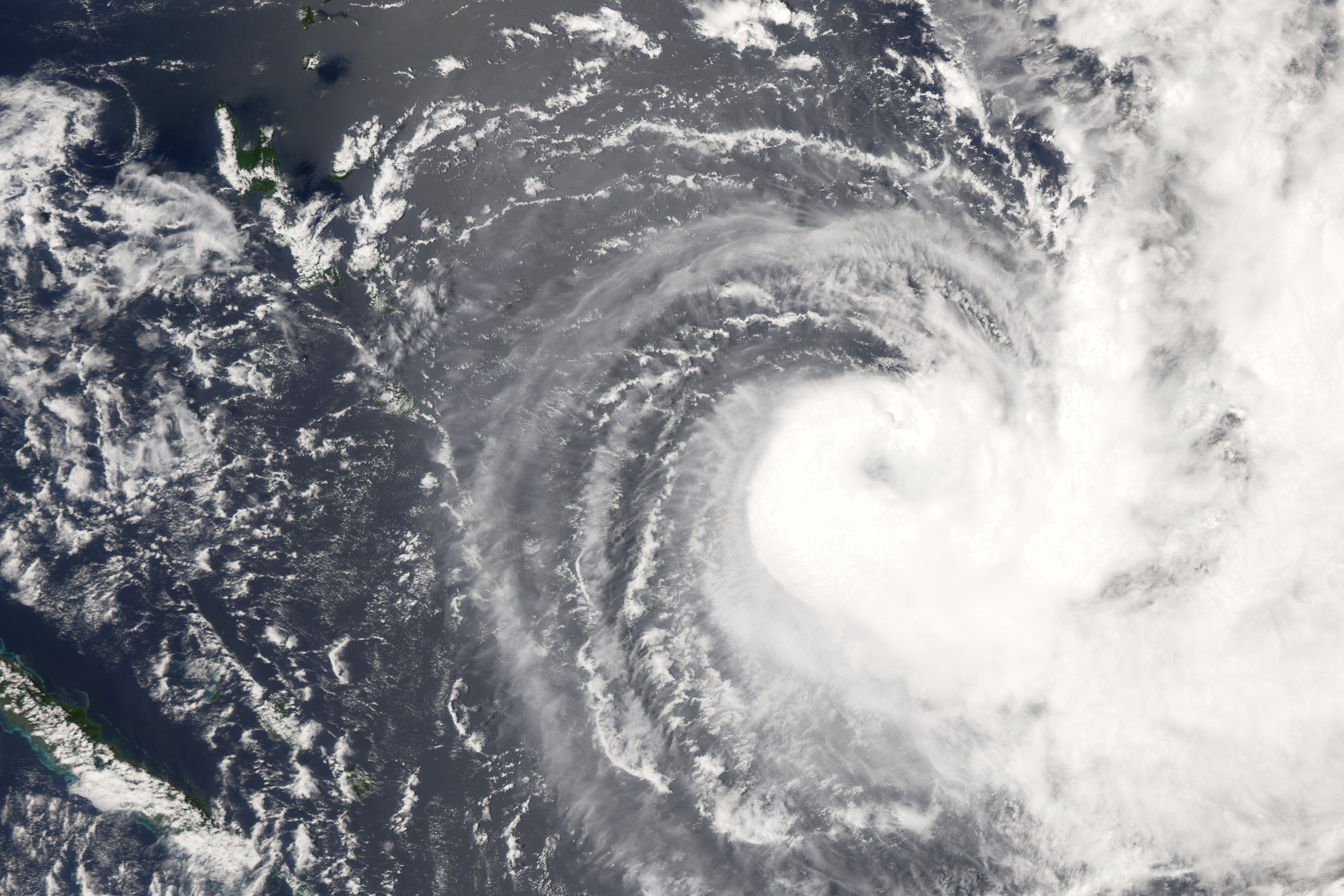
Duration January 25 – February 6 Intensity 155 km/h (100 mph) (10-min), 945 mbar (hPa) On January 25, RSMC Nadi reported that tropical disturbance 12F, had formed within the Fijian Archipelago.[47] Late the next day they reported that the disturbance had intensified in to a tropical depression, whilst the Joint Typhoon Warning Center issued a Tropical Cyclone Formation Alert on the developing depression.[48][49] On January 27 both RSMC Nadi and the JTWC upgraded the depression to a Tropical cyclone, with RSMC Nadi naming the cyclone Gene.[50][51]
Later that day Cyclone Gene made landfall on Viti Levu, in Fiji and caused 45 million (2008 US$) in damage.[30] After it emerged back in to the Pacific Ocean Gene intensified slowly. becoming a category three severe tropical cyclone on January 30.[30][52] Gene then reached its peak winds of 85 knots (100 mph, 150 km/h) the next day.[30] On February 1, Gene began to weaken becoming a category two cyclone with wind speeds of 55 knots (102 km/h). It kept this intensity until it had crossed 25S and had moved in to TCWC Wellington's Area of responsibility, when Gene intensified back in to a severe tropical cyclone.[30] Gene then slowly weakened with JTWC reporting that Gene had become an extra tropical cyclone on February 6. TCWC Wellington then released their final advisory on February 9.[30]
Tropical Depression 13F
Tropical depression (Australian scale) 
Duration February 17 – February 18 Intensity 55 km/h (35 mph) (10-min), 1008 mbar (hPa) An area of disturbed weather formed near the border of RSMC Nadi's Area of Responsibility (AOR) with TCWC Brisbane on February 17, and was designated as Tropical Depression 13F by RSMC Nadi.[53] As the Tropical depression moved southwards in to TCWC Wellington's Area of Responsibility late the next day RSMC Nadi issued the Final Tropical Disturbance summary on the depression.[54]
Tropical Depression 14F
Tropical depression (Australian scale) Tropical storm (SSHS) 
Duration March 19 – March 23 Intensity 55 km/h (35 mph) (10-min), 998 mbar (hPa) On March 19, an area of disturbed weather west of Vanuatu, was designated as Tropical Disturbance 14F by RSMC Nadi.[55] Later that day 14F had intensified enough to be upgraded to a tropical depression by RSMC Nadi.[56] The next day the Joint Typhoon Warning Center (JTWC) issued a Tropical Cyclone Formation Alert on the depression.[57] Later that day the JTWC initiated advisories on the depression designating it as Tropical Cyclone 24P.[58] The Tropical Depression then reached its peak wind speeds of 30 knots (56 km/h) that day.[59] On March 21, The Depression encountered an unfavourable environment of moderate to high vertical wind shear and weakened with the JTWC issuing its final advisory that day.[60][61] Early on March 22 RSMC Nadi downgraded Tropical Depression 14F to Tropical Disturbance 14F and then the next day issued their last advisory on the tropical disturbance.[62][63]
Tropical Depression 15F
Tropical depression (Australian scale) 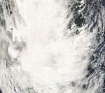
Duration April 4 – April 7 Intensity 45 km/h (30 mph) (10-min), 1002 mbar (hPa) On April 4, RSMC Nadi identified a Tropical Disturbance which was located just within TCWC Brisbane’s Area of Responsibility and started to issue advisories on it.[64] Later that day RSMC Nadi designated it as Tropical Disturbance 15F and then upgraded it to Tropical Depression 15F.[65][66] The next day the depression moved into RSMC Nadi’s Area of Responsibility,[67] the depression also reached its peak intensity of 25 knots (46 km/h) later that day.[68] However the Depression remained weak with RSMC Nadi issuing the final Tropical Disturbance Summary on Tropical Depression 15F as it approached the southern edge of RSMC Nadi’s Area of Responsibility.[69]
Tropical Depression 16F
Tropical depression (Australian scale) Tropical depression (SSHS) 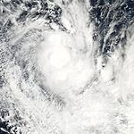

Duration April 16 – April 19 Intensity 55 km/h (35 mph) (10-min), 998 mbar (hPa) On April 16, a tropical disturbance developed about 1365 km (835 mi) northwest of New Caledonia, consisting of an elongated circulation within a marginal upper-level environment. Despite anticipation that tropical cyclogenesis was unlikely in the short term, deep convection rapidly developed over an increasingly better defined circulation, with an anticyclone aloft aiding in intensification.[70][71][72] Late on April 17, the Fiji Meteorological Service classified the system as Tropical Depression 16F,[73] and early the next day the Joint Typhoon Warning Center classified it as Tropical Cyclone 27P. Initially, it was forecast to intensify further;[74] however, the storm quickly became disorganized as wind shear increased.[75] At 0000 UTC on April 19, the JTWC issued its final warning on the system as it began dissipating.[76] with RSMC Nadi issuing its final tropical disturbance summary on the depression later that day.[77]
Season effects
Storm
NameDates active Storm category
at peak intensityPeak 10-min
sustained windsPressure Areas affected Damage
(USD)Deaths Refs 01F None October 17 - 19 Tropical Depression Unknown 1000 hPa (29.53 inHg) Solomon Islands None None 02F None November 20 - 22 Tropical Depression Unknown 1001 hPa (29.56 inHg) Fiji None None 03F None November 22 – December 2 Tropical Depression 04F Daman December 3 – 10 Category 4 Severe Tropical Cyclone 185 km/h (115 mph) Fiji, Tonga 05F None December 11 – 14 Tropical Depression 06F None December 26 – 28 Tropical Disturbance 07F Elisa January 7 – 11 Category 2 Tropical Cyclone 95 km/h (60 mph) 08F None January 9 – 14 Tropical Depression 09F None January 12 – 13 Tropical Depression 10F/12P Funa January 14 – 21 Category 4 Severe Tropical Cyclone 175 km/h (110 mph) 11F None January 19 – 24 Tropical Depression 12F/15P Gene January 25 – February 6 Category 3 Severe Tropical Cyclone 155 km/h (100 mph) 13F None February 17 – 18 Tropical Depression 14F/24P None March 19 – 23 Tropical Depression 15F None April 4 – 7 Tropical Depression 16F/27P None April 16 – 19 Tropical Depression Season Aggregates 16 depressions October 16 – April 19 165 km/h (105 mph) 935 hPa (27.61 inHg) See also
- List of Southern Hemisphere tropical cyclone seasons
- Atlantic hurricane seasons: 2007, 2008
- Pacific hurricane seasons: 2007, 2008
- Pacific typhoon seasons: 2007, 2008
- North Indian Ocean cyclone seasons: 2007, 2008
References
- ^ a b c d e Unattributed (2008). "RSMC Nadi Tropical Cyclone Seasonal Summary 2007-08". Fiji Meteorological Service. http://www.wmo.int/pages/prog/www/tcp/Best%20Tracks/documents/TCSeasonalSummary07-08.doc. Retrieved 2011-08-08.
- ^ Unattributed (2010-10-26). "Tropical Cyclone Guidance for Season 2010/11 for the Fiji and the Southwest Pacific". Fiji Meteorological Service. http://www.met.gov.fj/2010_2011%20TC%20Guide.pdf. Retrieved 2011-07-31.
- ^ Unattributed (2008-03-10). "Tropical Cyclone Operational Plan for the South Pacific and South-East Indian Ocean 2008" (PDF). RA V Tropical cyclone Committee. World Meteorological Organization. Archived from the original on 2009-05-21. http://www.webcitation.org/5gwsPSRNj. Retrieved 2009-04-15.
- ^ Unattributed (1998). "2008 Annual Tropical Cyclone Report". Joint Typhoon Warning Center. p. 240. http://www.usno.navy.mil/NOOC/nmfc-ph/RSS/jtwc/atcr/2008atcr.pdf. Retrieved 2011-06-16.
- ^ Salinger, Jim; Burgess, Stuart; Renwick, Jim (2007-09-21). "Lower risk of tropical cyclones east of the date line but all islands should remain vigilant". National Institute of Water & Atmospheric Research. Archived from the original on 2011-08-09. http://www.webcitation.org/60oMZ84zh. Retrieved 2008-11-26.
- ^ Prasad, Rajendra (2008-10-23). "RSMC Nadi 2007/2008 South Pacific Tropical Cyclone Season Outlook" (PDF). Fiji Meteorological Service. Archived from [www.met.gov.fj/aifs_prods/Media.pdf the original] on 2008-07-22. http://www.webcitation.org/5ceEzZY4Q. Retrieved 2008-10-24.
- ^ a b c Unattributed (2007-10-17). "Tropical Disturbance Summary 2007-10-17 2300z". Fiji Meteorological Service. http://www.webcitation.org/5SfXOnSZg. Retrieved 2007-10-17.
- ^ Unattributed (2007-10-19). "Tropical Disturbance Summary 2007-10-19 0900z". Fiji Meteorological Service. http://www.webcitation.org/5Si7trKVm. Retrieved 2011-08-10.
- ^ Unattributed (2007-10-17). "Marine Weather Bulletin 2007-10-17 1800z". Fiji Meteorological Service. http://www.webcitation.org/5SfR6QYGw. Retrieved 2008-10-17.
- ^ Unattributed (2007-10-19). "Tropical Disturbance Summary 2007-10-19 0200z". Fiji Meteorological Service. http://www.webcitation.org/5UfhhOncW. Retrieved 2011-08-10.
- ^ Unattributed (2007-10-19). "Tropical Disturbance Summary 2007-10-19 0900z". Fiji Meteorological Service. http://www.webcitation.org/5Si7trKVm. Retrieved 2011-08-10.
- ^ Unattributed (2007-11-20). "Tropical Disturbance Summary 2007-11-20 0900Z". Fiji Meteorological Service. http://www.webcitation.org/5TVLCpC1R. Retrieved 2007-11-20.
- ^ a b Unattributed (2007-12-11). "Fiji Islands Climate Summary November 2007" (PDF). Fiji Meteorological Service. http://www.wamis.org/countries/fiji/fiji200711.pdf. Retrieved 2011-08-11.
- ^ Unattributed (2007-11-20). "Tropical Disturbance Summary 2007-11-20 1800z". Fiji Meteorological Service. http://www.webcitation.org/5TVKKUcKq. Retrieved 2007-11-20.
- ^ Unattributed (2007-11-21). "Tropical Disturbance Summary 2007-11-21 1800z". Fiji Meteorological Service. http://www.webcitation.org/5TWm8QByl. Retrieved 2007-11-21.
- ^ a b "Tropical Disturbance Summary 2007-11-22 23z". Fiji Meteorological Service. 2007-11-22. http://mtarchive.geol.iastate.edu/2007/11/22/text/Severe/Severe_22.txt. Retrieved 2011-08-16.
- ^ Staff Writer (2008-12-08). "Seasonal Summary 2007-08". Fiji Meteorological Service. World Meteorological Organisation. http://www.wmo.int/pages/prog/www/tcp/documents/RAVTCC-12FinalReport.pdf. Retrieved 2008-09-28.
- ^ "Tropical Cyclone Daman (05P) best track analysis". Joint Typhoon Warning Center. 2009-03-31. http://www.usno.navy.mil/NOOC/nmfc-ph/RSS/jtwc/best_tracks/2008/2008s-bsh/bsh052008.txt. Retrieved 2010-03-01.
- ^ a b c d Unattributed (2009-05-12). "RSMC Nadi Best Track Data for the 2007/2008 Season". Fiji Meteorological Service. National Oceanic and Atmospheric Administration. ftp://eclipse.ncdc.noaa.gov/pub/ibtracs/original-bt-data-files/nadi/RSMC%20Nadi%20BT%20Data%202007_8.txt. Retrieved 2010-10-13.
- ^ "Severe cyclone skirts Fiji island". British Broadcasting Corporation. 2007-12-08. http://news.bbc.co.uk/1/hi/world/asia-pacific/7132886.stm. Retrieved 2008-10-06.
- ^ "Tropical Disturbance Summary 11-12-07 03Z". Fiji Meteorological Service. http://www.webcitation.org/5U0Bb35pQ. Retrieved 2007-12-12.
- ^ "Tropical Disturbance Summary 14-12-07 09Z". Fiji Meteorological Service. http://www.webcitation.org/5U5FQvfy0. Retrieved 2008-08-21.
- ^ "Tropical Disturbance summary 26-12-07 09Z". Fiji Meteorological Service. http://www.webcitation.org/5UNUnD2VT. Retrieved 2007-12-26.
- ^ "Tropical Disturbance summary 28-12-07 09Z". Fiji Meteorological Service. http://www.webcitation.org/5UQXg7QQp. Retrieved 2007-12-28.
- ^ "Marine Bulletin 28-12-07 20Z". Fiji Meteorological Service. http://www.webcitation.org/5UR0NaoYR. Retrieved 2007-12-28.
- ^ a b c d e Unattributed (2008-07-22). "JTWC Tropical Cyclone 11P (Elisa) Best Track Analysis". Joint Typhoon Warning Center. http://www.usno.navy.mil/NOOC/nmfc-ph/RSS/jtwc/best_tracks/2008/2008s-bsh/bsh112008.txt. Retrieved 2011-08-08.
- ^ Unattributed (2008-01-08). "Significant Tropical Weather Advisory for the Western and Southern Pacific 2008-01-08 15z". Joint Typhoon Warning Center. http://www.webcitation.org/5UhPNscU0. Retrieved 2008-10-31.
- ^ Unattributed. "RA V Tropical Cyclone Committee for the South Pacific and South-East Indian Ocean twelfth session final report". RA V Tropical Cyclone Committee for the South Pacific and Southeast Indian Ocean. World Meteorological Organization. Archived from the original on 2011-08-08. http://www.webcitation.org/60lzzQMYT. Retrieved 2008-09-04.
- ^ "Tropical Disturbance Summary 09-01-08 23Z". Fiji Meteorological Service. http://www.webcitation.org/5UjObDNu3. Retrieved 2008-01-09.
- ^ a b c d e f g h i j "Monthly Global Tropical Cyclone Summary (January)". Gary Padgett. http://www.typhoon2000.ph/garyp_mgtcs/jan08sum.txt. Retrieved 2008-07-29.
- ^ "Marine Weather Bulletin 14-01-08 06Z". Fiji Meteorological Service. http://www.webcitation.org/5UpwCbkwk. Retrieved 2008-01-14.
- ^ "Tropical Disturbance Summary 14-01-08 09Z". Fiji Meteorological Service. http://www.webcitation.org/5Uq4Fsfef. Retrieved 2008-01-14.
- ^ a b "Tropical disturbance summary 13-01-08 00Z". Fiji Meteorological Service. http://www.webcitation.org/5UnzqLEul. Retrieved 2008-01-13.
- ^ "Tropical disturbance summary 13-01-08 23Z". Fiji Meteorological Service. http://www.webcitation.org/5UpQSGs2E. Retrieved 2008-01-13.
- ^ "Tropical Disturbance Summary 15-01-2008 23z". Fiji Meteorological Service. http://www.webcitation.org/5Ur1lInpF. Retrieved 2008-08-21.
- ^ "Marine Weather Bulletin 15-01-2008 20Z". Fiji Meteorological Service. http://www.webcitation.org/5UsF2i4K8. Retrieved 2008-08-21.
- ^ "TCFA 16-01-08". Joint Typhoon Warning Center. http://www.webcitation.org/5UskBE1Q1. Retrieved 2008-08-21.
- ^ Prasad, Rajendra. "Tropical Cyclone Funa" (PDF). Fiji Meteorological Service. http://www.met.gov.fj/aifs_prods/Media_release_TC_FUNA.pdf. Retrieved 2008-08-21.
- ^ "JTWC TC12P warning 1". Joint Typhoon Warning Center. http://www.webcitation.org/5UjVLpxzs. Retrieved 2008-08-21.
- ^ "Tropical Disturbance Advisory 19-01-2008 12z". Fiji Meteorological Service. ftp://ftp.met.fsu.edu/pub/weather/tropical/Fiji/2008011912.WTPS11. Retrieved 2008-08-21.
- ^ "Tropical Disturbance Summary 18-01-2008 00z". Fiji Meteorological Service. ftp://ftp.met.fsu.edu/pub/weather/tropical/Fiji/2008011800.WTPS11. Retrieved 2008-08-21.
- ^ "JTWC TC12P warning 6". Joint Typhoon Warning Center. http://www.webcitation.org/5UxJELIPG. Retrieved 2008-08-21.
- ^ "JTWC TC12P warning 9". Joint Typhoon Warning Center. http://www.webcitation.org/5Uz3d7ATo. Retrieved 2008-08-21.
- ^ "Tropical disturbance summary 19-01-08". Fiji Meteorological Service. http://www.webcitation.org/5Uywv3Tmd. Retrieved 2008-01-19.
- ^ "Tropical disturbance summary 20-01-08 23z". Fiji Meteorological Service. http://www.webcitation.org/5V05Gs5np. Retrieved 2008-01-20.
- ^ "Tropical disturbance summary 23-01-08 23z". Fiji Meteorological Service. http://www.webcitation.org/5V4ix0j1I. Retrieved 2008-01-23.
- ^ "Marine Weather Bulletin 25-01-08 06z". Fiji Meteorological Service. http://www.webcitation.org/5bWhpJhiQ. Retrieved 2008-10-12.
- ^ "Tropical Cyclone Formation Alert". Joint Typhoon Warning Center. http://www.webcitation.org/5V94fZ3wg. Retrieved 2008-10-12.
- ^ "Marine Weather Bulletin 26-01-08 20z". Fiji Meteorological Service. http://www.webcitation.org/5V8yY12Ol. Retrieved 2008-10-12.
- ^ "JTWC warning 27-01-08 03z". Joint Typhoon Warning Center. http://www.webcitation.org/5VASE2OZv. Retrieved 2008-10-12.
- ^ "Storm Warning 73 28-01-08 00z". Fiji Meteorological Service. ftp://ftp.met.fsu.edu/pub/weather/tropical/Fiji/2008012800.WTPS01. Retrieved 2008-10-12.
- ^ "Tropical Disturbance Advisory 31-01-08 18z". Fiji Meteorological Service. ftp://ftp.met.fsu.edu/pub/weather/tropical/Fiji/2008013118.WTPS11. Retrieved 2008-08-02.
- ^ "Tropical disturbance summary 17-02-08 21z". Fiji Meteorological Service. http://www.webcitation.org/5ViBAIvyj. Retrieved 2008-02-17.
- ^ "Tropical disturbance summary 18-02-08 23Z". Fiji Meteorological Service. http://www.webcitation.org/5ViBYcsRW. Retrieved 2008-02-18.
- ^ "Marine Weather Bulletin 19-03-2008 20Z". Fiji Meteorological Service. http://www.webcitation.org/5WRbIoNpv. Retrieved 2008-03-19.
- ^ "Tropical Disturbance Summary 19-03-2008 23Z". Fiji Meteorological Service. http://www.webcitation.org/5WRkGhzIx. Retrieved 2008-03-19.
- ^ "Tropical Cyclone formation alert 20-03-2008 12Z". Joint Typhoon Warning Center. http://www.webcitation.org/5WSv2TicN. Retrieved 2008-03-20.
- ^ "Tropical cyclone 24P Advisory 1". Joint Typhoon Warning Center. http://www.webcitation.org/5WcOb6ngd. Retrieved 2008-03-20.
- ^ "Marine Weather Bulletin 21-03-2008 21Z". Fiji Meteorological Service. http://listserv.illinois.edu/wa.cgi?A2=ind0803c&L=wx-tropl&T=0&P=39022. Retrieved 2008-03-20.
- ^ "Monthly Global Tropical Cyclone Summary (March)". Joint Typhoon Warning Center. http://www.australiasevereweather.com/cyclones/2008/summ0803.htm. Retrieved 2008-07-25.
- ^ "Tropical cyclone 24P Advisory 3". Joint Typhoon Warning Center. http://www.webcitation.org/5WUz8stpf. Retrieved 2008-03-21.
- ^ "Tropical Disturbance Summary 22-03-2008 09Z". Fiji Meteorological Service. http://listserv.illinois.edu/wa.cgi?A2=ind0803d&L=wx-tropl&T=0&P=2633. Retrieved 2008-03-22.
- ^ "Tropical Disturbance Summary 23-03-2008 21Z". Fiji Meteorological Service. http://listserv.illinois.edu/wa.cgi?A2=ind0803d&L=wx-tropl&T=0&P=20423. Retrieved 2008-03-23.
- ^ "Tropical Disturbance Summary 04-04-2008 18Z". Fiji Meteorological Service. http://listserv.illinois.edu/wa.cgi?A2=ind0804a&L=wx-tropl&D=0&T=0&P=23637. Retrieved 2008-04-04.
- ^ "Tropical Disturbance Summary 05-04-2008 23Z". Fiji Meteorological Service. http://listserv.illinois.edu/wa.cgi?A2=ind0804a&L=wx-tropl&D=0&T=0&P=25216. Retrieved 2008-04-05.
- ^ "Tropical Disturbance Summary 05-04-2008 00Z". Fiji Meteorological Service. http://listserv.illinois.edu/wa.cgi?A2=ind0804a&L=wx-tropl&D=0&T=0&P=25456. Retrieved 2008-04-05.
- ^ "Tropical Disturbance Summary 05-04-2008 09Z". Fiji Meteorological Service. http://listserv.illinois.edu/wa.cgi?A2=ind0804a&L=wx-tropl&T=0&P=28182. Retrieved 2008-04-05.
- ^ "Marine Weather Bulletin 05-04-2008 18Z". Fiji Meteorological Service. http://listserv.illinois.edu/wa.cgi?A2=ind0804a&L=wx-tropl&T=0&P=30408. Retrieved 2008-04-05.
- ^ "Tropical Disturbance Summary 07-04-08 09Z". Fiji Meteorological Service. http://listserv.illinois.edu/wa.cgi?A2=ind0804a&L=wx-tropl&T=0&P=39227. Retrieved 2008-04-07.
- ^ Joint Typhoon Warning Center (2008). "Tropical Cyclone 15P". United States Naval Research Laboratory. http://199.9.2.143/tcdat/tc08/SHEM/27P.TWENTYSEVEN/trackfile.txt. Retrieved 2009-03-10.
- ^ Charlie Forecast Team (2008). "April 17 Significant Tropical Weather Advisory for the Western and South Pacific Oceans". Joint Typhoon Warning Center. ftp://ftp.met.fsu.edu/pub/weather/tropical/GuamStuff/2008041713-ABPW.PGTW. Retrieved 2008-04-18.
- ^ "April 17 Tropical Cyclone Formation Alert". Joint Typhoon Warning Center. 2008. http://www.webcitation.org/5X9eIZSPF. Retrieved 2008-04-18.
- ^ Fiji Meteorological Service (2008). "Marine Weather Bulletin 17-04-08". http://www.webcitation.org/5X9jP0mXw. Retrieved 2008-04-18.
- ^ Joint Typhoon Warning Center (2008). "Tropical Cyclone 26P Warning NR 001". http://www.webcitation.org/5XA6ji93r. Retrieved 2008-04-18.
- ^ Fiji Meteorological Service (2008). "April 18 1800z Marine Weather Bulletin". http://www.webcitation.org/5XB4LVBka. Retrieved 2008-04-18.
- ^ Joint Typhoon Warning Center (2008). "Tropical Cyclone 26P Warning NR 003". http://www.webcitation.org/5XBa28YSv. Retrieved 2008-04-18.
- ^ "Tropical Disturbance Summary 19-04-2008 23Z". Fiji Meteorological Service. http://www.webcitation.org/5XDSpU4lT. Retrieved 2008-04-19.
External links
- World Meteorological Organization
- Fiji Meteorological Service
- Meteorological Service of New Zealand
- Joint Typhoon Warning Center
Tropical cyclones of the 2007–08 South Pacific cyclone season
TimelineSouth Pacific Tropical Cyclone Scale TDI TDE 1 2 3 4 5  Book ·
  Category ·
  Portal ·
  WikiProject ·
  Commons
2000–09 South Pacific cyclone seasons


Wikimedia Foundation. 2010.