- 2006–07 South Pacific cyclone season
Infobox hurricane season
Basin=SPac
Year=2007
Track=2006-2007 South Pacific cyclone season summary.jpg
First storm formed=October 21 ,2006
Last storm dissipated=April 6 2007
Strongest storm name=Xavier
Strongest storm pressure=930
Strongest storm winds=95
Average wind speed=
Total depressions=14
Total storms=
Total hurricanes=6
Total intense=
Fatalities=
Da
Inflated=
five seasons=2004–05, 2005–06, 2006–07, 2007–08, 2008–09The 2006-07 South Pacific cyclone season was an event in the annual cycle of
tropical cyclone formation. It began onNovember 1 ,2006 and ended onApril 30 ,2007 . These dates conventionally delimit the period of each year when most tropical cyclones form in the southernPacific Ocean east of 160°E. Additionally, the regional tropical cyclone operational plan defines a "tropical cyclone year" separately from a "tropical cyclone season", and the "tropical cyclone year" runs fromJuly 1 ,2006 toJune 30 ,2007 .cite web|year=2006|title=Tropical Cyclone Operational Plan for the South Pacific and South-East Indian Ocean|accessdate=2008-08-15|publisher=World Meteorological Organization|url=http://www.wmo.int/pages/prog/www/tcp/documents/TCP-24-OP-PLN-2006-edition-english.pdf]Tropical cyclones between 160°E and 120°W and north of 25°S are monitored by the
Fiji Meteorological Service inNadi . Those that move south of 25°S are monitored by theTropical Cyclone Warning Centre inWellington ,New Zealand .__TOC__
torms
Tropical Cyclone Xavier
Infobox Hurricane Small
Basin=SPac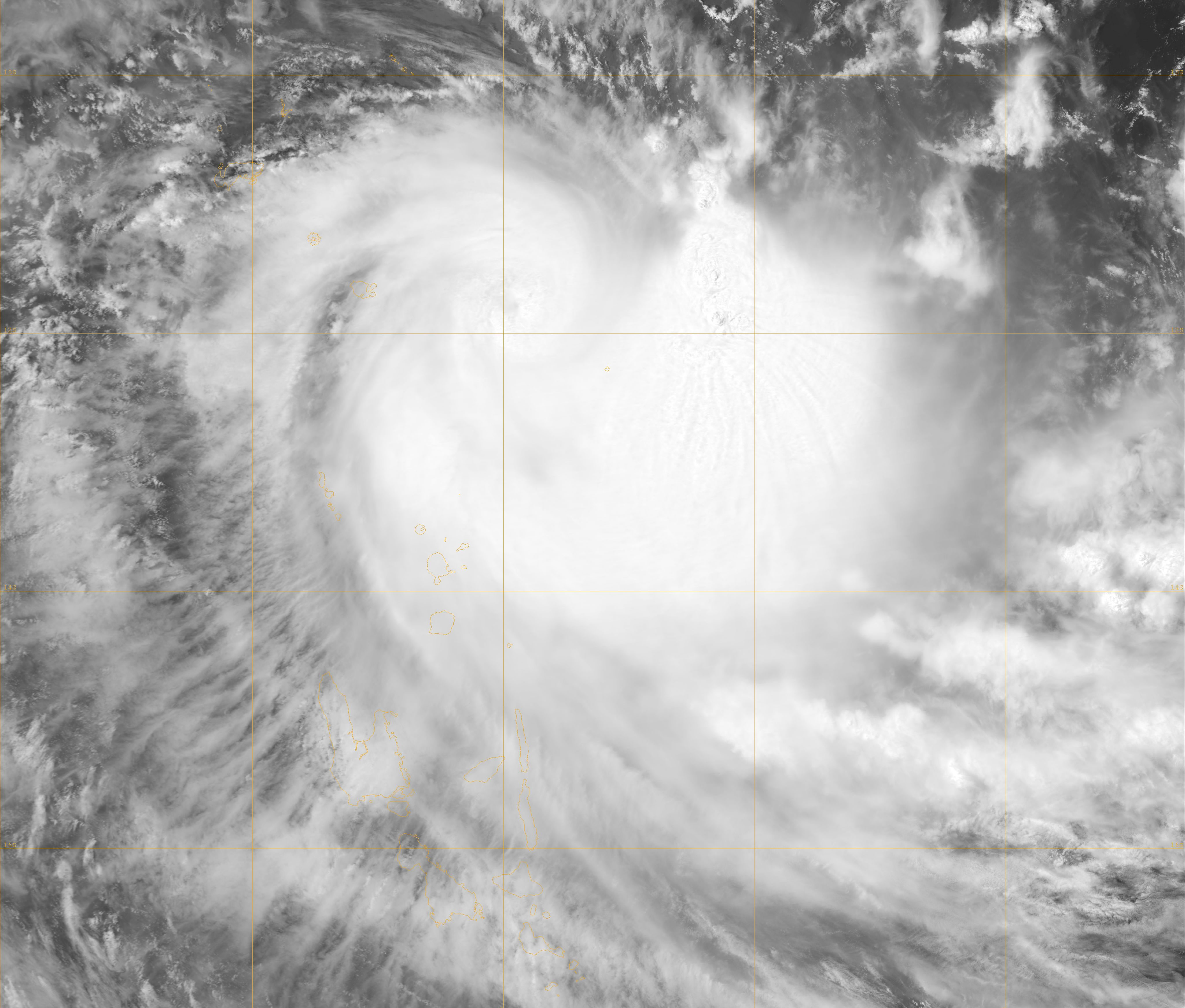
Track=Xavier 2006 track.pngOctober 21
Dissipated=October 26
10-min winds=95
1-min winds=115
Pressure=930October 21 , an area of deep convection that formed earlier in the day was designated a tropical depression by RSMC Nadi. It was soon upgraded to a tropical cyclone and named Xavier, having undergone explosive development. An eye soon became apparent on satellite imagery. Xavier continued to intensify, reaching a 10-minute average peak of 95-knot winds onOctober 24 . Later that day, RSMC Nadi indicated that the eye had disappeared off satellite and that cloud tops had warmed. Weakening outflow in most sectors was also reported, and Xavier began to weaken as it moved into an area of higherwind shear . It weakened into a depression onOctober 26 . The JTWC stopped advisories later the same day. RSMC Nadi last mentioned the system in marine weather bulletin onOctober 28 .Tropical Depression 02F
On
October 24 an area of convection east of theInternational Date Line was designated as a tropical depression by RSMC Nadi. However, the depression struggled to develop due to outflow from Tropical Cyclone Xavier, and weakened as it moved westward, dissipating onOctober 26 . RSMC Nadi last mentioned the system in marine weather bulletin onOctober 29 .Tropical Depression 03F
On
November 1 , RSMC Nadi identified a tropical disturbance just east of theInternational Date Line that had persisted for two days. It also noted the possibility of more than one circulation centre in the area nearlongitude 180°. It was designated a tropical depression later that day. The depression failed to strengthen further, however, and dissipated onNovember 3 .Tropical Cyclone Yani
Infobox Hurricane Small
Basin=SPac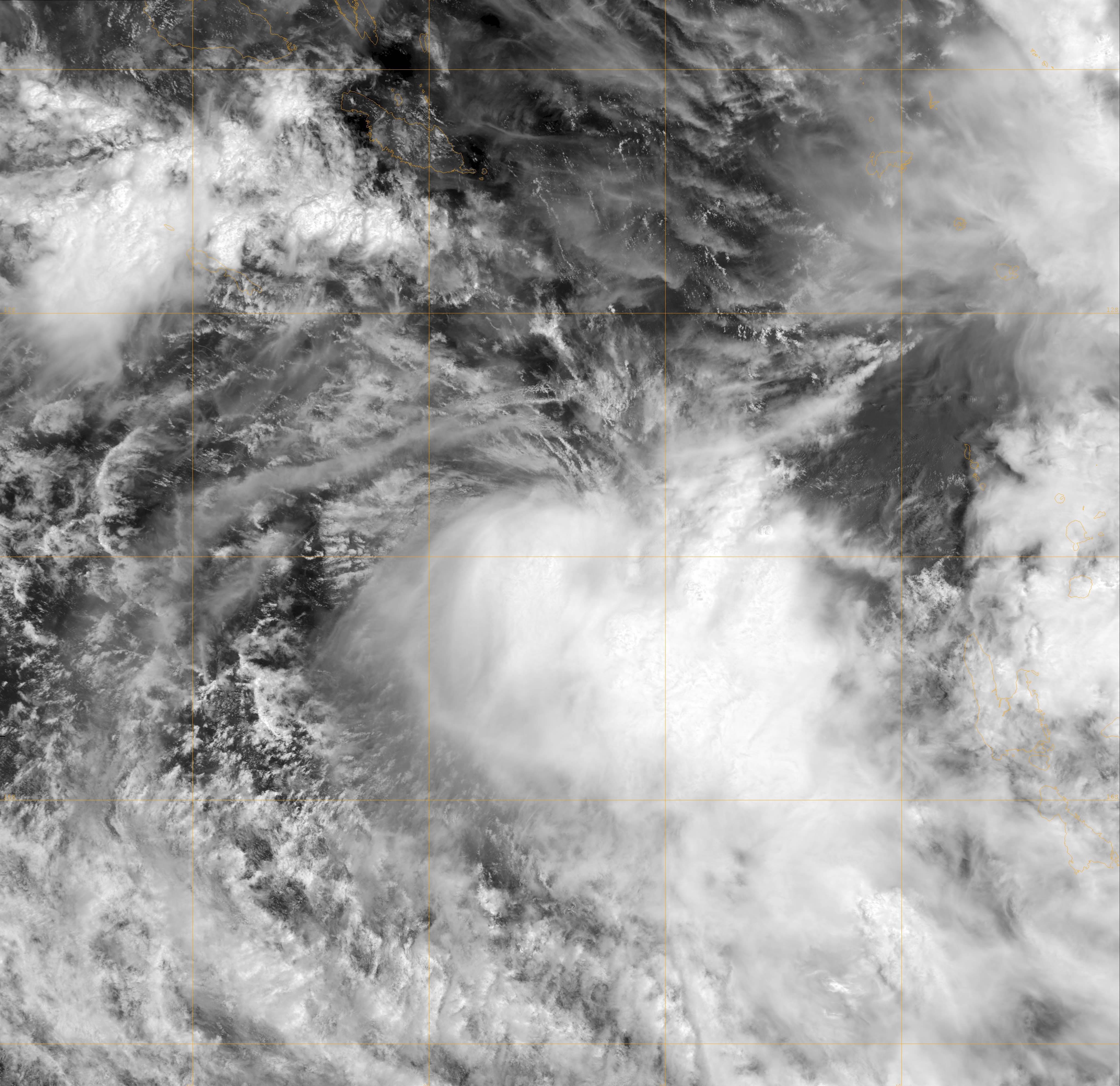
Track=Yani 2006 track.pngNovember 21
Dissipated=November 24
10-min winds=75
1-min winds=70
Pressure=960November 16 , just west of theInternational Date Line . It developed into a tropical depression the next day, with RSMC Nadi noting an increase in convection. The depression was embedded in a monsoonal trough in its early life, and according to RSMC Nadi, in an environment of low diffluence and moderate verticalwind shear . OnNovember 22 the system was named Yani after it increased in organisation. Yani continued to intensify as it tracked southward, reaching hurricane-equivalent strength early the next day. Continuing to move south, the system reached an area of strengthening wind shear and rapidly weakened. The low level convection centre became detached from the convection, and under the influence of a subtropical ridge, the storm turned sharply toward the west-northwest. RSMC Nadi issued their final tropical disturbance advisory on the cyclone onNovember 25 (local time), with the JTWC dropping advisories later that next day.Tropical Depression 05F
An area of disturbed weather developed east-northeast of the
Solomon Islands onNovember 28 . RSMC Nadi began monitoring it as a tropical disturbance early onNovember 29 as it moved westward in a favorable environment for development. The disturbance later that day was classified as a tropical depression. OnNovember 30 , theJoint Typhoon Warning Center initiated advisories on the storm, internally numbered Tropical Cyclone 04P. Under heavywind shear , the storm never developed further and the JTWC stopped advisories onDecember 1 , shortly after RSMC Nadi.Tropical Depression 06F
On
January 9 , RSMC Nadi identified a tropical depression well east of theInternational Date Line , located in a sheared environment, with convection having persisted for 24 hours. It never developed further and late onJanuary 15 RSMC Nadi noted that 06F had become extratropical. RSMC Nadi last noted it two days later.Tropical Cyclone Zita
Infobox Hurricane Small
Basin=SPac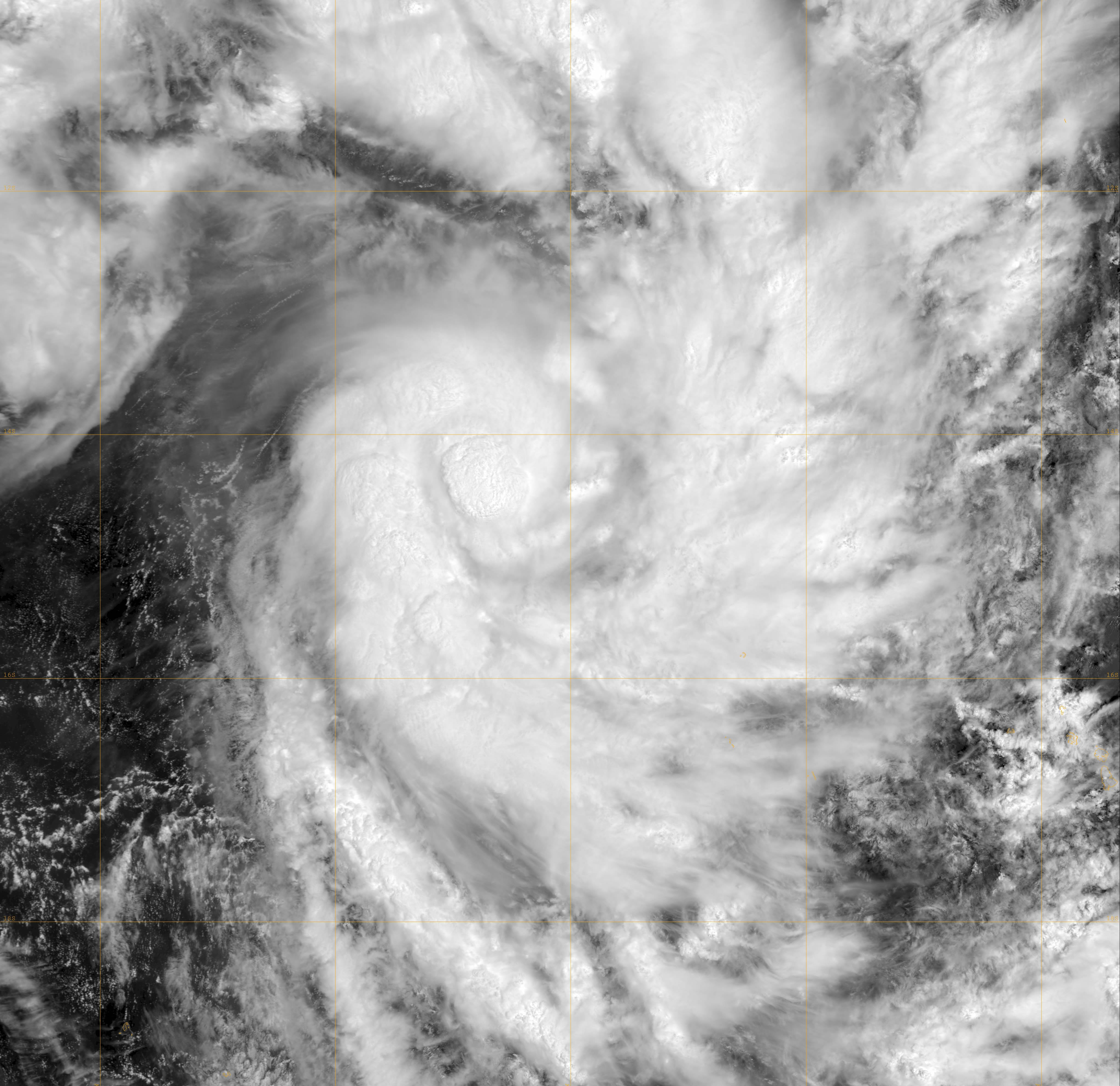
Track=Zita 2007 track.pngJanuary 18
Dissipated=January 25
10-min winds=60
1-min winds=60
Pressure=975January 16 , a RSMC Nadi marine bulletin identified a tropical disturbance east of theInternational Date Line . The low level circulation center was unidentifiable but was estimated to be at the southwestern edge of the major convection. OnJanuary 18 , RSMC Nadi identified the disturbance as a tropical depression while the system was still poorly organized. OnJanuary 20 , theJoint Typhoon Warning Center noted the system and treated it as a tropical disturbance. OnJanuary 22 , the JTWC issued aTropical Cyclone Formation Alert on the system. The system was assigned the name Zita by RSMC Nadi and commented in their tropical disturbance summary that the cyclone had undergone explosive development. It then quickly began extratropical transition as it moved south-southeast, with the JTWC declaring it extratropical onJanuary 24 . It entered the warning area of TCWC Wellington later that day as it passed south of 25°S, and completed extratropical transition early onJanuary 25 .Tropical Cyclone Arthur
Infobox Hurricane Small
Basin=SPac
Track=Arthur 2007 track.pngJanuary 21
Dissipated=January 27
10-min winds=60
1-min winds=65
Pressure=975Joint Typhoon Warning Center began satellite fixes on a tropical disturbance located east-northeast ofPago Pago ,American Samoa , onJanuary 20 . RSMC Nadi noted the disturbance earlier that day, and upgraded the disturbance to a tropical depression onJanuary 21 , noting that the potential for the depression to become a tropical cyclone was moderate to high. The JTWC issued a TCFA on the system later that day. OnJanuary 23 , 08F began to deteriorate, and RSMC Nadi downgraded the potential for formation, but this weakening was short-lived, and RSMC Nadi upgraded the system to a tropical cyclone the next day, naming it Arthur. OnJanuary 25 it reached its peak of 60 knots but then started to weaken as it moved into the vicinity of theCook Islands . The JTWC declared the cyclone extratropical onJanuary 26 , while RSMC Nadi reported a slight restrengthening of the system. Later that day, the JTWC reissued one warning on Arthur as a dissipating 55 kt tropical storm, reporting that the low-level circulation centre had reformed under the convection. Arthur passed into the area of responsibility of TCWC Wellington the next day onJanuary 27 , and became extratropical the same day.Tropical Depression 09F
RSMC Nadi noted a tropical disturbance in the general area of 10°S east of the
International Date Line onJanuary 30 . OnFebruary 2 , RSMC Nadi upgraded it to a tropical depression, and the next day, theJoint Typhoon Warning Center issued aTropical Cyclone Formation Alert . OnFebruary 4 , the JTWC upgraded the disturbance to a tropical cyclone, giving it the designation 11P. However, it quickly becameextratropical , and the final warning was issued just 24 hours later. RSMC Nadi also stopped tracking the low onFebruary 5 .Tropical Depression 12F
An area of disturbed weather formed northwest of
Fiji onMarch 19 and moved southeast over the next three days with little change in organisation. OnMarch 21 , the system began to increase in organisation, and RSMC Nadi designated the system Tropical Depression 12F late that day, noting that the potential for development into a tropical cyclone was low to moderate due to increasingwind shear to the south. TheJoint Typhoon Warning Center issued aTropical Cyclone Formation Alert on the now-quasi-stationary system the next day. [ [http://www.webcitation.org/5NWjQYK5t WebCite query result ] ] RSMC Nadi upgraded the potential for development to high and began issuing advisories later in the day, but the depression soon became disorganised due to increasing shear. The RSMC issued its last advisory early onMarch 23 . [ [http://www.webcitation.org/5NXkE3YEv WebCite query result ] ]Tropical Cyclone Becky
Infobox Hurricane Small
Basin=SPac
Track=Becky 2007 track.pngMarch 26
Dissipated=March 29
10-min winds=60
1-min winds=70
Pressure=975Vanuatu onMarch 24 . TheTropical Cyclone Warning Centre inBrisbane began monitoring it as a tropical low early onMarch 25 , before it moved eastward into the area of responsibility of RSMC Nadi later that day. RSMC Nadi designated the system Tropical Depression 13F and noted that it had a moderate potential for development into a tropical cyclone. Tropical disturbance advisories were initiated onMarch 26 as the system improved in organisation. TheJoint Typhoon Warning Center designated it Tropical Cyclone 21P later that day. RSMC Nadi followed suit and upgraded the system to a tropical cyclone and named it Becky.Becky initially strengthened quickly while moving south-southeastward, nearly reaching hurricane-equivalent intensity on
March 27 . RSMC Nadi initially issued astorm warning for Vanuatu, but the environment began to deteriorate, inhibiting any further strengthening. The cyclone began weakening late that day as it passed to the west of Vanuatu, and RSMC Nadi issued its final tropical disturbance advisory on Becky early onMarch 29 .Tropical Cyclone Cliff
Infobox Hurricane Small
Basin=SPac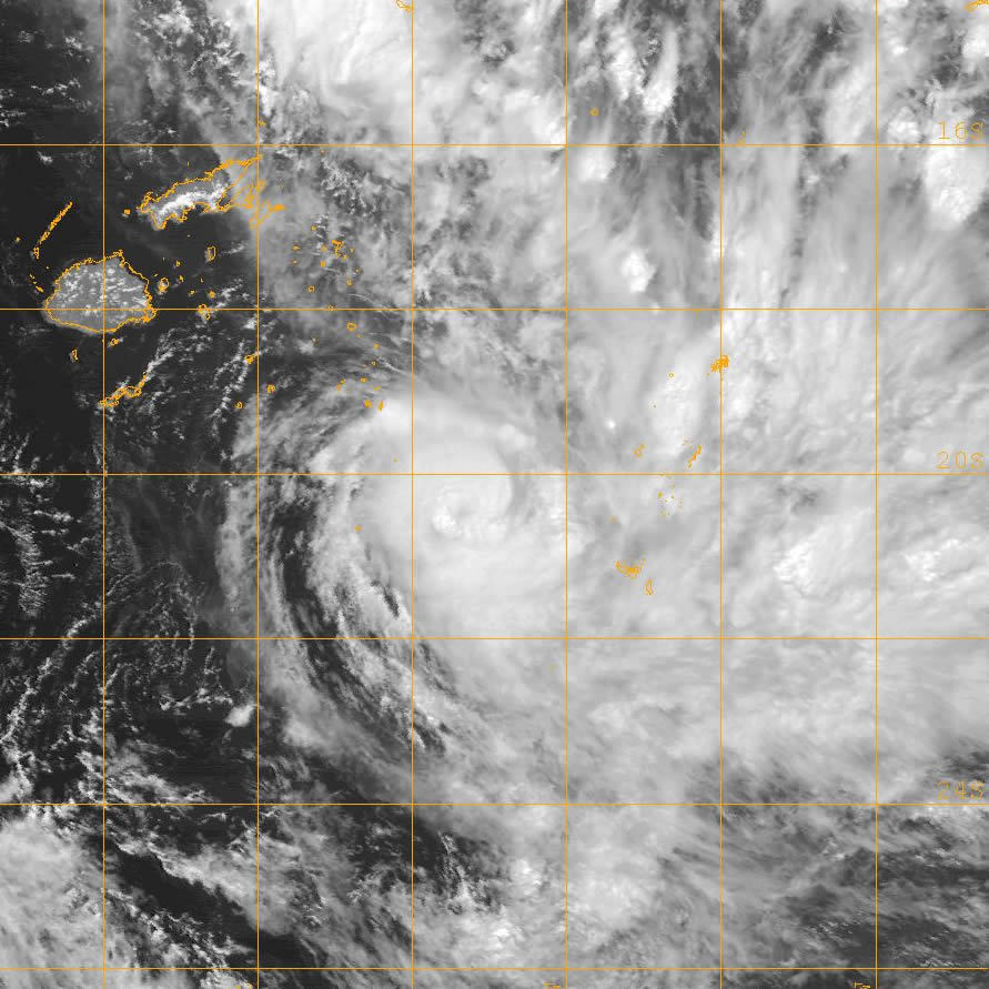
Track=Cliff 2007 track.pngApril 3
Dissipated=April 6
10-min winds=50
1-min winds=55
Pressure=980April 3 as a sheared system located in a highly-sheared environment. [ [http://www.webcitation.org/5NoxuMTKz WebCite query result ] ] Despite this, the system managed to organise and intensify as it moved southeast, and was named Tropical Cyclone Cliff onApril 4 near theinternational date line . TheJoint Typhoon Warning Center designated it a tropical cyclone, the 23rd in theSouthern Hemisphere for the season, later that day, as deep convective banding began to develop. Continuing to move generally southeast, Cliff peaked in intensity onApril 5 before starting to weaken as it crossed into the area of responsibility of TCWC Wellington. Late that night, Cliff started to show signs ofextratropical transition , causing Dvorak satellite intensity estimates to fall. The JTWC issued its final advisory the next day, followed later that day by TCWC Wellington as it completed transition.torm names
South Pacific tropical cyclones are usually assigned names by the RSMC in Nadi, or
Fiji Meteorological Service .cite web|year=2007|title=Tropical Cyclone names|accessdate=2008-08-15|publisher=Met Office|url=http://www.metoffice.gov.uk/weather/tropicalcyclone/names.html] As soon as a tropical depression becomes a tropical cyclone it is named by the warning centre having responsibility for it at that time. If a tropical depression becomes a tropical cyclone in the Wellington RSMC area of responsibility, MetService, in consultation with RSMC Nadi, will name the cyclone by using the next name from the list.cite web|year=2006|title=Tropical Cyclone Operational Plan for the South Pacific and South-East Indian Ocean|accessdate=2008-08-15|publisher=World Meteorological Organization|url=http://www.wmo.int/pages/prog/www/tcp/documents/TCP-24-OP-PLN-2006-edition-english.pdf]Retirement
At the 12th biannual meeting of the WMO's RA V Tropical Cyclone Committee during July 2008, it was decided that the following names would be retired Cliff Daman, Funa & Gene were retired from the southern Pacific list of names 2, with the following names selected to replace the retired Storm anmes Chip, Denia, Fotu, Glen. cite web|title=Tropical Cyclone names|accessdate=2008-09-04|publisher=WMO|url=http://www.wmo.int/pages/prog/www/tcp/Storm-naming.html]
ee also
*
List of Southern Hemisphere cyclone seasons
*Atlantic hurricane seasons: 2006, 2007
*Pacific hurricane seasons: 2006, 2007
*Pacific typhoon seasons: 2006, 2007
*North Indian Ocean cyclone seasons: 2006, 2007References
External links
* [https://metocph.nmci.navy.mil/jtwc.html Joint Typhoon Warning Center (JTWC)] .
* [http://www.met.gov.fj/advisories.html Fiji Meteorological Service (RSMC Nadi)] .
* [http://www.metservice.co.nz/forecasts/index.asp Meteorological Service of New Zealand, Ltd. (TCWC Wellington)] .
* [http://www.wmo.int/index-en.html World Meteorological Organization]
Wikimedia Foundation. 2010.