- Maçambara
-
Map 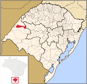
Statistics State: Rio Grande do Sul Meso-region: Micro-Region: Campanha Ocidental Founded: October 22, 1997 Location: 29.141/29° 8' 34" S lat.
56.06/56° 3' 54" W long.Area: 1,682.5 km² Population (2003):
- Total
- Change
- Density
5,339
-
3.17/km²Elevation: 110 m Postal code: 97560-xxx Distance from the capital: 590 Website: www.macambara.rs.gov.br Maçambara is a small Brazilian town in the western part of the state of Rio Grande do Sul. It has a population of 5,339 (2005). Its elevation is 110 m. It has an area of 1,682.5 km². It is located west of the state capital of Porto Alegre and northeast of Alegrete.
Neighbouring municipalities
Other
Maçambara has a school or a collegiate, churches and a few squares and parks.
External links
- http://www.citybrazil.com.br/rs/macambara/ (Portuguese)
Coordinates: 29°8′34″S 56°3′54″W / 29.14278°S 56.065°W
Campanha Ocidental Alegrete · Barra do Quaraí · Garruchos · Itaqui · Maçambara · Manoel Viana · Quaraí · São Borja · São Francisco de Assis · Uruguaiana
Categories:- Municipalities of Brazil
- Populated places in Rio Grande do Sul
- Rio Grande do Sul geography stubs


Wikimedia Foundation. 2010.