Dezesseis de Novembro

Dezesseis de Novembro
Map
Map of the state of Rio Grande do Sul, Brazil highlighting Rolador
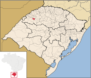
Statistics
State: Rio Grande do Sul
Meso-region: Micro-Region: Cerro Largo
Anniversary: April 11, 1988
Founded: November 4, 1988
Location: 28.2123/28° 12' 46" S lat.
55.67/55° 4' 4" W long.
Postal code: 97845-xxx

Dezesseis de Novembro (Portuguese meaning November 16) is a municipality of the weswestern part of the state of Rio Grande do Sul, Brazil. It is 535 kilometres (332 mi) west of the state capital of Porto Alegre, northeast of Alegrete.

It produces the most alfalfa crops in Brazil which earns the nickname the "Alfalfa Capital of Brazil".

Bounding municipalities

Other

Dezesseis de Novembro has a school or a collegiate, churches and a few squares and parks.

External links


Wikimedia Foundation. 2010.

Игры ⚽ Поможем решить контрольную работу

Look at other dictionaries:

  • Dezesseis de Novembro — Saltar a navegación, búsqueda Dezesseis de Novembro …   Wikipedia Español

  • Dezesseis de Novembro — es un municipio brasileño del estado de Rio Grande do Sul. Su población estimada para el año 2003 era de 3.210 habitantes. Ocupa una superficie de 216,8 km2 …   Enciclopedia Universal

  • Dezesseis De Novembro — Admin ASC 2 Code Orig. name Dezesseis de Novembro Country and Admin Code BR.23.4306353 BR …   World countries Adminstrative division ASC I-II

  • List of municipalities in Rio Grande do Sul — Municipalities of Rio Grande do Sul, Brazil This is a list of the municipalities in the state of Rio Grande do Sul (RS), Brazil. Mesoregion Microregion Municipality Centro Ocidental Rio Grandense Restinga Seca …   Wikipedia

  • Муниципалитеты штата Риу-Гранди-ду-Сул — …   Википедия

  • Дезесейс-ди-Новембру — Муниципалитет Дезесейс ди Новембру Dezesseis de Novembro Страна БразилияБразилия …   Википедия

  • Montenegro, Rio Grande do Sul — This article is about a city in Brazil. For other places named Montenegro, see Montenegro (disambiguation). Montenegro is a city and municipality of the state of Rio Grande do Sul, Brazil; 59.000 inhabitants. The town was established in 1847 to… …   Wikipedia

  • Nova Petrópolis — Coordinates: 23°31′43″S 46°20′42″W / 23.52861°S 46.345°W / 23.52861; 46.345 …   Wikipedia

  • Novo Hamburgo — City of Novo Hamburgo From upper left: Ernesto Frederico Scheffel Foundation, Cathedral Basilica of St. Louis Gonzaga, Monument to the Shoemaker, Friedrich Museum, Schmitt Presser Museum, and Panoramic view of Novo Hamburgo …   Wikipedia

  • Osório — is a city in Rio Grande Do Sul, Brazil. Its population is about 40,000 inhabitants. Osório is situated 90 km east of Porto Alegre. In 2006, a Spanish company, Enerfin, built the largest and most modern aeolic energy generation park in Latin… …   Wikipedia

Share the article and excerpts

Direct link
Do a right-click on the link above
and select “Copy Link”