- Gramado
Infobox City |official_name = Gramado, Rio Grande do Sul
nickname = Hydrangeas' Garden
website = [http://www.gramado.rs.gov.br/ www.gramado.rs.gov.br]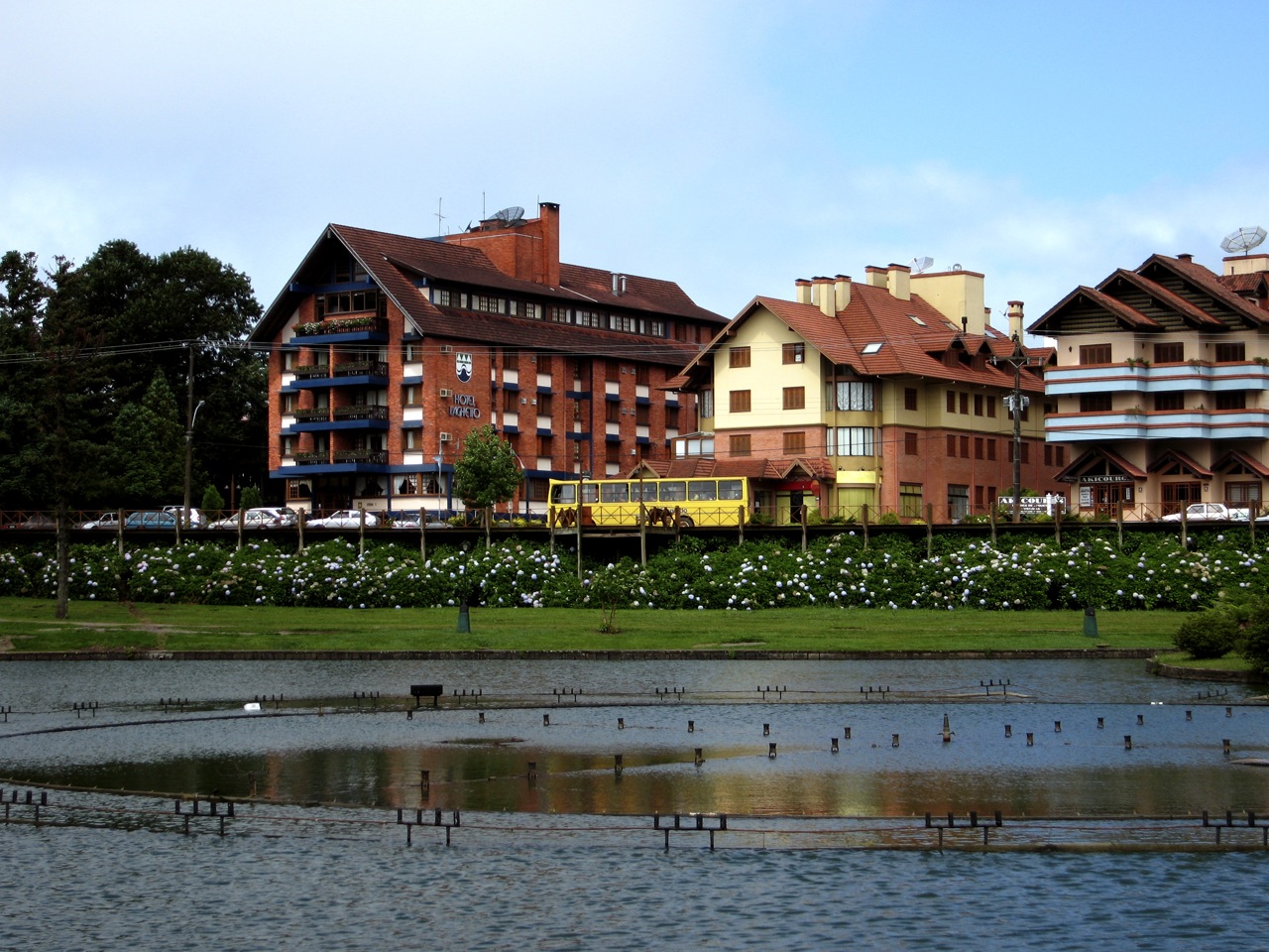
image_

map_caption = Geographical subdivisions of Rio Grande do Sul. Gramado is highlighted with red.
subdivision_type = State
subdivision_name =Rio Grande do Sul
leader_title = Mayor
leader_name =Pedro Bertolucci
area_footnotes = "Gramado." RESUMO ESTATÍSTICO RS - Municípios. Fundação de Economia e Estatística. 9 Sep 2006
area_total_km2 = 237
area_total_sq_mi =
population_as_of = 2005
population_total = 33278
population_footnotes =
population_density_km2 = 140.4
timezone =
utc_offset = -3
timezone_DST =
utc_offset_DST = -2
latd = 29
latm = 24
lats = 17
latNS = S
longd = 50
longm = 52
longs = 35
longEW = W
elevation_m = 850
footnotes =Gramado is a municipality and small touristic town, southeast of
Caxias do Sul and east ofNova Petrópolis in the southernBrazil ian state ofRio Grande do Sul , in theSerra Gaúcha region. Most of the population of Gramado are of German or Italian descent. Gramado is one of the towns along the scenic route known asRota Romântica . The town is also part of the scenicRegião das Hortênsias route.Gramado hosts the
Festival de Gramado , a major South Americanfilm festival and Gramado's most important event. Gramado is also known by hydrangeas blossoming in late spring. Another key event in Gramado is "Natal Luz ", when Gramado is decked out in lights and wreathes made of recycled material by local residents.History
Gramado was originally settled in
1875 by Portuguese immigrants. Five years later, the first German immigrants arrived and these were followed shortly after by Italian immigrants arriving from the Italian settlements inCaxias do Sul .In
1913 , the town seat was moved to Linha Nova, where now is the town center. At this time, Gramado was an unincorporated township within the municipality ofTaquara . Railway arrived in Gramado in1921 , boosting the local economy. Gramado became officially a village in1937 , when Gramado was already known as a summer holiday resort. Gramado became a municipality in1954 .Politics and Government
Gramado Government is in a strong
mayor-council government model, as set forth by the Brazilian Constitution of 1988. Elections for both mayoral and legislative offices are held every fourth year. The Mayor may seek reelection once, while Councilmen have no restriction on terms they may serve.Executive Branch
Executive powers are held by the Mayor of Gramado, who appoints a Cabinet, the heads of several municipal bodies and members of the Planning Commission. The current Mayor is Pedro H. Bertolucci (PP) elected in
2004 .Cabinet Membership
#Secretary of Administration:
Marcia Masotti ;
#Secretary of Agriculture:José Branchini ;
#Secretary of Development:Jaime Schaumlöffel , Undersecretary:Sérgio Prinstrop ;
#Secretary of Education:Jeferson W Moschen ;
#Secretary of the Environment:
#Secretary of Health:Ubiratã de Oliveira ;
#Secretary for Housing and Welfare:Iria Pinto ;
#Secretary of Public Works:Rafel Ronsoni ;
#Secretary of Finances:João Till ;
#Secretary of Tourism:Alemir Coletto
#Secretary of Urban Planning:Vonei Benetti .Legislative Branch
All Legislative powers are vested in the Gramado Town Council. Gramado Town Council is a
unicameral ,open list , 9-member legislature. Gramado Town Council is seated at Municipal Culture centre and holds weekly sessions, between February and December. The Speaker, Committee chairmen and members are elected every year; the current Speaker of the Council isJeferson Moschen (Progressive Party).Town Council Membership
As of
July 22 ,2005 .] , these are the members of the Gramado Town Council. Next elections are likely to be held in the first Sunday of October,2008 . Members are sorted by political position (Government or Opposition), by party and, by last name:Government
*Brazilian Social Democracy Party – PSDB
*#Jorge Drumm
*Progressive Party - PP
*#Ilton Gomes
*#Leonildo Noel
*#Camilo Roldo
*#Rafael Ronsoni , who is also Deputy Speaker of the CouncilOpposition
*Democratic Labour Party – PDT
*#Ivo Tomazelli
*Party of the Brazilian Democratic Movement – PMDB
*#Josué Altreiter
*#Luiz Bolfe
*Workers’ Party – PT
*#Gilnei Benetti Open spaces
Gramado has several green areas, the most important are Black Lake, Communications Square, Knorr Park, Orchard Park, Major Nicoletti Square and, Roses Square.
Black Lake
Black Lake (English for Lago Negro) is the most known, visited green area of Gramado. Black Lake was created"Gramado." BrasilViagem.com. 15 Sept. 2006
1953 byLeopoldo Rosenfeld on an area it was the biggest woods of the Hydrangeas' Region, this very area had been destroyed by fire in1942 . Black Lake's site was named after Good Rest Valley (Vale do Bom Retiro) before fire.

Wikimedia Foundation. 2010.