- Igrejinha
Infobox City
official_name = Município de Igrejinha
nickname =
motto =
website = [http://www.igrejinha.rs.gov.br/ Prefeitura de Igrejinha]
image_

map_caption = Location inRio Grande do Sul ,Brazil
subdivision_type = Country
subdivision_type1 = Region
subdivision_type2 = State
subdivision_name =Brazil
subdivision_name1 = South
subdivision_name2 =Rio Grande do Sul
leader_title =Mayor
leader_name = Elir Domingo Giradi (PTB)
established_title = Emanciped
established_date =1964-06-01
established_title2 =
established_date2 =
established_title3 =
established_date3 =
area_footnotes =pt icon [http://www.ibge.gov.br/cidadesat Cidades@] , Brazilian Institute of Geography and Statistics, Accessed on2007-09-25 .]
area_magnitude =
area_total_km2 = 136.816
area_total_sq_mi =
area_land_km2 =
area_land_sq_mi =
area_water_km2 =
area_water_sq_mi =
population_footnotes =
population_as_of = 2006 est.
population_total = 31389
population_metro =
population_density_km2 = 229.4
population_density_sq_mi =
timezone = UTC-3
utc_offset = -3
timezone_DST = UTC-2
utc_offset_DST = -2
latd = 29
latm = 34
lats = 26
latNS = S
longd = 50
longm = 47
longs = 24
longEW = W
elevation_footnotes =
elevation_m = 18
elevation_ft =
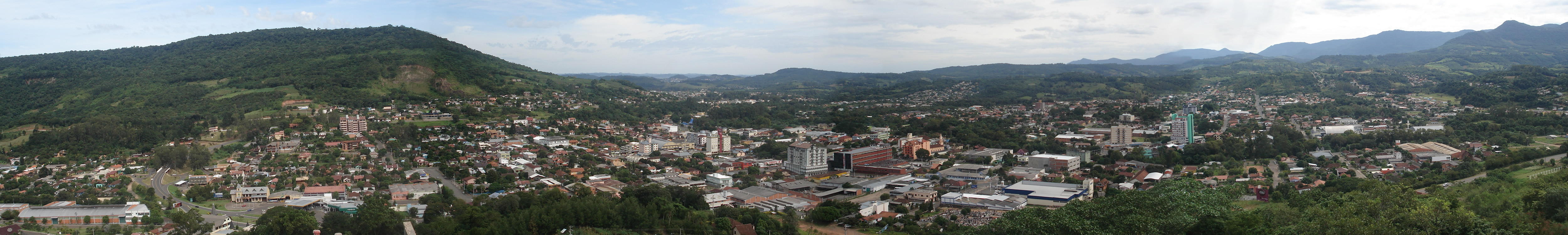
footnotes =Igrejinha is a town located in the
Serra Gaúcha ofRio Grande do Sul ,Brazil . The city has approximately 31,000 inhabitants and sits about 82 km (about 51 miles) from the capital city of the state,Porto Alegre .Oktoberfest
Each year, the citizens of Igrejinha and visitors from the region celebrate
Oktoberfest . The city has a large population ofGerman-Brazilian s. Thousands turn out each year for the Oktoberfest celebration.The most significant period for tourism is during Oktoberfest, a traditional
Bavaria n beer festival, which sold 186,000 tickets at its pavilions in 2005—at which 209,561 liters of beer were drunk.External links
* [http://www.igrejinha.rs.gov.br/ Igrejinha Hall website]
* [http://www.oktoberfest.org.br Igrejinha Oktoberfest site] functions a few months before October onlyMore photos of Igrejinha
References

Wikimedia Foundation. 2010.