- Brogdale
-
Coordinates: 51°18′00″N 0°52′00″E / 51.299999°N 0.866667°E
Brogdale 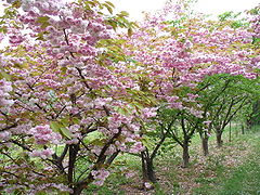
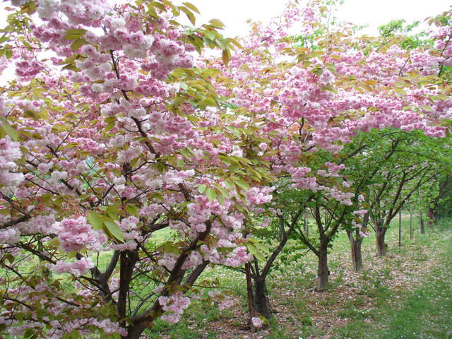
Flowering cherries at the National Fruit Collection
 Brogdale
Brogdale shown within KentOS grid reference TR0059 Parish Ospringe District Swale Shire county Kent Region South East Country England Sovereign state United Kingdom Post town FAVERSHAM Postcode district ME13 Dialling code 01795 Police Kent Fire Kent Ambulance South East Coast EU Parliament South East England UK Parliament Faversham and Mid Kent List of places: UK • England • Kent Brogdale is a hamlet in Kent, England, located beside the M2 motorway 2 miles (3.2 km) south of Faversham. It is one of several hamlets making up the civil parish of Ospringe and is in the Borough of Swale.
On 10 August 2003 the temperature reached 38.5 °C (101.3 °F) here, a record for the United Kingdom.[1]
Brogdale Farm is home to the National Fruit Collection, one of the largest collections of fruit trees and plants in the world. Over 2,040 varieties of apple, 502 of pear, 350 of plum, 322 of cherry and smaller collections of bush fruits, nuts and grapes are grown here in 150 acres (61 ha) of orchards.[2]
Brogdale Farm has been the home of Faversham miniature railway since 2001.
External links
References
- ^ Met Office : November 2010 : Weather Extremes Retrieved 31 December 2010
- ^ British Broadcasting Corporation : 17 August 2006 : A Tour Around Kent's Garden of Eden Retrieved 26 June 2010
Towns and villages in the Borough of Swale in Kent, England 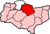 Bapchild · Badlesmere · Bay View · Bobbing · Borden · Boughton Street · Boughton under Blean · Bredgar · Brogdale · Buckland · Chestnut Street · Conyer · Dargate · Davington · Denstroude · Doddington · Dunkirk · Eastchurch · Eastling · Elmley · Faversham · Faversham Without · Goodnestone · Graveney · Halfway Houses · Hartlip · Harty · Heart's Delight, Swale · Hernhill · Highsted · Iwade · Kemsley · Keycol · Kingsdown · Leaveland · Leysdown-on-Sea · Lower Halstow · Luddenham · Lynsted · Milstead · Milton Regis · Minster · Mockbeggar · Murston · Newington · Newnham · Norton · Oad Street · Oare · Ospringe · Oversland · Painters Forstal · Queenborough · Rodmersham Green · Rushenden · Selling · Sheldwich · Shellness · Sheerness · Sittingbourne · Stalisfield Green · Teynham · Throwley · Tonge · Tunstall · Upchurch · Uplees · Warden · Waterham · WhitehillCategories:
- Swale
- Hamlets in Kent
- Kent geography stubs


Wikimedia Foundation. 2010.