- Oad Street
-
Coordinates: 51°19′37″N 0°40′48″E / 51.327°N 0.68°E
Oad Street 
 Oad Street
Oad Street shown within KentOS grid reference TQ869621 District Swale Shire county Kent Region South East Country England Sovereign state United Kingdom Police Kent Fire Kent Ambulance South East Coast EU Parliament South East England List of places: UK • England • Kent Oad Street is a small village in the English county of Kent.
Oad Street forms part of the civil parish of Borden which, in turn, is part of Swale district. Oad Street is located close to Junction 5 of the M2 motorway where it crosses the A249 road.
External links
 Media related to Oad Street at Wikimedia Commons
Towns and villages in the Borough of Swale in Kent, England 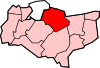 Bapchild · Badlesmere · Bay View · Bobbing · Borden · Boughton Street · Boughton under Blean · Bredgar · Brogdale · Buckland · Chestnut Street · Conyer · Dargate · Davington · Denstroude · Doddington · Dunkirk · Eastchurch · Eastling · Elmley · Faversham · Faversham Without · Goodnestone · Graveney · Halfway Houses · Hartlip · Harty · Heart's Delight, Swale · Hernhill · Highsted · Iwade · Kemsley · Keycol · Kingsdown · Leaveland · Leysdown-on-Sea · Lower Halstow · Luddenham · Lynsted · Milstead · Milton Regis · Minster · Mockbeggar · Murston · Newington · Newnham · Norton · Oad Street · Oare · Ospringe · Oversland · Painters Forstal · Queenborough · Rodmersham Green · Rushenden · Selling · Sheldwich · Shellness · Sheerness · Sittingbourne · Stalisfield Green · Teynham · Throwley · Tonge · Tunstall · Upchurch · Uplees · Warden · Waterham · WhitehillCategories:
- Swale
- Villages in Kent
- Kent geography stubs


Wikimedia Foundation. 2010.