- Newnham, Kent
-
For other places with the same name, see Newnham (disambiguation).
Coordinates: 51°16′00″N 0°48′00″E / 51.26667°N 0.8°E
Newnham 
View of Newnham from hilly field 2006
 Newnham
Newnham shown within KentDistrict Swale Shire county Kent Region South East Country England Sovereign state United Kingdom Police Kent Fire Kent Ambulance South East Coast EU Parliament South East England UK Parliament Faversham and Mid Kent List of places: UK • England • Kent Newnham is a village in the Syndale valley in Kent, England, in the administrative borough of Swale near the medieval market town of Faversham.
Contents
History
Newnham has existed as a community of dwellings and work-units for at least 1,000 years. Though it had a lord of the manor and the church of SS Peter and Paul at the beginning of the 12th century, it could be said that nothing of importance ever happened there; yet in it took place centuries of everyday social history and a history of domestic and economic life of generations of English people.
Originally little more than a grouping of farmhouses and farmworkers’ cottages clustered around a church and pub, both more than 600 years old, the village featured blacksmiths, a draper, a butcher, a baker and several other shops and pubs by the early 20th century.
Even until the Second World War, most of its inhabitants were born, worked, lived and died in the valley. Many of the men worked on the hop farms, the apple and cherry orchards, or the wood industries that dominated the local economy. The women performed domestic service in some of the big houses, many set in parklands on surrounding hills (Sharsted Court, Doddington House, Belmont, Champion Court).
A modern village life
Though Newnham has changed enormously over the past 250 years, it retains the feel of an archetypal southern English village, though few farmworkers still live there. Fast railway connections to London and the continent of Europe add to the appeal with jobs in Ashford, Canterbury, Maidstone and Medway within easy reach after the completion of the M20, M2, M26 and M25 between the mid-1960s and early 1990s.
The police house was sold as a private residence in the 1990s, and the post office shut in 1998 while the last shop closed in 2002. Two pub-restaurants remain: opposite the church is the George Inn, which is now no longer mainly a drinking house for locals but instead attracts families and groups of businesspeople for meals. It features 16th-century rafters, inglenook fireplaces, and beer brewed locally (Shepherd Neame at Faversham), and a garden that looks up to the hilly field.
Above the field stands the 12th-century manor house, Champion Court, still an apple farm, though employing few people now and an abundance of modern science, overlooking the valley. The other pub-restaurant is much newer but has the air of a barn converted from use on the Syndale vineyard. From its garden there is another striking view across the village past the oast house, now converted from drying hops for beer into a private home. At the location of Syndale Vinyard is also the local brewery, Hopdaemon.
The church’s glebe lands, near the centre of the village, provided the space for a post-war housing development. Most of the other houses in the village front onto The Street and include Tudor dwellings, Victorian terraced cottages, and many houses now joined to make larger homes. There is also a collection of infilled recently-built houses squeezed into former orchards and fields that abutted The Street and which provided the only late 20th-century development land (which has to be within the “village envelope” according to planning restrictions).
Architectural points
Much of the village is a conservation area and several buildings are individually listed while the village is within the Kent Downs Area of Outstanding Natural Beauty (Kent Downs AONB). Building in the open countryside is tightly restricted, whereas “rural pursuits”, horse-riding and walking are encouraged.
A notable listed house is Calico House,[1] built in the early 17th century. Another sizable house was the 19th-century vicarage, no longer used as such. It was built in 1860 by the incumbent needs naming who also rebuilt the crumbling church, largely at his own expense. The tiny Congregationalist chapel also stands, disused, as a reminder that the Church of England and the squirearchy did encounter some resistance to their rule.
The valley road was a highway in Norman times, linking the Roman Watling Street (Dover and Canterbury to London, the A2) to the Pilgrims' Way on the other side of the downs. However it was almost impassable in winter and Newnham was substantially self-sufficient until the 19th century. Indeed the shops that residents whose closure the older villagers bemoan probably did not begin till the 1840 when passing tradesmen and deliveries made it possible to open a draper’s and grocery shop. A 2010 excavation established that a full-scale Roman road passed along the valley though its precise route remains to be confirmed; it has been explored only near the Watling Street (A2) Syndale junction and at the foot of Newnham's "hilly field".
The farmhouses in the village, including the old Parsonage Farm whose farmhouse now stands in only half an acre next to the church in The Street, yielded most of their farmlands to provide space to accommodate incomers in the past 30 years. There is now considerable turnover in population.[citation needed]
Church, school and amenities
The church of SS Peter and Paul now shares a vicar with half a dozen other parishes. The village no longer has a school of its own (indeed it lost it as early as 1877 when the board school opened in Doddington, the only other village in the valley. Doddington lost its primary school too in 2008).
Nearby Doddington still has a butcher’s shop and that successor of the village blacksmith, a garage and petrol station, as well as its pub and church. It also has a hostel for walkers to complement the bed and breakfast accommodation it offers to visitors to the area.
Both villages, about two miles (2 km) apart, have a village hall, now used for keep-fit classes and the occasional auction or flower show. They share a war memorial to those killed in two world wars. Neither village in the valley has street lights or mains drainage as there is little demand for such. Broadband internet access, mobile phone connection and satellite television signals matter as much to many current villagers, especially to home-workers and children, as the mains water and gas supplies.[citation needed]
The valley is chalky downland and is atop a plentiful aquifer which provides water to the growing nearby urban communities. The pumping station in the valley stands beside a unique 1937 experimental building, recently bought and undergoing conversion to residential use. The building was designed to soften the hard lime-scaling water which it pumps from the ground. The water softening plant was built for the Kent Water Board and is one of few remaining if not the last of its kind.[citation needed] The Twentieth Century Society proposed the concrete structures for listing citing their “tremendous sculptural qualities” and Grade II listing was granted in November 2006.[citation needed] As such, it joined a range of older and more traditional buildings, including several thatched houses.
The population of Newnham numbered 24 householders in 1569. In the first national census in 1801, there were 262 residents reaching what may have been a peak of 451 in 88 houses in 1841 just before out-migration began in earnest. In 1931, there were 258 people in 92 homes and there are now about 350 people in 145 houses.
External links
- Newnham & Doddington villages: shared site
- Kent Downs AONB
- Swale borough tourism site
- water softening plant at C20th Society site
- Hopdaemon
References
External links
 Media related to Newnham, Kent at Wikimedia Commons
Towns and villages in the Borough of Swale in Kent, England 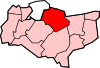 Bapchild · Badlesmere · Bay View · Bobbing · Borden · Boughton Street · Boughton under Blean · Bredgar · Brogdale · Buckland · Chestnut Street · Conyer · Dargate · Davington · Denstroude · Doddington · Dunkirk · Eastchurch · Eastling · Elmley · Faversham · Faversham Without · Goodnestone · Graveney · Halfway Houses · Hartlip · Harty · Heart's Delight, Swale · Hernhill · Highsted · Iwade · Kemsley · Keycol · Kingsdown · Leaveland · Leysdown-on-Sea · Lower Halstow · Luddenham · Lynsted · Milstead · Milton Regis · Minster · Mockbeggar · Murston · Newington · Newnham · Norton · Oad Street · Oare · Ospringe · Oversland · Painters Forstal · Queenborough · Rodmersham Green · Rushenden · Selling · Sheldwich · Shellness · Sheerness · Sittingbourne · Stalisfield Green · Teynham · Throwley · Tonge · Tunstall · Upchurch · Uplees · Warden · Waterham · Whitehill
List of places in Kent Categories:- Swale
- Villages in Kent
- Unreferenced Kent-related articles


Wikimedia Foundation. 2010.