- Nerang River
-
Nerang River 
View south at Surfers Paradise, 2007Origin McPherson Range Mouth Gold Coast Broadwater Basin countries Australia Length 250km Basin area 490 km²[1] The Nerang River is a river that begins in the McPherson Range in the Gold Coast hinterland and runs through Gold Coast City in South East Queensland, Australia. It starts in the Numinbah Valley on the New South Wales border and heads north, then east where it flows through Nerang and onto the Gold Coast Broadwater at Southport on the Gold Coast.
The Nerang River catchment covers an area of 490 km²,[1] with it only covering 250 km.[2]
Contents
Name

The river was initially named the River Barrow by government surveyor Robert Dixon when he charted the Gold Coast in 1840, after Sir John Barrow, Secretary of the Admiralty.[3] The surveyor general Thomas Mitchell later changed many places to Aboriginal names, and this included giving the Nerang River its present name. Neerang is a Yugambeh word meaning "little shark" or "shovel-nosed shark". But the local aboriginal people in fact called the river Mogumbin or Been-goor-abee. And the peoples of the Tweed called it Talgai.
Dams
On the Nerang river is the Hinze Dam, creating Advancetown Lake, the Gold Coast's main water supply. Hinze Dam has had a significant flood mitigation effect.[2] An older dam, higher up in the catchment and now called the Little Nerang Dam was an earlier water supply for the Gold Coast. The dams are managed by Gold Coast Water
Surfers Riverwalk
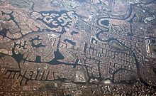 The Nerang River (right of image) and canals
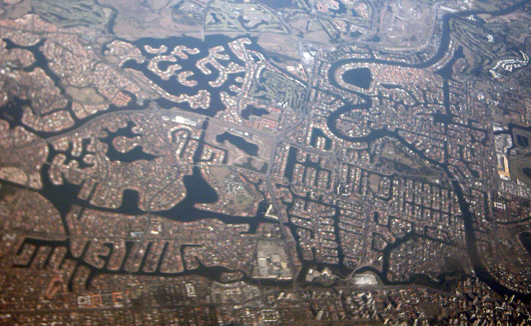
 Part of the lower Nerang River
The Gold Coast City Council is considering investing into the quality and capacity of the Surfers Riverwalk. The route would connect the Gold Coast Highway Bridge crossing of the Nerang River at Main Beach to Pacific Fair Shopping Centre at Broadbeach. The route includes
- The western facing beaches of Main Beach
- The anabranch foreshores of McIntosh Island.
- Jaraparilla Cove
- The Marriott Hotel boardwalk
- Budds Beach
- Surfers Central Riverwalk[4] from Budds Beach to Lionel Perry Park
- The Paradise Island anabranch
- Cannes Avenue Reach of the Nerang River
- Cascade Gardens foreshores of Little Tallebudgera Creek
- Gold Coast Convention and Exhibition Centre boardwalk
- Jupiters Casino Island foreshores
- Pacific Fair Shopping Centre
Boatramps
Nerang River Boatramps open to the public are located at Waterways Drive at Main Beach, Budds Beach, Evandale, on the Isle of Capri, TE Peters Drive at Broadbeach Waters (Convention Centre), Carrara Road, Carrara,and at the Nerang River Parklands.
See also
- List of rivers in Australia
References
- ^ a b "Nerang River Factsheet". Gold Coast City Council. http://www.goldcoast.qld.gov.au/attachment/factsheet_nerangriver.pdf. Retrieved 2010-03-29.
- ^ a b "Flood Warning System For The Nerang River". Bureau of Meteorology (Australia). http://www.bom.gov.au/hydro/flood/qld/brochures/south_coast/nerang.shtml. Retrieved 2009-09-03.
- ^ Place Names of South-East Queensland by Piula Publications
- ^ Surfers Central Riverwalk
External links
- Nerang page at the Gold Coast City Council
- The History of the Gold Coast at reflections.com.au
Categories:- Gold Coast, Queensland
- Rivers of Queensland


Wikimedia Foundation. 2010.