- Namyangju
-
Namyangju
남양주
南楊州— Municipal City — Korean transcription(s) - Hangul 남양주시 - Hanja 南楊州市 - Revised Romanization Namyangju-si - McCune-Reischauer Namyangju-si 
Emblem of Namyangju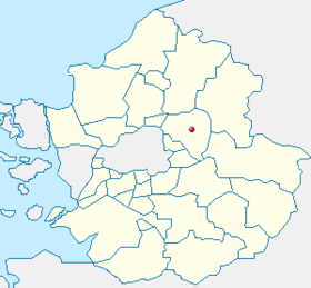
Country  South Korea
Region Sudogwon Administrative divisions 5 eup, 4 myeon, 6 dong, ?? gu Area - Total 460 km2 (177.6 sq mi) Population (2011 Aug) - Total 581,629 - Density 1,264.4/km2 (3,274.8/sq mi) - Dialect Seoul Namyangju is a city in Gyeonggi Province, South Korea. To the east is Gapyeong County, to the west is Guri City, and to the north is Pocheon City.
Contents
Education
There are 2 campuses of Gyeong Hee graduate school and Gyeong bok college, 15 high schools, 29 middle schools, and 55 elementary schools.
History of Namyangju
- 1980 April 1 Namyangju County was made with Guri-eup, Migeum-eup, Jinjeob-myeon, Jingeon-myeon, Hwado-myeon, Sudong-myeon, Wabu-myeon, and Byeolnae-myeon (2 eup, 6 myeon)
- 1980 December 1 Wabu-myeon became Wabu-eup (3 eup, 5 myeon)
- 1983 February 15 Jingeon-myeon Yangji-ri, Onam-ri, Palheon-ri were absorbed by Jinjeob-myeon
- 1986 January 1 Guri-eup became Guri City (2 eup, 5 myeon)
- 1986 April 1 Wabu-eup Joan branch office became Joan-myeon (2 eup, 6 myeon)
- 1989 January 1 Migeum-eup became Miguem City (1 eup, 6 myeon)
- 1989 April 1 Jinjeob-myeon became Jinjeob-eup (2 eup, 5 myeon)
- 1989 April 1 Toegyewon branch office became Toegyewon-myeon (2 eup, 6 myeon)
- 1991 December 1 Hwado-myeon became Hwado-eup (3 eup, 5 myeon)
- 1992 April 1 In Jinjeob-eup, Onam branch office opened.
- 1995 January 1 Migeum City and Namyangju County were merged. (3 eup, 5 myeon, 6 dong)
- 1995 May 6 Onam branch office became Onam-myeon (3 eup, 6 myeon, 6 dong)
- 2001 September 12 Jingeon-myeon became Jingeon-eup (4 eup, 5 myeon, 6 dong)
- 2001 September 12 Onam-myeon became Onam-eup (5 eup, 4 myeon, 6 dong)
- 2005 June 1 In Byeolnae-mueon, Cheonghak branch office opened.
- 2006 January 20 Pungyang branch office opened; It has jurisdiction over Onam-eup, Jinjeob-eup, Toegyewon-myeon, Byeolnae-myeon
- 2006 November 20 In Hwado-eup, Dongbu branch office opened.
- 2008 October 7 The population reached 500,000 (the 13th city in South Korea to do so).
- 2009 December 14 Cheonghak branch office closed.
- 5 Eup
-Jinjeob
-Jingeon
-Hwado
-Onam
-Wabu- 4 Myeon
-Joan
-Byeolnae
-Sudong
-Toegyaewon- 6 Dong
-Geumgok
-Hopyeong
-Yangjeong - Ilpae, Ipae, Sampae
-Jigeum - Gaun, Suseok
-Pyeongnae
-DonongLocation
Namyangju is a northeastern city which is part of the ring around Seoul. Seoul Ring Expressway passes through.
Jungang Line passes through Namyangju. - Donong station, Yangjeong station, Dukso station, Dosim station, Paldang station, Ungilsan station
A refurbished Gyeongchun Line reopened in late 2010 - Byeollae, Toegyewon, Sareung, Geumgok, Pyeongnae-hopyeong, Maseok stations are in Namyangju.
The Transportation and Construction Committee of the National Assembly has approved that Line 4 will be extended from Danggogae to Jinjeop, Namyangju.
Products
The sweet pears are exported to the USA, Japan, Canada. Organic vegetables are cultivated with ecofriendly methods.
Gorosoei is a special product made in the Namyangju area. It is medicinal water which has abundant minerals.
The term "Gorosoei" comes from "Gollisu" meaning "water for bones." The sap is extracted at Sudong-Myeon, Mountain Jugeum in Mount Chungnyeong Natural Recreation Forest, Mount Cheonma in Palhyeon and Onam township.[1]
Sister cities
 Dartford (borough), Kent of UK
 Changzhou, China
 Ulaanbaatar, Mongolia
- Gangjin, South Korea
- Yeongwol, South Korea
 Vinh, Vietnam
See also
References
Namyangju historical character: Jeong Yak-yong, also Jeong Yag-yong or Dasan[茶山](1762-1836), was a leading Korean philosopher during the Joseon Dynasty. He is widely regarded as the greatest of the Silhak thinkers, who advocated that the formalist Neo-Confucian philosophy of Joseon return to practical concerns. Jeong Yag-yong and his brothers were also among the earliest Korean converts to Roman Catholicism. Jeong was born, and also ended his days, in modern-day Namyangju, Gyeonggi province
External links
Gyeonggi 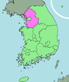
Capital Cities Counties Metropolitan cities of South Korea Special city Metropolitan cities Provincial capitals with gus
(not included above)Provincial capitals without gus
(not included above)Cities with gu
(not included above)Cities
(not included above)Andong · Anseong · Asan · Boryeong · Chungju · Dongducheon · Donghae · Gangneung · Geoje · Gimcheon · Gimhae · Gimje · Gimpo · Gongju · Gumi · Gunpo · Guri · Gunsan · Gwacheon · Gwangju · Gwangmyeong · Gwangyang · Gyeongju · Gyeongsan · Gyeryong · Hanam · Hwaseong · Icheon · Iksan · Jecheon · Jeongeup · Jinju · Miryang · Mungyeong · Namwon · Namyangju · Naju · Nonsan · Osan · Paju · Pocheon · Pyeongtaek · Sacheon · Samcheok · Sangju · Seogwipo · Seosan · Siheung · Sokcho · Suncheon · Taebaek · Tongyeong · Uijeongbu · Uiwang · Wonju · Yangju · Yangsan · Yeongcheon · Yeongju · YeosuCategories:- Cities in Gyeonggi
- South Korea geography stubs


Wikimedia Foundation. 2010.