- Uijeongbu
Infobox Korean settlement
logo=Uijeongbu logo.gif
hangul=의정부시
hanja=議政府市
rr=Uijeongbu-si
mr=Ŭijŏngbu-si
area_km2=81.59
pop=417915
popyear=2005
popnote= [ [http://www.mongabay.com/igapo/2005_world_city_populations/2005_city_population_03.html World cities with 400,000 to 600,000 people in 2005 ] ]
popden_km2=4436.8
divs=15 "dong"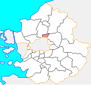
Uijeongbu (IPA2|ɰi.dʑʌŋ.bu) is a city in
Gyeonggi Province,South Korea . Its geographical location is coord|37|45|N|127|3|E|region:KR_type:city.The city is located just north of
Seoul with many U.S. and Korean military bases for the defense of the Korean capital. TheU.S. Second Infantry Division has established its headquarters in the city with main troops deployed inDongducheon City.There are several mountains such as Mt.Dobong, Mt.Surak, Mt.Soyo nearby, which are popularwith residents living in Seoul Metropolitan area for climbing as leisure activity.In "M*A*S*H", this city (then just a village) served as the home of MASH 4077.
tatistics
(Land Use)
Transport
A
VAL driverless metro system is in development with one elevated line, 10.6 km long, covering 14 stations. [http://www.transportation.siemens.com/en/data/pdf/ts_internet/ts_corp/presse/2006/29_korea_ujeongbu_e.pdf] The opening is scheduled for April 2011.The Seoul metropolitan subway system covers the city with 6 stations, it takes around 40 minutes from center of Seoul to the first station in Uijeongbu by subway.It has extensive bus routes covering north-eastern region of Kyunggi-Do. Also, the buses are classified into 3 kinds - one is Ilban-bus(normal bus) and another is Jwaseok-bus(full of seats and a little more expensive than Ilban-bus), the other called Maeul-bus(mini-bus with less number of seats running into small towns)
ister Cities
*flagicon|Japan Shibata,
Japan ee also
*
List of cities in South Korea
*Gyeonggibuk Science High School , in UijeongbuReferences
External links
* [http://www.ui4u.net/english/ City government website]
* [http://dmoz.org/Regional/Asia/South_Korea/Gyeonggi/Uijeongbu/ Open Directory category]
Wikimedia Foundation. 2010.